James Spann: Alberto nearing the Gulf Coast, then inland Alabama
James Spann has the latest on Alberto’s timing, track and likely effects on Alabama from Alabama NewsCenter on Vimeo.
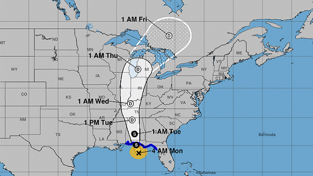
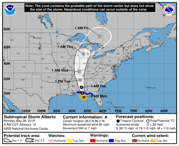
ALBERTO CLOSE TO THE COAST: The center of Subtropical Storm Alberto this morning is about 100 miles south of Destin, and sustained winds remain near 65 mph. The system is considered “subtropical” since it is more of a hybrid between a classic tropical storm and a broad, mid-latitude system like we see in the cool season here. Most likely it will remain subtropical through landfall later today.
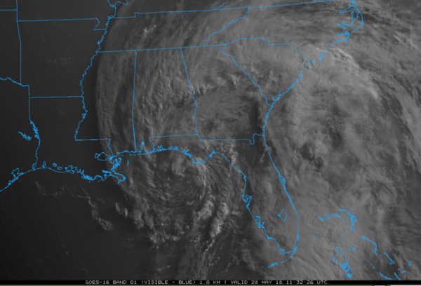
Landfall will come around Fort Walton Beach late this morning.
KEY POINTS FOR THE GULF COAST:
- The Alabama coast and Pensacola are on the “good” west side of the system with an offshore flow. Rain will be fairly light, with no flooding and no risk of a tornado. The sun might even pop out at times today there.
- From Fort Walton to Destin, Panama City Beach and Apalachicola, winds could gust to 40/50 mph later today as Alberto moves inland. This might knock down a few trees and cause scattered power outages, but the main issue is rain, not wind.
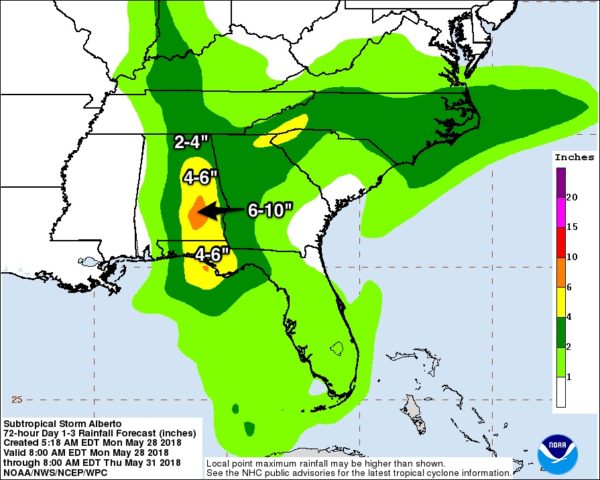
- Rain amounts of 4 to 6 inches are likely from Destin to Apalachicola over the next 24 hours; flooding is possible.
- A few isolated small, short-lived tornadoes are possible from Destin east to Jacksonville today.
- The rip current danger remains VERY high along the central Gulf Coast. Stay OUT of Gulf waters until the red flags are lowered!
- The weather improves on the coast tonight, and routine weather is likely for the rest of the week and the weekend, with a decent amount of sun each day and a few scattered thunderstorms.
KEY POINTS FOR INLAND PARTS OF ALABAMA:
- Periods of rain are likely through tomorrow as Alberto moves up slowly through central Alabama while weakening. A flood watch is in effect for much of east and south Alabama, where rain amounts of 2 to 6 inches are likely. A few spots could see amounts exceeding 6 inches across southeast Alabama.
- A wind advisory is in effect for parts of central and southeast Alabama; winds will average 20 to 30 mph tonight and tomorrow.
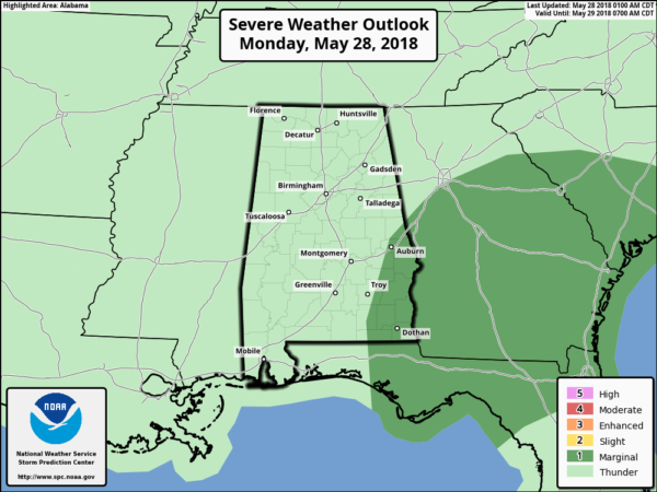
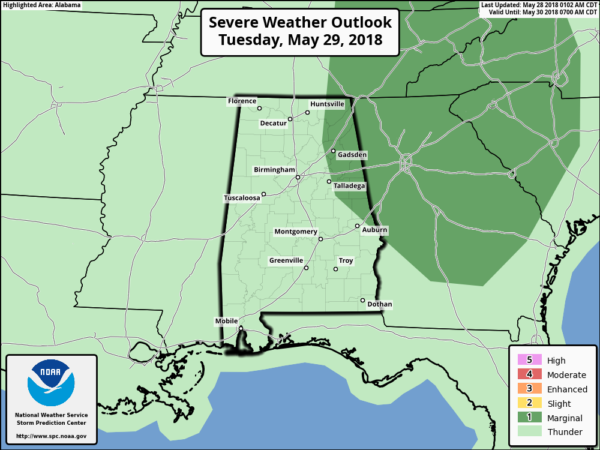
- A few isolated small, short-lived tornadoes are possible over east Alabama late today, tonight and tomorrow, generally east of U.S. 431. This is a very low-end threat; the Storm Prediction Center has a “marginal risk” defined here.
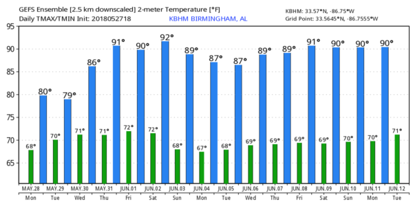
WEDNESDAY THROUGH FRIDAY: Our weather lapses back into a more normal summer pattern, with warm, humid days, a mix of sun and clouds, and scattered, mostly afternoon and evening showers and thunderstorms. Highs will be in the 85- to 89-degree range.
THE ALABAMA WEEKEND: No real change. Expect routine June weather — partly sunny Saturday and Sunday with scattered, random showers and storms mostly during the afternoon and evening hours. Highs in the mid to upper 80s. And this pattern should hold into next week.
If you are new to Alabama, read this post on how weather goes on most summer days here.
BEACH FORECAST: Click here to see the AlabamaWx Beach Forecast Center page.
WEATHER BRAINS: You can listen to our weekly 90-minute netcast any time on the web, or on iTunes. This is the show all about weather featuring many familiar voices, including meteorologists at ABC 33/40.
CONNECT: You can find me on all of the major social networks:
Facebook
Twitter
Google Plus
Instagram
Pinterest
Snapchat: spannwx
For more weather news and information from James Spann and his team, visit AlabamaWx.


