Brian Peters: Stormy in Alabama today
Brian Peters has the Friday forecast for Alabama from Alabama NewsCenter on Vimeo.
TODAY: Again this morning our satellite view showed numerous areas of cloudiness across Alabama because of convection overnight. Much of the convection formed along and south of storms in the Tennessee River Valley and moved generally southward, but radar showed these storms to be weakening just before sunrise. Temperatures were just slightly cooler this morning thanks to the rain, with readings in the upper 60s.
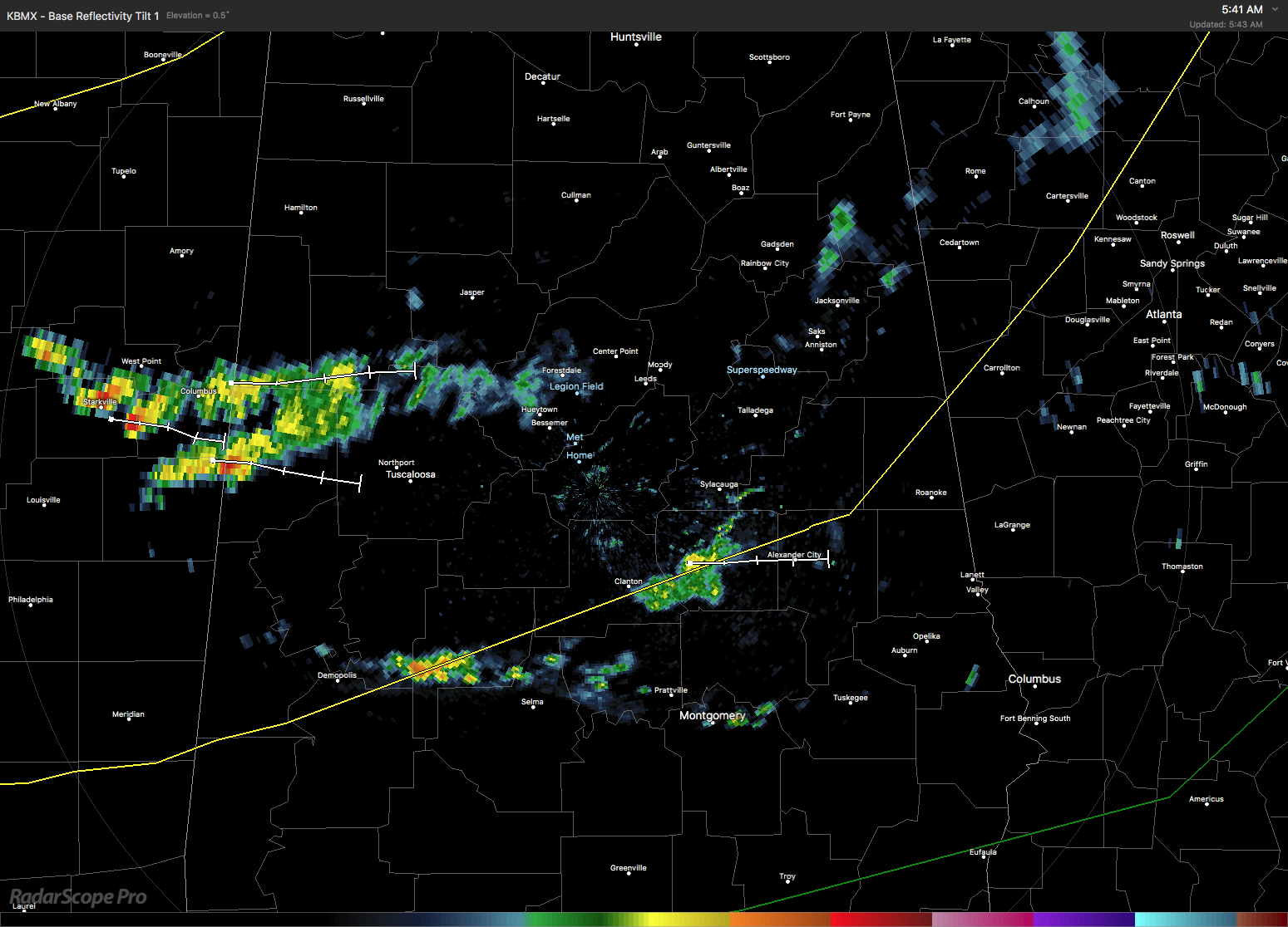
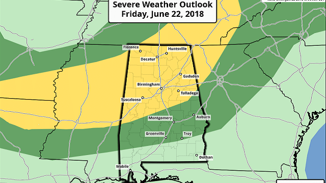
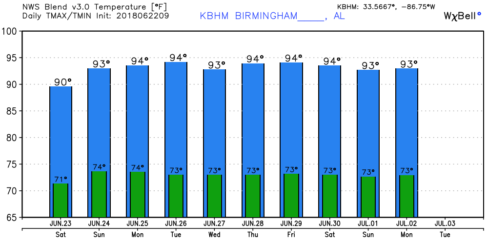
A closed low at 500 millibars was situated just northwest of St. Louis early this morning. As small perturbations move around this low, we should see a couple of rounds of thunderstorms. In fact, the Storm Prediction Center has included much of the northern half of Alabama in a slight risk for severe storms, with damaging wind expected to be the primary threat. An isolated tornado will be possible with the presence of fairly strong shear. Strong flow aloft will contribute to robust updraft strength. Today’s highs should climb into the upper 80s.
TROPICS: The tropical Atlantic is quiet this morning. The eastern Pacific shows two areas of concern, neither of which is likely to form a storm or depression over the next couple of days.
THE WEEKEND AND NEXT WEEK: The upper low will continue to weaken and move into the eastern Great Lakes area on Saturday; however, a weak short wave will be moving by on Saturday that could contribute to fairly numerous showers and storms again. The highs Saturday should be near 90.
The upper flow goes pretty zonal on Sunday, so shower and thunderstorm activity should diminish considerably. While most of us will remain dry, an isolated storm or two still may occur as highs climb into the lower 90s. A trough over Nebraska will pump up a ridge over the Southeast on Monday, so a more summer-like pattern returns with isolated to scattered storms and highs in the lower 90s.
The ridge stays with us Tuesday but is dampened down by a strong trough moving through the Great Lakes on Wednesday, so showers remain in the forecast. We never completely lose the humid air mass. Highs at midweek will be in the lower 90s and are likely to remain there for the the later half of the week.
LONG TERM: The Global Forecast System remains bullish on developing a ridge over the eastern half of the country as we enter July. That ridge migrates west on July 2 and takes up residence over Kansas by July 5. That certainly spells more heat for the central U.S., but it keeps us out of the extreme heat.
BEACH FORECAST: Click here to see the AlabamaWx Beach Forecast Center page.
WEATHERBRAINS: You can listen to our weekly 90-minute netcast any time on the web, or on iTunes. This is the show all about weather featuring many familiar voices, including meteorologists at ABC 33/40.
SPANN AWAY: The forecast posts on Alabama NewsCenter are one-a-day this week while James Spann is on vacation.
Enjoy the day, but remember to stay weather aware because of the threat for severe weather. Godspeed.
For more weather news and information from James Spann, Brian Peters and other members of the James Spann team, visit AlabamaWx.


