Brian Peters: Another stormy day for Alabama
Brian Peters has the Saturday forecast for Alabama from Alabama NewsCenter on Vimeo.
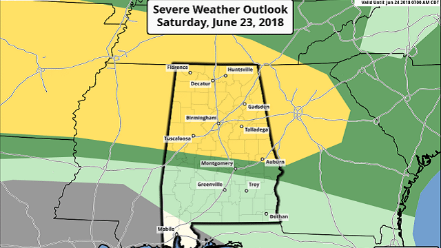
STAY ALERT: Friday was quite the stormy day across north and central Alabama, and it looks like we’ll have something of a repeat today, with damaging wind the primary threat. The Storm Prediction Center has outlined a slight risk area from north central Texas eastward across the northern half of Alabama into north Georgia. Numerous boundaries are in place from the convection that occurred yesterday as well as convection occurring this morning, and CAPE values are forecast to top out this afternoon in the 3,500 to 4,500 j/kg range. In addition to the surface boundaries, the upper flow will feature a weak short wave moving across west Tennessee that will help to enhance convection.
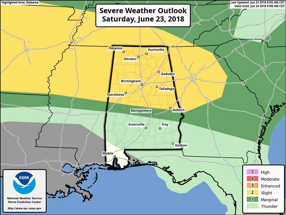
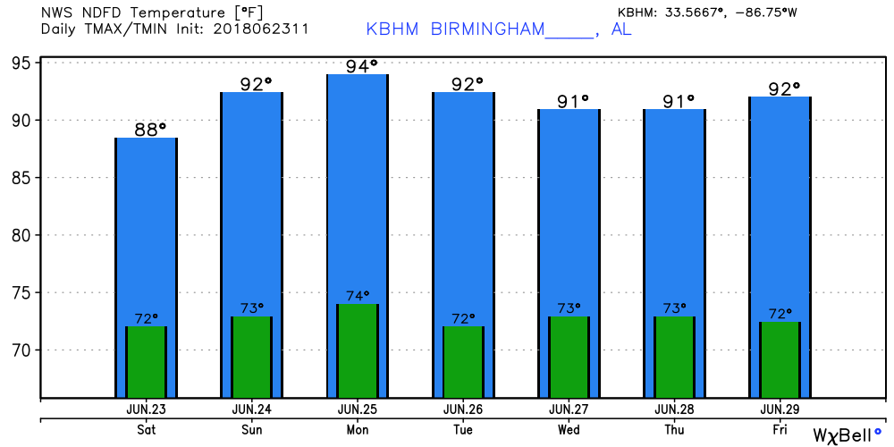
Most of the morning convection is likely to diminish during the morning, but additional development is forecast to occur this afternoon. Highs today should climb into the upper 80s for much of the area.
SUNDAY AND THE WEEK AHEAD: The boundary lying across our area today is forecast to push northward on Sunday, and we should see a break in thunderstorm action, with the possibility of isolated thunderstorms mainly during the afternoon. Highs will warm into the lower 90s. By Monday and Tuesday the upper ridge is building into the eastern U.S. as another strong trough moves out of the northern Rockies. Isolated showers will be possible as highs climb well into the lower 90s, generally 91 to 95.
That strong upper trough moves into the Great Lakes area by Wednesday and New England by Thursday with the potential for a weak front to once again sag into the Southeast. So for the middle of the week it looks like a slightly better chance for showers and storms again. The upper ridge becomes the primary feature in our pattern by Friday and into next weekend. This sets up a fairly typical summer-like pattern with diurnal chances for storms each day generally in the 20 to 30 percent range. Highs will be in the lower and middle 90s.
TROPICS: The tropical Atlantic remains quiet today while the eastern Pacific is a bit busier with two areas of disturbed weather, one of which could become a storm in the next five days. Both disturbances should remain at sea.
LONG TERM: Looking into voodoo country, the Global Forecast System remains bullish on an upper ridge migrating from east to west across the U.S. The center of the ridge starts out over the Mid-Atlantic states around July 2 but ends up centered over the Rockies by the July 8. So it looks like hot weather for the Fourth of July in Alabama, moderating just a little as the upper ridge gets to our west.
BEACH FORECAST: Click here to see the AlabamaWx Beach Forecast Center page.
WEATHERBRAINS: You can listen to our weekly 90-minute netcast any time on the web, or on iTunes. This is the show all about weather featuring many familiar voices, including meteorologists at ABC 33/40.
For more weather news and information from James Spann, Brian Peters and other members of the James Spann team, visit AlabamaWx.


