James Spann: Wet, unsettled weather for Alabama this week
James Spann’s Alabama forecast says goodbye to the 90s from Alabama NewsCenter on Vimeo.
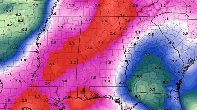
WET PATTERN DEVELOPING: Birmingham has received less than one inch (0.89) of rain during the entire month of September, so conditions are getting pretty dry around here. In fact, the last day with more than one-half inch of rain was back on Aug. 1. The good news is that a wet pattern is setting up across Alabama and the Deep South this week as the upper ridge weakens and moves eastward, and a surface front approaches.
We will forecast mostly cloudy weather through Thursday with occasional showers and thunderstorms. While they will be most active during the afternoon and evening hours, some rain is very possible during the late-night and morning hours. Rain is falling this morning over parts of east and northwest Alabama.
Rain amounts of 1 to 2 inches are likely between now and Thursday night, and highs will be generally in the 80- to 85-degree range, very close to seasonal values. The average high today for Birmingham is 83 (the average high doesn’t drop below 80 until October).
ON THE MAPS: An upper trough will help to push a cold front into extreme north Alabama Wednesday night, then down to near I-20 Thursday. Both global models last week advertised this front pushing down into the Gulf of Mexico, followed by a push of refreshing, cool air. Unfortunately, now the models have backed off on the amplitude of the trough, and accordingly the front hangs up over central Alabama. This means the really cool air will stay north of here, and we will be stuck in the low to mid 80s through Friday and the weekend as the persistent ridge begins to rebuild.
On the positive side, there is a very good chance we have seen our last 90-degree high of the year.
FRIDAY AND THE WEEKEND: We will forecast a mix of sun and clouds on these three days with scattered showers and thunderstorms; the chance of any one spot getting wet is in the 30-40 percent range each day. Afternoon highs will be generally in the mid 80s.
NEXT WEEK: Don’t expect much change, at least for the first half of the week, with partly sunny days, the risk of scattered showers and thunderstorms, and highs in the mid 80s.

TROPICS: Subtropical Storm Leslie is in the middle of the Atlantic, far from land, and should dissipate by tomorrow night. Tropical Depression Kirk is a low-latitude system; it could regain tropical storm strength as it approaches the Windward Islands late this week, but then there is a good chance it dissipates in the Caribbean because of strong shearing conditions. There are no systems near the Gulf of Mexico.
ON THIS DATE IN 1956: Hurricane Flossy clipped the mouth of the Mississippi River in the early morning of Sept. 24, 1956. The storm made a second landfall as a Category 1 hurricane near Fort Walton Beach and Destin in far southeastern Okaloosa County late that evening.
BEACH FORECAST: Click here to see the AlabamaWx Beach Forecast Center page.
WEATHER BRAINS: You can listen to our weekly 90-minute netcast any time on the web, or on iTunes. This is the show all about weather featuring many familiar voices, including meteorologists at ABC 33/40.
CONNECT: You can find me on all of the major social networks:
Facebook
Twitter
Instagram
Pinterest
Snapchat: spannwx
For more weather news and information from James Spann and his team, visit AlabamaWx.