Scott Martin: Sunshine, cool temperatures this Alabama weekend

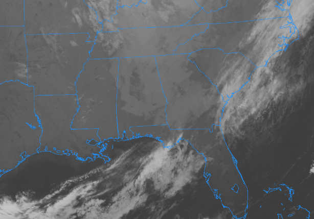
We still have cloud cover over much of Central Alabama this morning, but radar continues to be free from any rain activity. There may be some very light drizzle that may not be picked up, but I believe that what you see is what you get. Temperatures are currently in the upper 40s to the mid-50s at 7:30 a.m.… a few degrees cooler than when I did the video at 6:20 a.m.
SATURDAY
We have a trough sitting over the southeast, but as you can see, we are now on the back half of it. That means for us that much of Central Alabama will stay dry, but a few sprinkles or very light showers are possible over the northeastern parts of the area. Skies will begin to clear out behind that from the southwest to northeast, and we should be mostly clear by sunset. Afternoon highs will top out in the upper 50s to the upper 60s. We’ll have mainly clear skies through the overnight hours, with lows in the mid to upper 40s.
For the Magic City Classic, which kicks off at 2:30 p.m. this afternoon, skies will be clearing over Legion Field throughout the game. Temperatures will start off right around 60 degrees and will fall into the upper 50s by the 4th quarter.
SUNDAY
The trough continues to move off to the east, allowing for nice weather to settle in for the second half of the weekend. We’ll have plenty of sunshine with just a cloud or two. Afternoon highs will be back up in the 70s throughout the area. Sunday night will be fair with lows in the mid-40s to the mid-50s.
THE BEGINNING OF THE WORK WEEK
Ridging is building just off to our west for the start of the work week, but it starts to level off just a bit on Tuesday as we’ll have a trough that starts forming in the west-central parts of the country. That means for us plenty of sunshine on both days with highs in the 70s. A few locations in the southern parts of Central Alabama may briefly touch 80 degrees.
HALLOWEEN
The trough is really starting to get its act together off to our west and a cold front will be draping from the Great Lakes down to Central Texas. Warm and moist air will be advecting in front of that, meaning we could have a few scattered showers throughout the day, mainly in the western half of the area, with showers and maybe a clap of thunder becoming more likely after sunset. Unfortunately, it may be wet for some Trick Or Treaters. Rain moves in for the entire area during the overnight hours. Highs will be in the mid-70s to the lower 80s, while dropping into the mid-60s to the lower 70s by sunset.
THURSDAY
The trough really digs in on Thursday, pushing the cold front through the area during the day. Showers and a few thunderstorms are likely through the morning hours for all of the area, then rain begins to taper off from west to east throughout the afternoon and into the evening hours. All of the shower activity should be out of the state by the late local news. Highs will be in the upper 60s to the mid-70s. We should end up with rainfall totals in the neighborhood on 1/2 to 1 inch from south to north in Central Alabama.
FRIDAY
The center of the trough will be just off to our west as it has really deepened by this time, but the good news is that all of the rain will be well east of us, leaving us with partly to mostly cloudy skies. Highs will be back down in the 60s across the area.
THE TROPICS
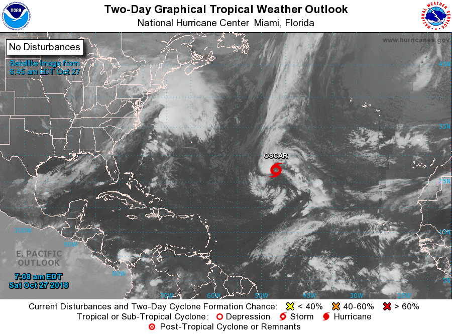
Subtropical Storm Oscar formed late last night over the Central Atlantic. He will move westward while strengthening into a hurricane, before being forced out to the northeast by an upper-level trough. No threat to the US Mainland. The rest of the Atlantic Basin is quiet at this point.
BEACH FORECAST CENTER
Get the latest weather and rip current forecasts for the beaches from Fort Morgan to Panama City on our Beach Forecast Center page. There, you can select the forecast of the region that you are interested in.
WEATHERBRAINS
Don’t forget you can listen to our weekly 90 minute netcast anytime on the web at WeatherBrains.com or on iTunes, Stitcher, or Spotify. This is the show all about weather featuring many familiar voices, including the meteorologists at ABC 33/40.
CONNECT ON SOCIAL MEDIA
You can find the AlabamaWx Weather Blog on the major social media networks:
Facebook
Twitter
E-FORECAST
Get the Alabama Wx Weather Blog’s Seven-Day Forecast delivered directly to your inbox by email twice daily. It is the most detailed weather forecast available in Central Alabama. Subscribe here… It’s free!
For more weather news and information from Scott Martin and the rest of the James Spann team, visit AlabamaWx.com.