James Spann: Clouds, rain at times through Saturday
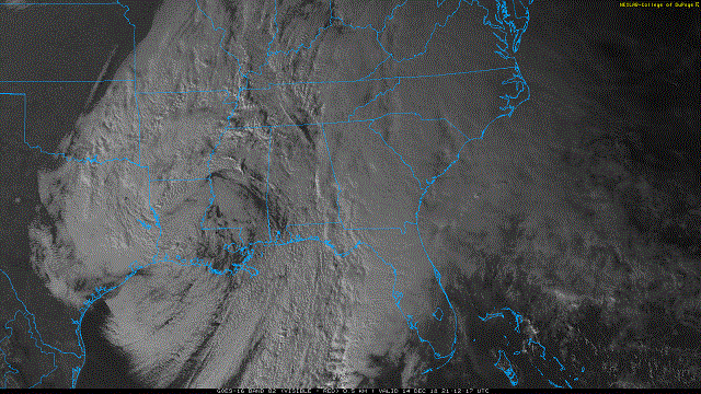
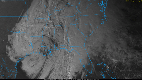
UNSETTLED WEATHER: An upper low will move over Alabama during the next 24 hours, meaning clouds will continue to hang over the state with periods of mostly light rain. Additional rain should be one-half inch or less for most places; rain will diminish Saturday afternoon as the upper low lifts away from Alabama.
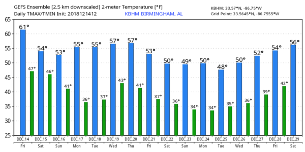
Sunday will be dry, but clouds will linger much of the day. We could see a few breaks in the overcast Sunday afternoon as drier air enters the state. Highs over the weekend will be mostly in the 50s.
NEXT WEEK: A calm, dry pattern sets up for Alabama and the Deep South. We are forecasting mostly sunny days and fair nights Monday through Friday, with highs around 60 degrees and lows mostly in the 30s.
CHRISTMAS? It’s really too early for a specific forecast, but for now Christmas Day looks dry with seasonal temperatures across Alabama. Of course, this could change.
ON THIS DATE IN 1997: Parts of west-central Alabama saw significant snowfall of 4 to 8 inches thanks to a deep, cold-core upper low passing over the region. To the west in Mississippi, this was one of the heavier snowfalls to occur since 1929. The weight of the snow caused limbs of trees to break, which knocked down power lines. Heavier snow in Alabama fell in places like Demopolis and Livingston.
BEACH FORECAST: Click here to see the AlabamaWx Beach Forecast Center page.
WEATHER BRAINS: You can listen to our weekly 90-minute show any time on your favorite podcast app. This is the show all about weather featuring many familiar voices, including meteorologists at ABC 33/40.
CONNECT: You can find me on the major social networks:
Facebook
Twitter
Instagram
Pinterest
Snapchat: spannwx
For more weather news and information from James Spann and his team, visit AlabamaWx.


