James Spann: Dry weekend for Alabama; snow possible Tuesday
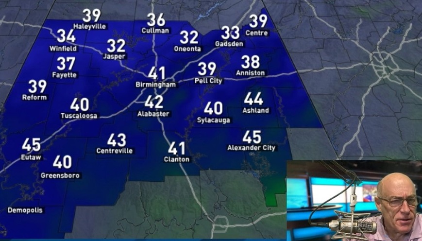
BLUE SKY AND SUNSHINE: The sky is mostly sunny across Alabama this afternoon with temperatures in the 40s for the northern counties of the state and 50s to the south. Tonight will be fair and cold, with freezing temperatures early Saturday; most places will fall into the 20s.
THE ALABAMA WEEKEND: Saturday will be partly sunny with a high in the low 50s, and for most of the state Sunday will be dry with a mix of sun and clouds and a high in the mid 50s. A few sprinkles are possible near the Tennessee state line thanks to a clipper, but even there most places will stay dry.
Monday will be dry and pleasant, with a high between 55 and 60 degrees.
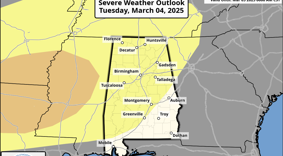
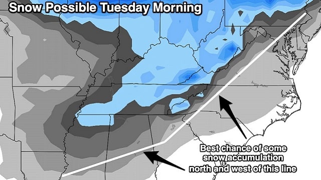
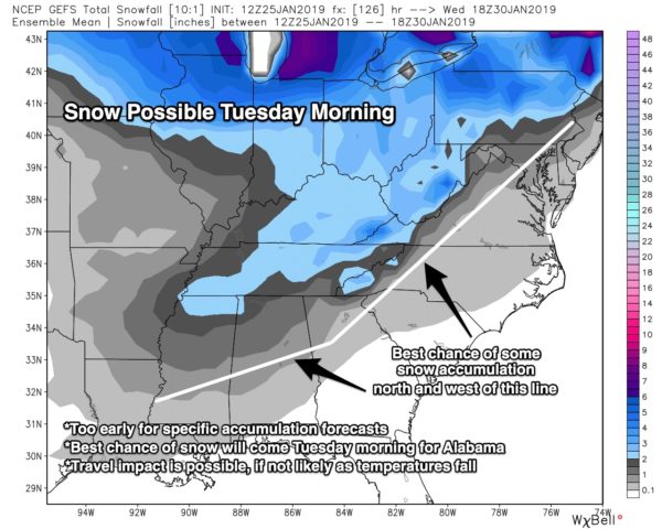
TUESDAY SNOW UPDATE: Model data remains fairly consistent, suggesting potential for some light snow across Alabama Tuesday. Here is the current thinking:
- Precipitation should begin early Tuesday, during the pre-dawn hours, as light rain over north Alabama.
- The light rain will change to light snow during the morning as an Arctic front passes through and temperatures fall.
- The main window for snow will come from 6 a.m. until 1 p.m. Tuesday.
- Systems like this typically don’t produce heavy amounts of precipitation, but the coldest air so far this season will roll in during the day, with surface temperatures falling below freezing. Even with light snow, this will have potential to create icy travel across the northern half of Alabama Tuesday and into Tuesday night/Wednesday morning.
- Current indications show the greatest potential for accumulation along I-20 and points to the north. Locations south of I-20 can see snow and accumulation as well, though warmer surface temperatures will increase melting rates and limit accumulation there. It is too early for specific accumulation predictions.
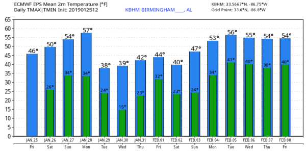
- Temperatures will drop into the teens across north Alabama both Wednesday and Thursday mornings.
We will be much more specific on the snow situation and impact over the weekend as we get within the 72-hour forecast window. A warming trend begins late next week.
ON THIS DATE IN 1949: Las Vegas, Nevada, recorded 4.7 inches of snow. This brought the monthly snowfall total to 16.7 inches, which still ranks as its snowiest month on record.
BEACH FORECAST: Click here to see the AlabamaWx Beach Forecast Center page.
WEATHER BRAINS: You can listen to our weekly 90-minute show any time on your favorite podcast app. This is the show all about weather featuring many familiar voices, including meteorologists at ABC 33/40.
CONNECT: You can find me on all of the major social networks:
Facebook
Twitter
Instagram
Pinterest
Snapchat: spannwx
For more weather news and information from James Spann and his team, visit AlabamaWx.