James Spann: Another freeze for Alabama tonight
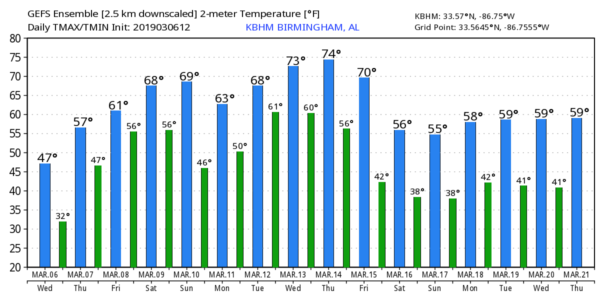
SUNNY BUT COLD: A deep cobalt blue sky is over Alabama this afternoon; temperatures are in the 40s over the northern counties, with 50s to the south. Another freeze is ahead tonight; most places will drop into the 20s early Thursday morning.
A warming trend begins Thursday afternoon; with ample sunshine we project a high around 60 degrees. Clouds will increase Thursday night, and a few passing showers are possible on Friday as moist air returns. The high Friday will be in the 60s.
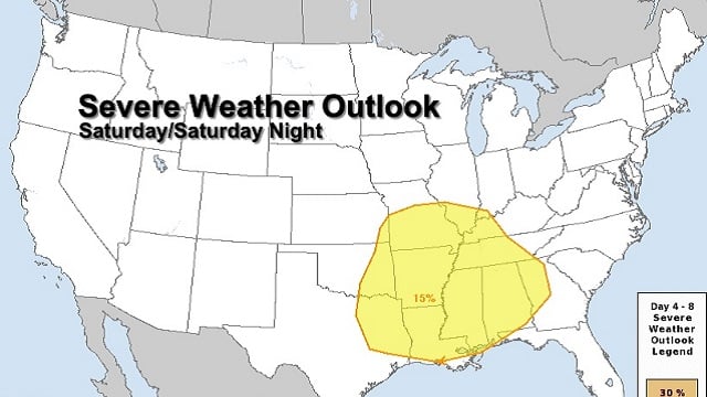
SEVERE STORMS POSSIBLE OVER THE WEEKEND: Saturday will be a mild, breezy day with a high in the mid 70s. While a shower is possible during the morning, the most active weather will come during the afternoon and night.
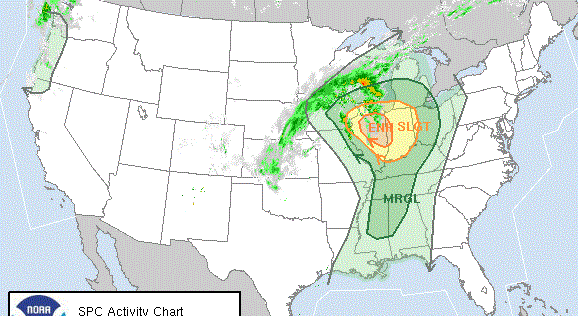
A dynamic storm system with strong wind fields will approach the state, interacting with unstable air over the region. Severe storms are possible across much of the southern United States; the Storm Prediction Center has a rather large severe weather risk area defined for Saturday from east Texas and east Oklahoma through the Deep South, including pretty much all of Alabama.
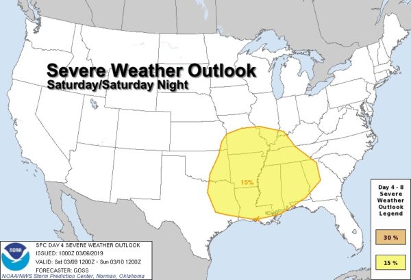
New model data continues to suggest the main window for severe storms in Alabama will come from roughly 3 p.m. Saturday through 6 a.m. Sunday. All modes of severe weather will be possible, including large hail, damaging winds and a few tornadoes. We will be much more specific about the threats, timing and placement Thursday morning.
Rain amounts of 1 to 2 inches are likely, probably not enough for major flooding issues. Rain will end early Sunday across north Alabama, but the severe weather threat could linger into Sunday morning across the southern quarter of the state.
Look for gradual clearing Sunday afternoon with a high in the low 70s.
NEXT WEEK: Monday and Tuesday look dry with a high in the 60s. The next round of showers and storms will move into the state Wednesday.
LOWS THIS MORNING: Here are some of the colder temperatures reported across Alabama this morning:
- Addison — 15
- Black Creek — 17
- Hamilton — 18
- Hueytown — 19
- Valley Head — 19
- Cullman — 19
- Cottondale — 20
- Decatur — 20
- Jacksonville — 21
- Bessemer — 22
- Coker — 23
- Northport — 23
STORM SURVEYS: Ten tornadoes have been identified by National Weather Service offices in Birmingham and Mobile from Sunday’s severe thunderstorms. EF-0 tornado tracks were discovered Tuesday in Autauga and Bullock counties.
ON THIS DATE IN 1962: The strongest nor’easter of this century struck the Mid-Atlantic Region on March 5-9, 1962. It is known as the “Ash Wednesday Storm” and caused more than $200 million (1962 dollars) in property damage and major coastal erosion from North Carolina to Long Island, New York. In New Jersey alone, it was estimated to have destroyed or greatly damaged 45,000 homes. The storm killed 40 people. The same storm dropped snow as far as north Alabama.
DST BEGINS: Daylight Saving Time begins Sunday; set your clocks forward one hour before you go to bed Saturday night. Sunset in Birmingham Sunday will be at 6:51 p.m.
BEACH FORECAST: Click here to see the AlabamaWx Beach Forecast Center page.
WEATHER BRAINS: You can listen to our weekly 90-minute show any time on your favorite podcast app. This is the show all about weather featuring many familiar voices, including the meteorologists at ABC 33/40.
CONNECT: You can find me on the major social networks:
Facebook
Twitter
Instagram
Pinterest
Snapchat: spannwx
For more weather news and information from James Spann and his team, visit AlabamaWx.