James Spann: Scattered storms fire up again later today in Alabama
James Spann forecasts more typical summer weather for Alabama from Alabama NewsCenter on Vimeo.
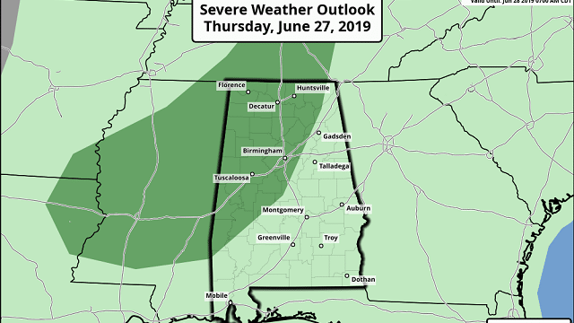
SUN, HEAT, STORMS: Alabama will be in a routine summer weather for the foreseeable future. The main westerly winds aloft over North America are well to the north, but the daytime heating process makes the air over Alabama unstable, and again we will deal with random, scattered showers and thunderstorms this afternoon and tonight. The Storm Prediction Center has introduced a marginal risk (level 1 of 5) for areas north and west of a line from Linden to Calera to Scottsboro.
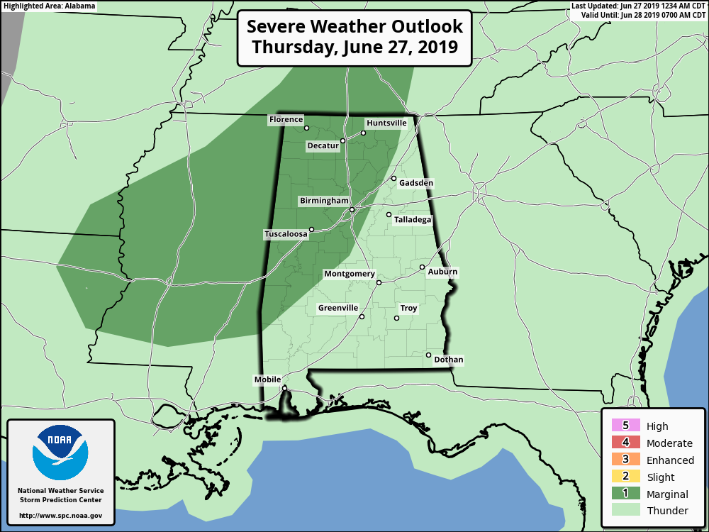
Some of the storms there could produce strong, gusty winds and small hail. Odds of any one spot seeing a storm later today are about 1 in 4, and the high this afternoon will be in the 89- to 92-degree range.
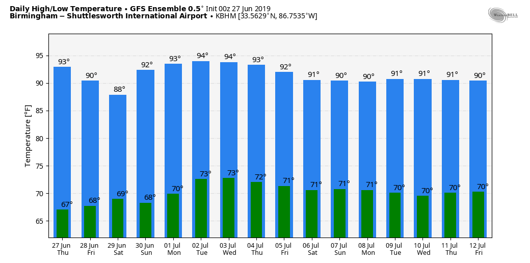
FRIDAY THROUGH NEXT WEEK: We will go with a broad-brush persistence forecast over the next seven days — partly sunny, hot, humid days with scattered, mostly afternoon and evening showers and thunderstorms. These storms will be random; there’s no way of knowing exactly when and where they pop up. Most will be between 2 and 10 p.m., although a few late-night and early-morning showers can never be ruled out.
There will be some variations in the placement and coverage of scattered storms each day, but no real way of resolving that far in advance because of the very small-scale features that affect the convection. Odds of any one spot getting wet most days will be in the 30% to 50% range. Afternoon highs will be generally in the low 90s. Basically, it’s what you expect in late June and early July in Alabama.
RAIN UPDATE: Birmingham’s rain total for the year is 28.89 inches; the surplus is 1.17. Some of the heavier rain totals Wednesday around the state included 1.78 inch at Black Creek (just northeast of Gadsden), and 1.56 inch in northern Shelby County on Dunnavant Valley Road east of Shoal Creek and Mount Laurel.
TROPICS: All remains very quiet across the Atlantic basin, and tropical storm formation is not expected through next week.
ON THIS DATE IN 1995: The Madison County flood on June 27, 1995, was the worst flash flood Virginia had seen since the remnants of Camille dropped up to 30 inches of rain one night in Nelson County in August 1969. The Nelson County flood ranked as one of the nation’s worst flash floods of this century and resulted in the deaths of 117 people. The Madison County flood killed one person.
BEACH FORECAST: Click here to see the AlabamaWx Beach Forecast Center page.
WEATHER BRAINS: You can listen to our weekly 90-minute show any time on your favorite podcast app. This is the show all about weather featuring many familiar voices, including the meteorologists at ABC 33/40.
CONNECT: You can find me on the major social networks:
Facebook
Twitter
Instagram
Pinterest
Snapchat: spannwx
For more weather news and information from James Spann and his team, visit AlabamaWx.


