James Spann: Alabama afternoon storms few and far between so far
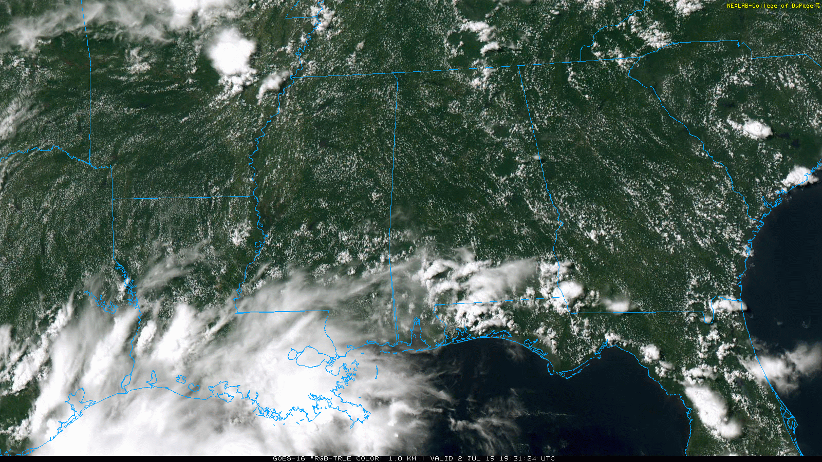
RADAR CHECK: You can almost count the number of showers and thunderstorms over the northern half of the state on one hand this afternoon; most of the action on radar is over the southern quarter of the state. Like recent days, showers are moving little, and away from them the sky is partly sunny with temperatures generally between 91 and 95 degrees.
Isolated showers remain possible through the evening; then the sky will be mostly fair late tonight.
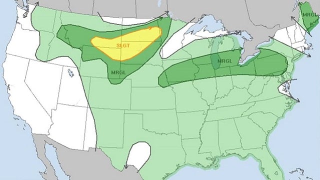
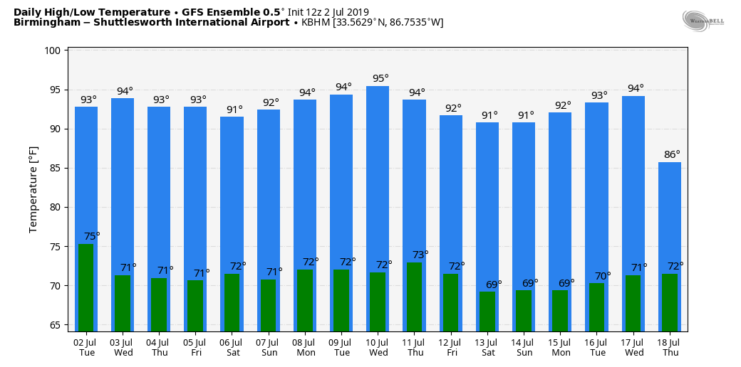
REST OF THE WEEK: The air aloft should be a little colder in coming days with a slight increase in precipitable water values, meaning the coverage of afternoon and evening showers and thunderstorms should be higher Wednesday through Friday. They still will be random and scattered, but odds of any one place getting wet will rise into the 30% to 40% range. Most of the showers and storms will come from 1 until 9 p.m. Highs will be mostly in the 89- to 93-degree range.
For the fireworks shows Thursday night, most of the showers and thunderstorms, but not necessarily all of them, will be over by 9. Temperatures should be in the low 80s as the shows begin.
THE ALABAMA WEEKEND AND BEYOND: This is the time of the year when the weather changes little, so we will continue with a persistence forecast this weekend and through much of next week. That means partly sunny, hot, humid days with scattered, mostly afternoon and evening showers and thunderstorms. Highs will be mostly in the low 90s. Of course, there will be variations in the daily placement and coverage of afternoon showers, but synoptic scale models don’t have the resolution or the ability to handle the small-scale features that determine those changes days in advance.
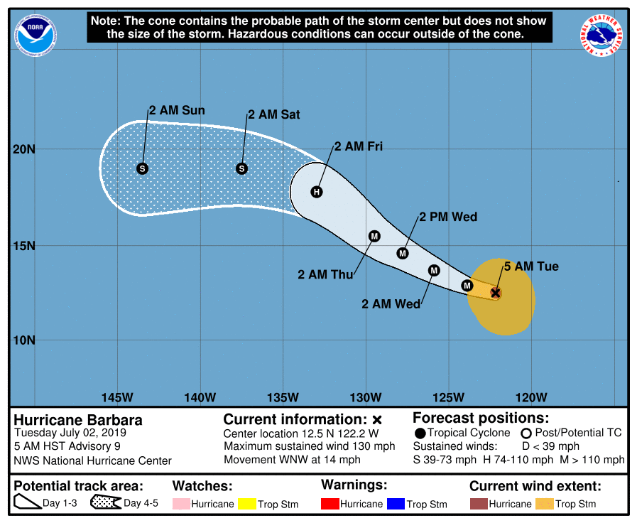
TROPICS: No tropical storms or hurricanes are expected in the Atlantic basin for the next five to seven days. Over in the eastern Pacific, Barbara is now a major hurricane with sustained winds of 130 mph. It is far from land, well west of Mexico and moving to the west/northwest. It should weaken late this week over open water as it gains latitude.
ON THIS DATE IN 1833: The following is from the “History and Description of New England” published in 1860: “On the 2nd of July, 1833, this town (Holland, Vermont) was visited by a violent tornado, which commenced on Salem Pond in Salem, and passed over this place in a northeasterly direction. It was from half to three-quarters of a mile wide and prostrated and scattered nearly all the trees, fences and buildings in its course. It crossed the outlet of Norton Pond and passed into Canada, and its path could be traced through the forests nearly to Connecticut River.”
BEACH FORECAST: Click here to see the AlabamaWx Beach Forecast Center page.
WEATHER BRAINS: You can listen to our weekly 90-minute show any time on your favorite podcast app. This is the show all about weather featuring many familiar voices, including the meteorologists at ABC 33/40.
CONNECT: You can find me on all of the major social networks:
Facebook
Twitter
Instagram
Pinterest
Snapchat: spannwx
For more weather news and information from James Spann and his team, visit AlabamaWx.


