James Spann: Hot, muggy weather continues for Alabama, with a few pop-up storms
James Spann has a deja vu Alabama forecast for Tuesday from Alabama NewsCenter on Vimeo.
SUMMERTIME WEATHER: It is a familiar forecast for Alabama today, and each day for the rest of the week. An upper ridge covers the southern U.S. and the primary band of westerly winds aloft (the jet stream) is well to the north, not far from the Canadian border. This leaves us in a pattern of hot, humid days with the risk of showers and thunderstorms during the peak of the daytime heating process. They form in random, scattered places, and there is no way of knowing in advance exactly when and where they pop up. They are most likely between 1 and 9 p.m.
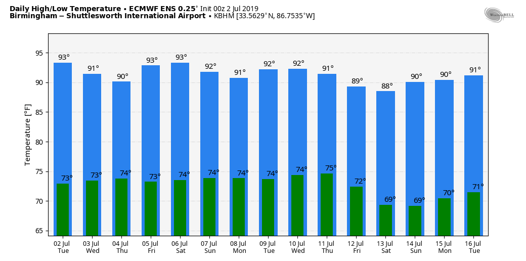
Odds of any one spot getting wet will be in the 20% to 30% range today and 30% to 40% Wednesday through Friday. Otherwise, look for partly sunny days, fair nights and highs between 91 and 94 degrees for most communities.
For the fireworks shows Thursday night, most (but not necessary all) of the scattered thunderstorms should be over by then. Temperatures at 9 p.m. should be in the low 80s.
THE ALABAMA WEEKEND AND BEYOND: The pattern remains the same — partly sunny, hot, humid days with scattered, mostly afternoon and evening showers and thunderstorms. Highs will be in the low 90s Saturday and Sunday. Same story next week as well — classic July weather. There will be variations in the daily coverage and placement of showers and thunderstorms, but that is determined by small-scale features that the synoptic scale computer models can’t handle (not enough resolution).
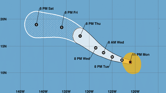
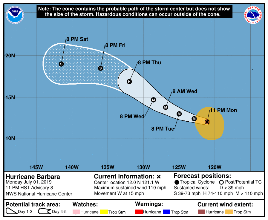
TROPICS: You’ll have no worries with tropical storms or hurricanes if you are beach bound for the Fourth of July; the Atlantic basin remains very quiet. Over in the eastern Pacific, Barbara is expected to become a major hurricane today, but it is far from from land (well west of Mexico). It is expected to weaken later this week as it gains latitude and encounters colder water.
ON THIS DATE IN 1833: The following is from the “History and Description of New England” published in 1860: “On the 2nd of July, 1833, this town (Holland, Vermont) was visited by a violent tornado, which commenced on Salem Pond in Salem, and passed over this place in a northeasterly direction. It was from half to three-quarters of a mile wide and prostrated and scattered nearly all the trees, fences and buildings in its course. It crossed the outlet of Norton Pond and passed into Canada, and its path could be traced through the forests nearly to Connecticut River.”
BEACH FORECAST: Click here to see the AlabamaWx Beach Forecast Center page.
WEATHER BRAINS: You can listen to our weekly 90-minute show any time on your favorite podcast app. This is the show all about weather featuring many familiar voices, including the meteorologists at ABC 33/40.
CONNECT: You can find me on all of the major social networks:
Facebook
Twitter
Instagram
Pinterest
Snapchat: spannwx
For more weather news and information from James Spann and his team, visit AlabamaWx.