James Spann: Tropical storm development likely in the Gulf, bringing rain to Alabama
RADAR CHECK: We have scattered strong thunderstorms in progress across Alabama this afternoon over the eastern and southern counties of the state; they are moving southwest. Away from those storms it is a hot, humid summer day with temperatures mostly in the mid 90s. The hot spot in the state at 2 p.m. was Greenville, in Butler County, with 99 degrees.
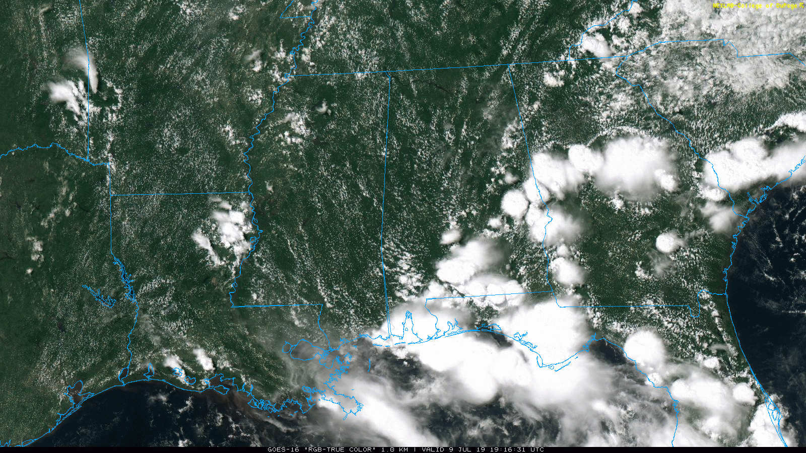
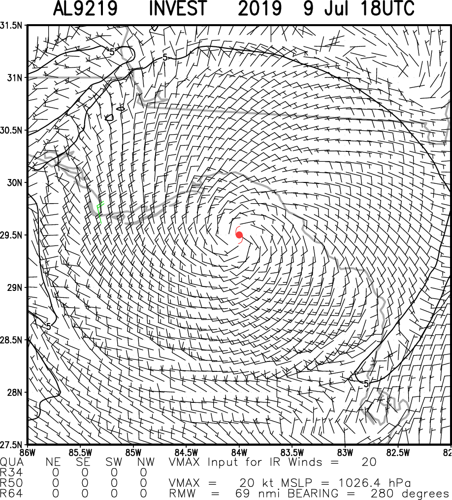
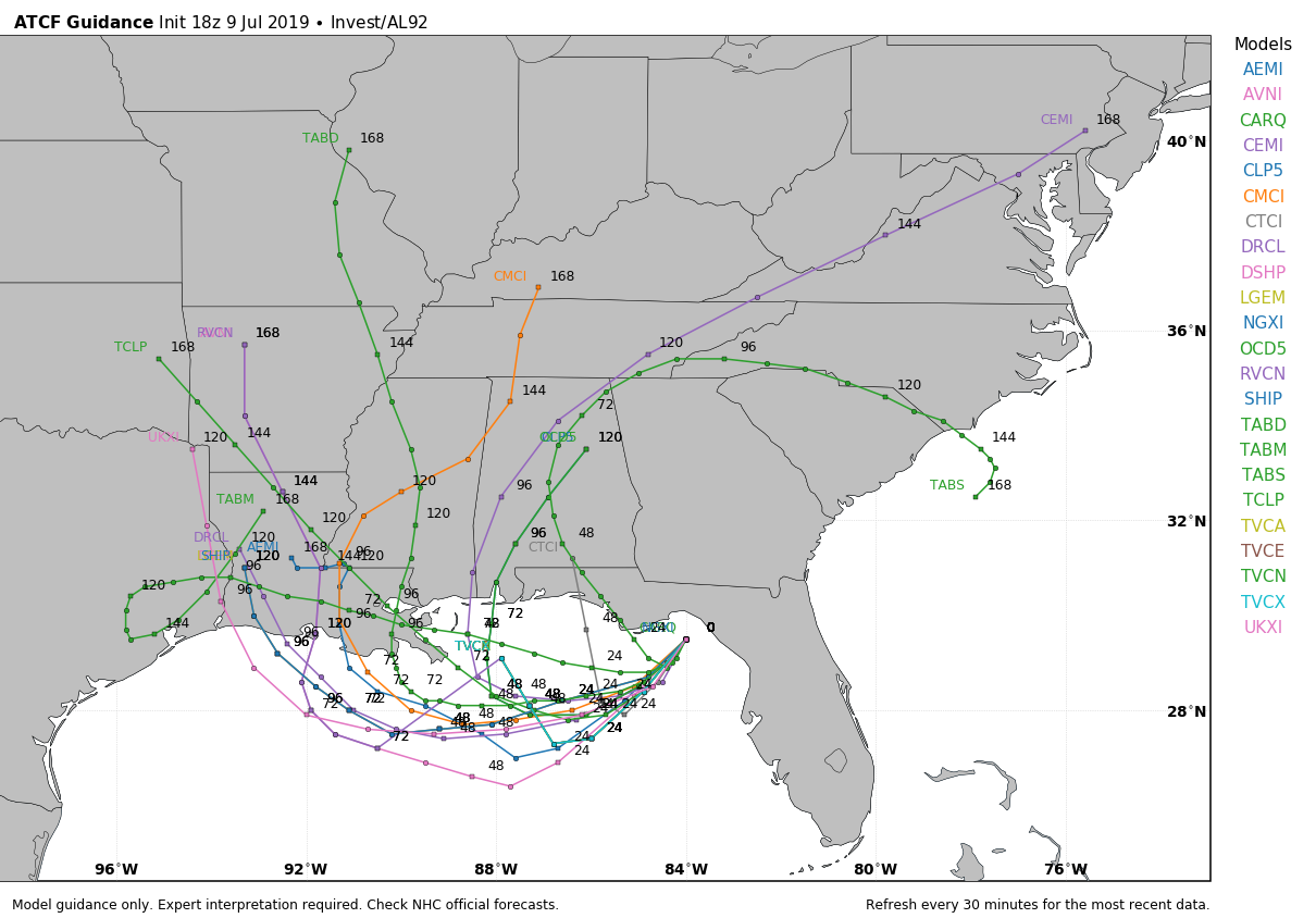
UNSETTLED WEATHER AHEAD: A disturbance, now in Apalachee Bay, is expected to become better organized over the next 24 hours, ultimately becoming a tropical storm (the name will be Barry) by Thursday.
It will drift slowly westward and will bring wet, unsettled weather to the central Gulf Coast and inland parts of Alabama Wednesday through at least Friday. Here are the key points:
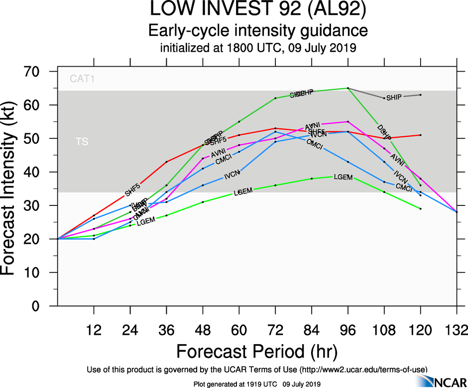
- New intensity guidance is a little more aggressive with the storm, suggesting it might be an upper-end tropical storm by Friday. But for now, we still expect it to stay below hurricane strength. Certainly keep an eye on forecast updates over the next few days.
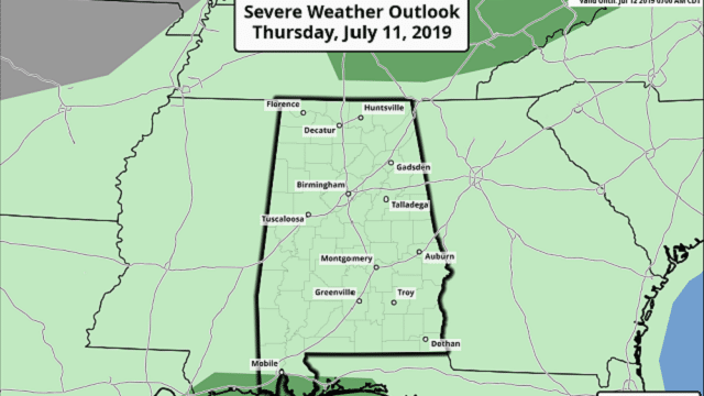
- The main impact will come from heavy rain/flooding and rough surf/rip currents. Gusty winds are likely, and a few brief waterspouts or tornadoes are possible by Thursday along the coast. The Storm Prediction Center has a marginal risk (level 1 of 5) defined for the western Florida Panhandle and the coasts of Alabama and Mississippi.
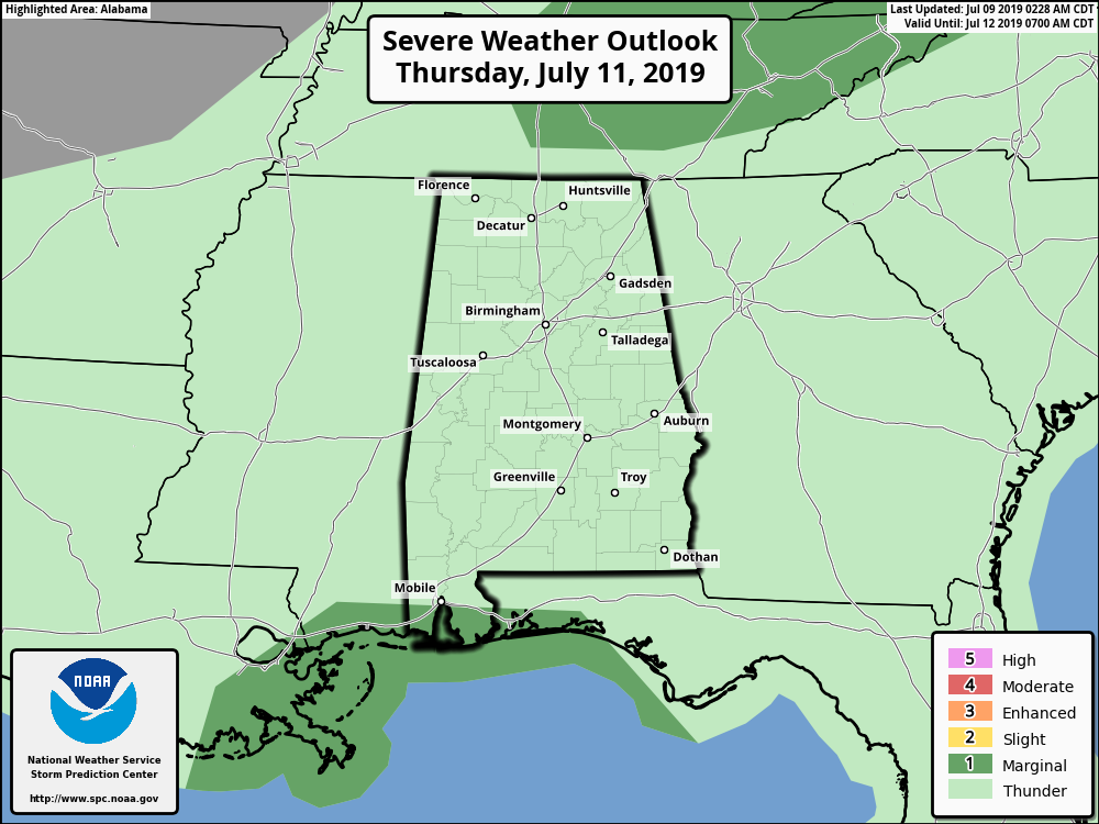
- The combination of deep tropical moisture feeding northward and a surface front approaching from the north will mean a good chance of showers and thunderstorms for north and central Alabama as well Wednesday afternoon, Thursday and Friday. There will be breaks in the rain, of course. There should be a slow decrease in the number of showers and storms for inland parts of Alabama over the weekend as Barry drifts westward.
- The system should drift inland over Louisiana at some point over the weekend. As you look at forecast and model tracks, don’t focus on the circulation center too much. The rain shield associated with the tropical storm will extend a few hundred miles to the east, on the “wet side” of the storm.
- The weather should improve for places like Panama City Beach, Destin and Pensacola over the weekend, but scattered showers and storms will remain possible. The Alabama Gulf Coast will stay fairly wet over the weekend with scattered to numerous showers and thunderstorms. All of the Gulf Coast will see a trend toward drier weather next week, although you have some risk of a passing storm there just about every summer day.
- Once we get an established center in the Gulf, there will be much greater confidence in impact forecasts. That should happen over the next 12-15 hours.
NEXT WEEK: The weather trends back toward seasonal conditions, with the routine risk of scattered, mostly afternoon and evening thunderstorms each day.
ON THIS DATE IN 1979: Hurricane Bob was born in the Gulf of Mexico, becoming the first Atlantic hurricane to be given a male name.
BEACH FORECAST: Click here to see the AlabamaWx Beach Forecast Center page.
WEATHER BRAINS: You can listen to our weekly 90-minute show any time on your favorite podcast app. This is the show all about weather featuring many familiar voices, including the meteorologists at ABC 33/40.
CONNECT: You can find me on the major social networks:
Facebook
Twitter
Instagram
Pinterest
Snapchat: spannwx
For more weather news and information from James Spann and his team, visit AlabamaWx.


