James Spann: Strong storms for Alabama this evening
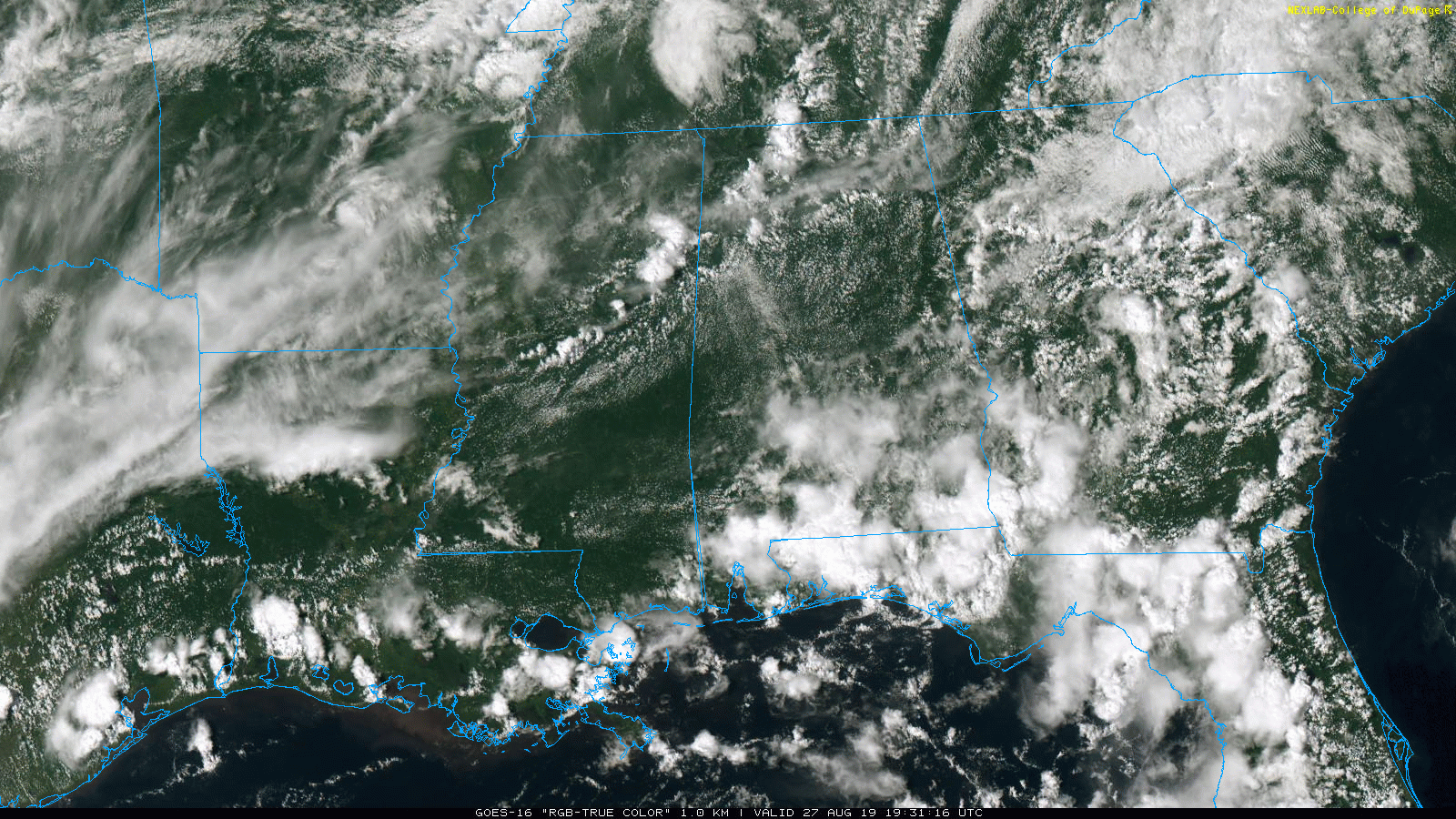
RADAR CHECK: Showers and strong thunderstorms continue to develop across north and west Alabama this afternoon ahead of a surface front. Heavier storms are producing gusty winds, heavy rain and lots of lightning as they move east/southeast. Away from the storms, the sky is partly sunny with temperatures in the 80s. Storms will end later tonight as drier air begins to push into north Alabama.
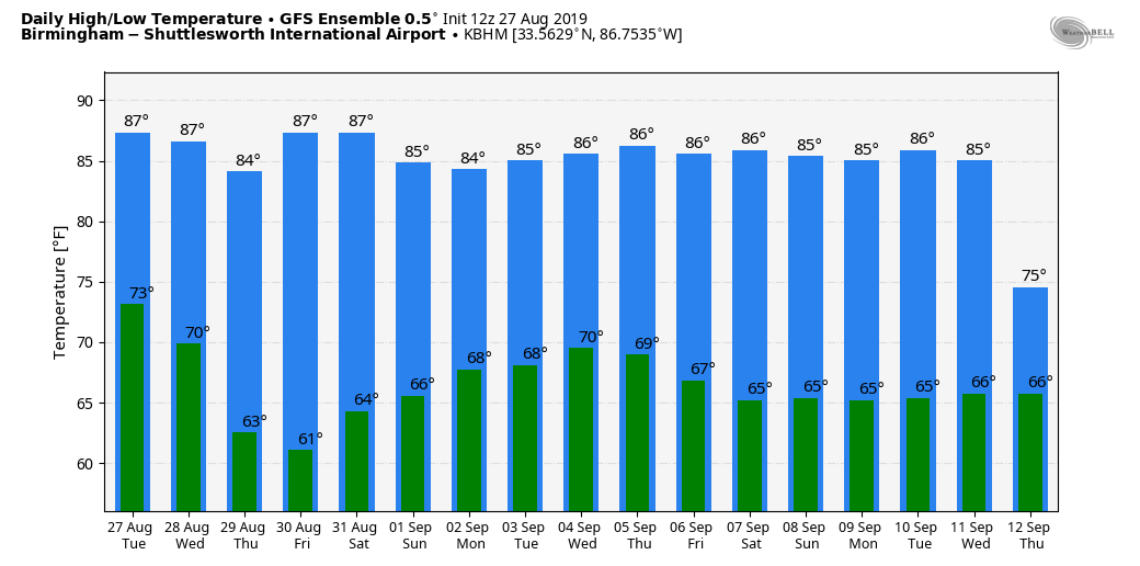
WEDNESDAY THROUGH FRIDAY: Dry air settles into the state. Wednesday will feature a good supply of sunshine over the northern half of Alabama; any showers will be confined to the far southern counties. Thursday and Friday will be dry statewide with sunny days, lower humidity and cooler nights. Some of the cooler spots across north and central Alabama will reach the 50s early Thursday morning.
LABOR DAY WEEKEND: It now looks like most of Alabama will be dry on Saturday, but we will mention a chance of scattered showers and thunderstorms statewide Sunday and Monday. The amount of rain we see Monday will be determined by the behavior of Tropical Storm Dorian, so the forecast is a low-confidence one for now. That pretty much applies to much of next week; the weather will all depend on the tropical weather situation, which is unclear at this point.
FOOTBALL WEATHER: UAB will host Alabama State Thursday night at Birmingham’s Legion Field; the kickoff is at 7. The weather will be delightful — a clear sky with temperatures falling from near 85 at kickoff into the 70s during the second half.
Alabama will take on Duke in the Chick-fil-A Kickoff Classic in Atlanta (2:30 p.m. Central kickoff). The game will be played indoors at Mercedes-Benz Stadium, but outside the sky will be mostly sunny with only isolated showers. Temperatures will peak close to 90 in Atlanta Saturday afternoon.
Auburn travels to Dallas/Fort Worth to take on Oregon at AT&T Stadium Saturday evening (7:30 Central kickoff). Temperatures will top out in the mid 90s during the day Saturday with a sunny sky, falling though the 80s during the game.
TROPICS: Tropical Depression Six, well east of the U.S. Atlantic coast, has moved little today with no real change in organization. It is still expected to become Tropical Storm Erin tonight; it will head toward the Canadian maritimes as a post tropical storm late this week.
DORIAN: Tropical Storm Dorian, now in the far eastern Caribbean, is packing sustained winds of 50 mph. The National Hurricane Center still forecasts the system to remain below hurricane strength over the next five days; the circulation center will clip the western tip of Puerto Rico Wednesday night and the Dominican Republic Thursday morning. Then, the system moves through the Bahamas Friday and Saturday, and comes to a point north of West Palm Beach, Florida, early Sunday morning.
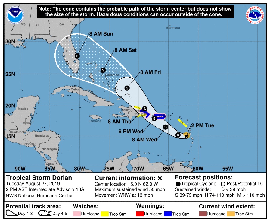
Some important points concerning Dorian:
- Don’t focus on the details of the extended track forecast, as the average five-day track error is around 200 miles.
- Uncertainty in the intensity forecast later this week remains higher than usual because of Dorian’s potential interaction with Hispaniola and Puerto Rico.
- The threat of winds and heavy rains later this week into this weekend in the Turks and Caicos, the Bahamas and Florida is increasing. Residents in these areas should monitor the progress of Dorian and ensure that they have their hurricane plan in place.
- It remains to be seen if Dorian will have any direct impact on Alabama or the Central Gulf Coast. If you have a Labor Day beach trip planned to places like Panama City Beach, Destin or Gulf Shores, there’s no need to cancel plans, but keep a close eye on updates as the weekend approaches.
- Remember, the “wet” side of the system will be along and to the east of the circulation center as Dorian approaches the Florida Peninsula.
The rest of the Atlantic basin is quiet.
ON THIS DATE IN 1883: Krakatoa Volcano exploded in the East Indies. The explosion was heard more than 2,500 miles away, and every barograph around the world recorded the passage of the airwave, up to seven times. Giant waves, 125 feet high and traveling 300 mph, devastated everything in their path, hurling ashore coral blocks weighing up to 900 tons, and killing more than 36,000 people. Volcanic ash was carried around the globe in 13 days, producing blue and green suns in the tropics and vivid red sunsets in higher latitudes. The temperature of the earth was lowered one degree for the next two years, finally recovering to normal by 1888.
BEACH FORECAST: Click here to see the AlabamaWx Beach Forecast Center page.
WEATHER BRAINS: You can listen to our weekly 90-minute show any time on your favorite podcast app. This is the show all about weather featuring many familiar voices, including the meteorologists at ABC 33/40.
CONNECT: You can find me on all of the major social networks:
Facebook
Twitter
Instagram
Pinterest
Snapchat: spannwx
For more weather news and information from James Spann and his team, visit AlabamaWx.


