James Spann: Dry air remains over Alabama; Dorian to grow stronger
James Spann forecasts dry weather for the rest of the Alabama work week from Alabama NewsCenter on Vimeo.
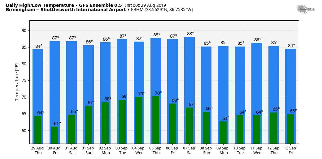
REFRESHING MORNING: We have a nice taste of fall in the air across Alabama this morning. Places like Cullman and Fort Payne are down in the upper 50s, and most other communities are seeing temperatures in the low 60s at daybreak. Today will be another sunny day with low humidity and a high in the upper 80s. Don’t look for any real change on Friday; sunshine will be in full supply with a high not too far from 90 after a cool morning.
LABOR DAY WEEKEND: The northern half of the state stays dry Saturday, although a few scattered showers could show up over the southern counties. Then, on Sunday and Monday, look for a partly sunny sky both days with potential for a few showers statewide, but they should be widely spaced. Highs over the weekend will be generally in the 87- to 90-degree range.
NEXT WEEK: Our weather will depend on the behavior of Hurricane Dorian; the latest guidance suggests the northward turn will happen east of Alabama, meaning we stay on the dry side of the system. Any rain from Dorian, as it looks now, will be over far east and southeast Alabama (but, of course, this could change). Highs will be mostly in the upper 80s.
 FOOTBALL WEATHER: We should have perfect weather for high school football games across the state tonight and Friday night — clear with low humidity and temperatures falling from the low 80s at kickoff into the 70s during the second half.
UAB will host Alabama State tonight at Birmingham’s Legion Field; the kickoff is at 7. The weather will be delightful — a clear sky with temperatures falling from near 85 at kickoff into the 70s during the second half.
Alabama will take on Duke in the Chick-fil-A Kickoff Classic in Atlanta (2:30 p.m. Central kickoff). The game will be played indoors at Mercedes-Benz Stadium, but outside the sky will be mostly sunny. Temperatures will peak close to 90 in Atlanta Saturday afternoon.
Auburn travels to Dallas/Fort Worth to take on Oregon at AT&T Stadium Saturday evening (6:30 Central kickoff). Temperatures will top out in the mid 90s during the day Saturday with a sunny sky, falling though the 80s during the game.
ERIN: This system, in the Atlantic east of Cape Hatteras, is now post-tropical.
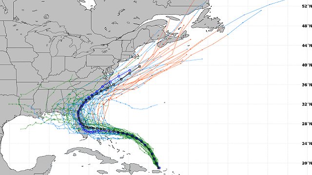
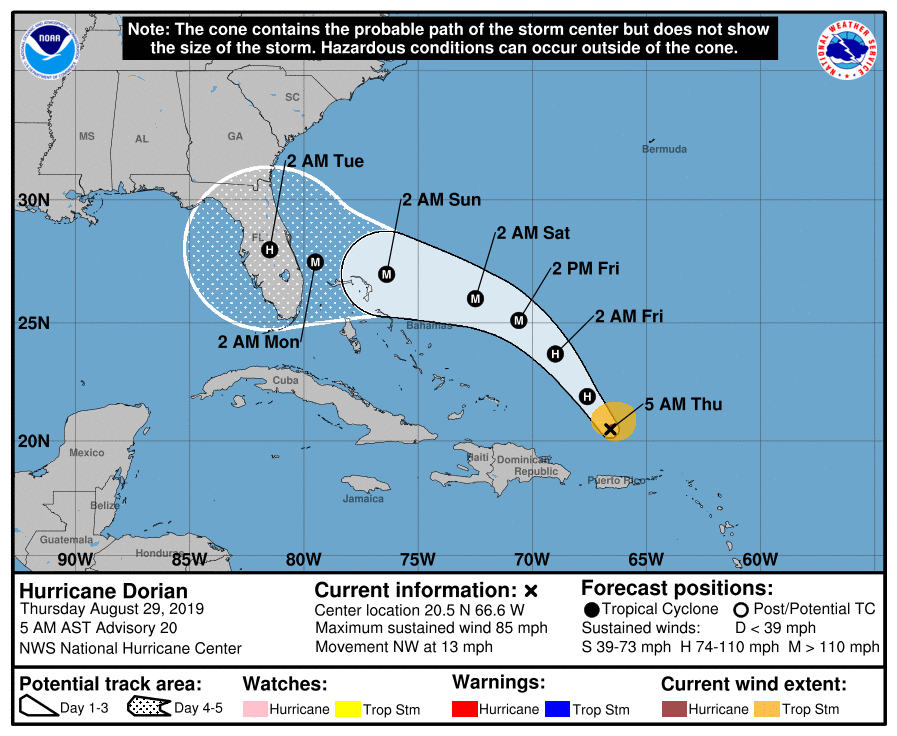
DORIAN: Hurricane Dorian is packing sustained winds of 85 mph, and is moving northwest in the Atlantic north of Puerto Rico. The National Hurricane Center still is forecasting major hurricane strength (Category 3) within 24 hours, and landfall is projected on Florida’s east coast on Labor Day.
Here are some important points this morning:
- The most notable change in the new NHC forecast is that it’s a little bit slower than the previous one as Dorian approaches Florida.
- The risk of dangerous storm surge and hurricane-force winds later this week and this weekend continues to increase in the central and northwestern Bahamas and along the Florida east coast, although it is too soon to determine where these hazards will occur. Residents in these areas should ensure they have their hurricane plan in place and not focus on the exact forecast track of Dorian’s center.
- If you have a Labor Day weekend trip planned to Disney World, the weather looks routine Saturday and a decent part of the day Sunday with a mix of sun and clouds and scattered storms, but weather conditions will deteriorate Sunday night and Monday with increasing wind and rain.
- There will be no impact from Dorian on the central Gulf Coast (places like Gulf Shores, Destin and Panama City Beach) over the Labor Day weekend. Routine late summer weather is likely with sun and scattered thunderstorms.
- The new model sets have shown a weaker upper ridge north of the system early next week, allowing for a northward turn east of Alabama. If this is the case, Alabama and the central Gulf Coast will remain on the dry, west side of the system and there will be little, if any, direct impact. But run-to-run model output has not been especially consistent, and this is not carved in stone.
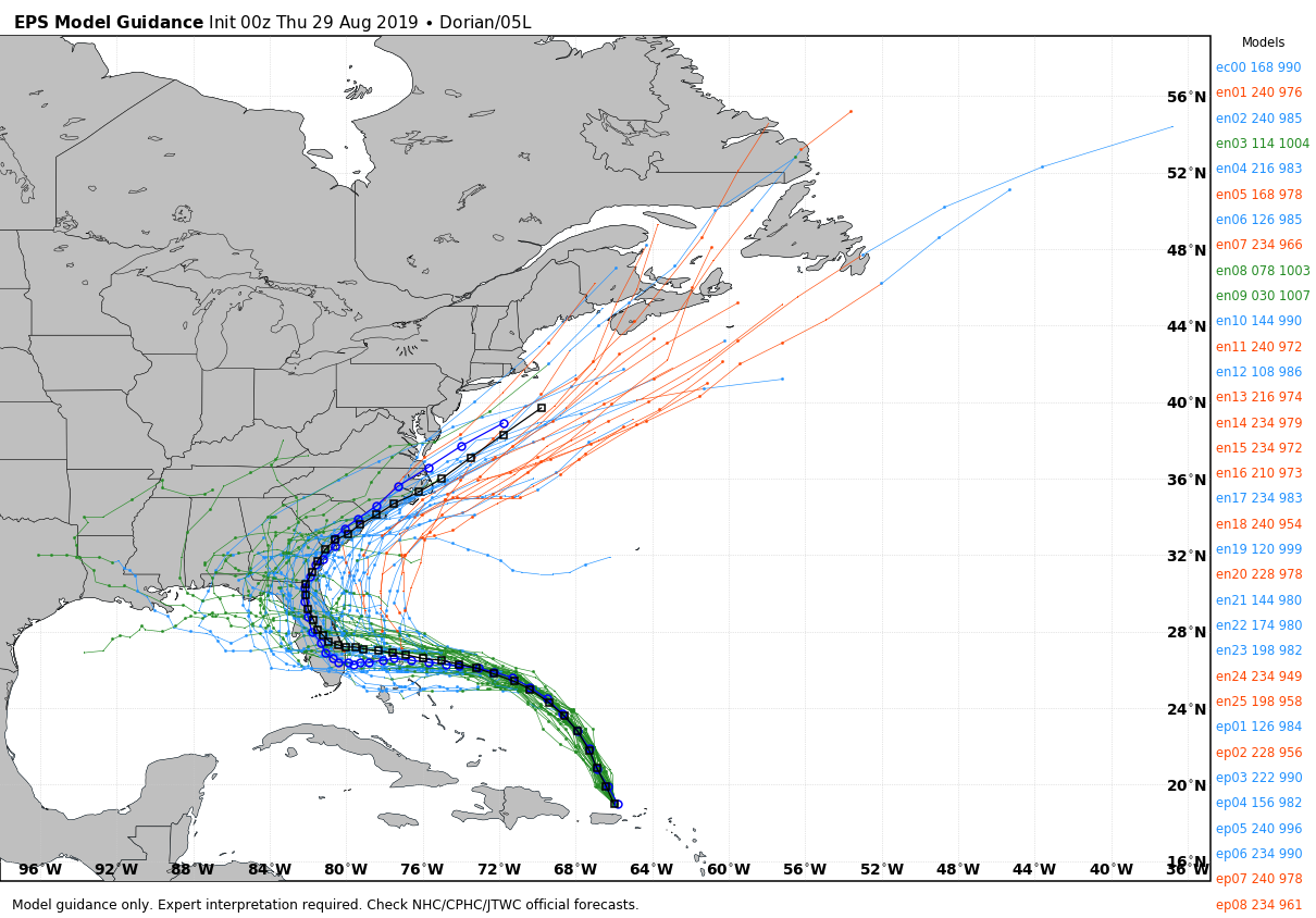
- Do not focus on the exact forecast track, as the average five-day track error is around 200 miles. The forecast can and will change. If you want the most accurate and up-to-date information, you will have to check the Dorian forecast several times a day. Otherwise, you’re working with old (and most likely bad) information.
The rest of the Atlantic basin is quiet.
ON THIS DATE IN 2005: Hurricane Katrina makes landfall near New Orleans, Louisiana, as a Category 3 hurricane. Despite being only the third most powerful storm of the 2005 hurricane season, Katrina was one of the worst natural disasters in the history of the United States.
BEACH FORECAST: Click here to see the AlabamaWx Beach Forecast Center page.
WEATHER BRAINS: You can listen to our weekly 90-minute show any time on your favorite podcast app. This is the show all about weather featuring many familiar voices, including the meteorologists at ABC 33/40.
CONNECT: You can find me on all of the major social networks:
Facebook
Twitter
Instagram
Pinterest
Snapchat: spannwx
For more weather news and information from James Spann and his team, visit AlabamaWx.


