James Spann: Hot, dry weather for Alabama; Dorian stalls
James Spann has the Alabama forecast and a Labor Day update on Dorian from Alabama NewsCenter on Vimeo.
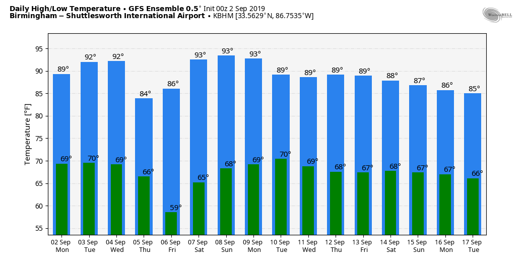
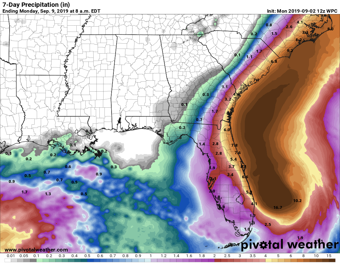
DRY PATTERN FOR ALABAMA: Most of Alabama will be rain-free for the week with mostly sunny days and fair nights. This is despite a surface front that is expected to move through Wednesday night. With little moisture, we believe the front will pass through in dry fashion. Highs will be in the low to mid 90s today through Wednesday and closer to 90 Thursday and Friday. Nights will be cooler later this week; many places will drop into the 50s early Friday morning thanks to very dry air covering the region.
THE ALABAMA WEEKEND: Dry weather continues; we expect a partly to mostly sunny sky Saturday and Sunday with highs in the low 90s.
Most likely the dry conditions stay in place early next week. The next hope of getting some rain in here is toward the middle of next week with a front approaching from the north.
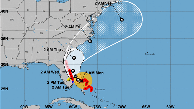
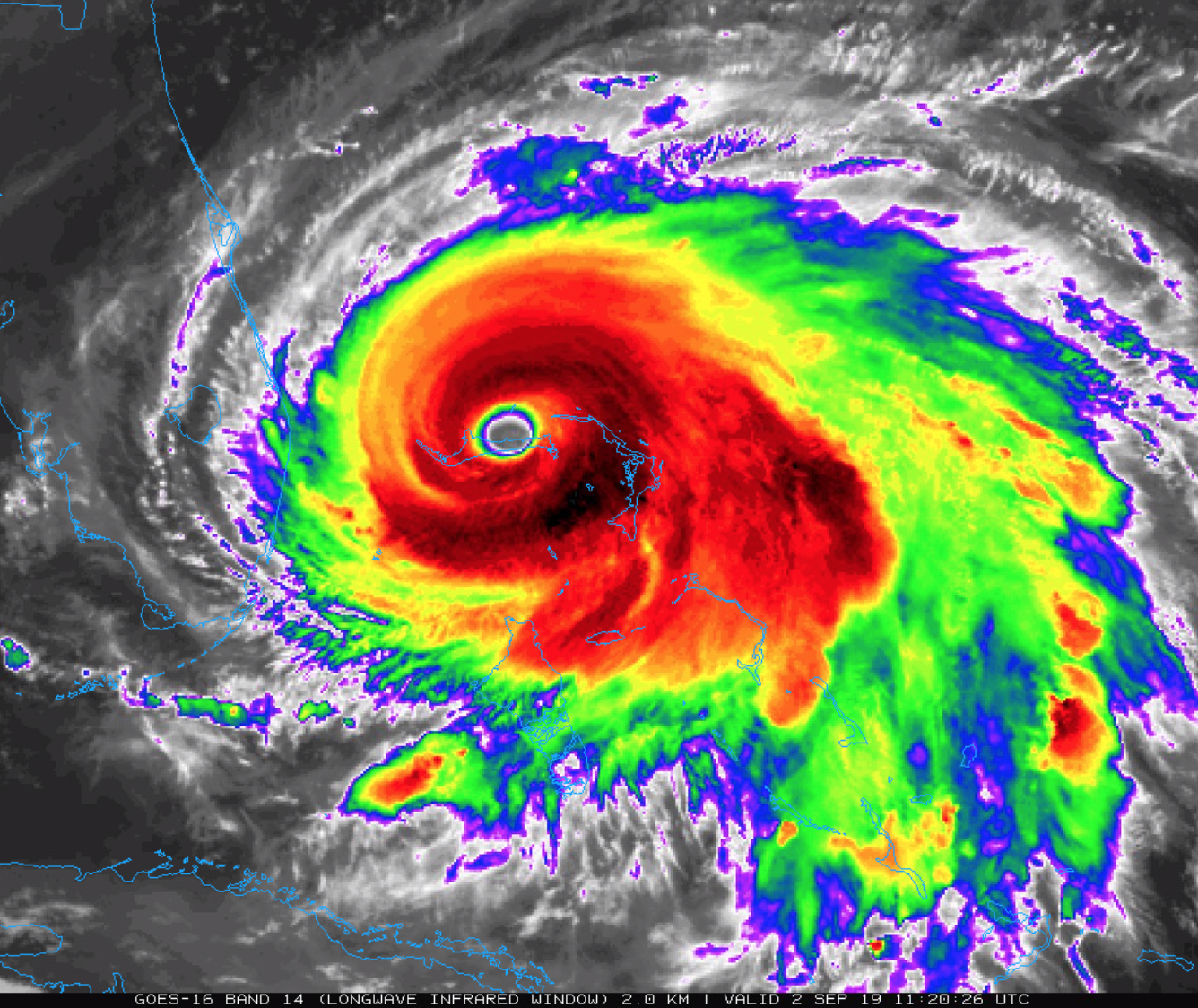
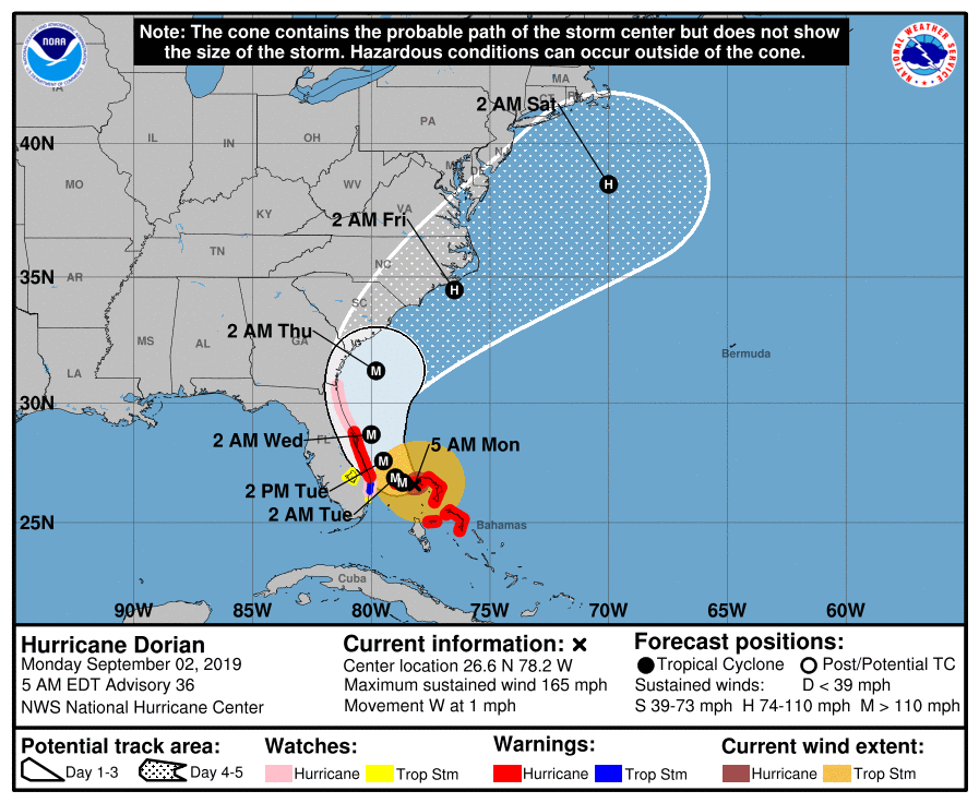
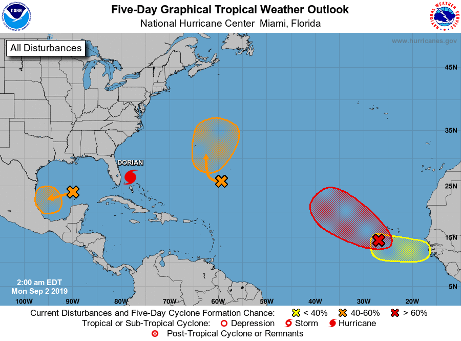
HURRICANE DORIAN: This extremely dangerous hurricane is stalled over Grand Bahama Island this morning; sustained winds are 165 mph, still at Category 5 strength.
Here are some important points:
- A prolonged period of catastrophic winds and storm surge will continue to affect Grand Bahama Island through today and tonight. Everyone there should remain in shelter and not venture into the eye.
- During the next few days, Dorian should be encountering some increase in shear, which will likely result in weakening. However, it is anticipated that the system will remain a dangerous major hurricane for the next several days.
- Life-threatening storm surges and dangerous hurricane-force winds are expected along portions of the Florida east coast through midweek, and storm surge and hurricane warnings are in effect. Only a slight deviation to the left of the official forecast would bring the core of Dorian near or over the Florida east coast. Residents should listen to advice given by local emergency officials.
- A Hurricane Warning is in effect for Grand Bahama and the Abacos Islands in the northwestern Bahamas, and for Jupiter Inlet to the Volusia/Brevard county line.
- A Hurricane Watch is in effect north of Deerfield Beach to Jupiter Inlet, and from the Volusia/Brevard county line to the mouth of the St. Mary’s River.
- Remember, a hurricane is not a dot on a map. Hurricane-force winds extend outward up to 45 miles from the center, and tropical-storm-force winds extend outward up to 140 miles.
- There is an increasing likelihood of strong winds and dangerous storm surge along the coasts of Georgia, South Carolina and North Carolina later this week. Residents in these areas should continue to monitor the progress of Dorian and listen to advice given by local emergency officials.
- Individuals east of I-95 in Bryan, Camden, Chatham, Glynn, Liberty and McIntosh counties in Georgia must evacuate beginning Tuesday.
- There is a mandatory evacuation of the entire South Carolina coastline, beginning at noon Eastern Time on Tuesday.
- Dorian will not affect Alabama or the central Gulf Coast in any way.
ELSEWHERE IN THE TROPICS: The National Hurricane Center is monitoring four other waves in the Atlantic basin; none of them poses a threat to the U.S. over the next five days.
ON THIS DATE IN 1935: The 1935 Labor Day hurricane (formally known as Hurricane Three) was the most intense Atlantic hurricane to make landfall on record in terms of pressure, and tied with Hurricane Dorian for the strongest landfalling Atlantic hurricane by maximum sustained winds, with winds of 185 mph at landfall. It was also the most intense Atlantic hurricane on record until Hurricane Gilbert in 1988. Officially, 408 people lost their lives as a result of the storm, including more than 250 veterans, but the death toll may have actually been much higher.
BEACH FORECAST: Click here to see the AlabamaWx Beach Forecast Center page.
WEATHER BRAINS: You can listen to our weekly 90-minute show any time on your favorite podcast app. This is the show all about weather featuring many familiar voices, including the meteorologists at ABC 33/40.
CONNECT: You can find me on the major social networks:
Facebook
Twitter
Instagram
Pinterest
Snapchat: spannwx
For more weather news and information from James Spann and his team, visit AlabamaWx.


