James Spann: Alabama still dry today, but breezy with low humidity
James Spann forecasts more dry days for Alabama from Alabama NewsCenter on Vimeo.
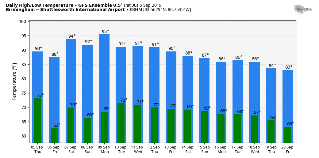
DRY DAYS: Sunny weather continues across Alabama today, but humidity levels will be a tad lower following a dry front that passed through last night. And a north breeze will increase this afternoon into the 10-20 mph range, making the September heat feel more comfortable. The high today will be in the low 90s; tonight will be clear and pleasant. Cooler spots could see lows in the upper 50s early Friday.
FRIDAY AND THE WEEKEND: Not much change. Dry air means sunny, hot days and fair nights; the high will be in the low 90s Friday, followed by mid 90s Saturday and Sunday.
NEXT WEEK: Hope of beneficial rain looks low, although we will mention a chance of isolated showers Tuesday and Wednesday. Otherwise, expect partly to mostly sunny days, fair nights and highs mostly in the low 90s.
FOOTBALL WEATHER: For the high school games Friday night, the sky will be clear with temperatures falling from the upper 80s at kickoff into the upper 70s by the final whistle.
On Saturday, Alabama hosts New Mexico State at Bryant-Denny Stadium in Tuscaloosa (3 p.m. kickoff). It will be a sizzling afternoon with a kickoff temperature near 97 degrees, falling into the low 90s by the fourth quarter. The sky will be mostly sunny.
Auburn will host Tulane Saturday evening (6:30 kickoff). The sky will be clear with temperatures falling from 90 degrees at kickoff into the upper 70s by the final whistle.
UAB is on the road, traveling to Akron, Ohio, to play the Zips Saturday (11 a.m. Central kickoff). The sky will be mostly sunny with temperatures rising from near 70 at kickoff into the mid 70s by the fourth quarter.
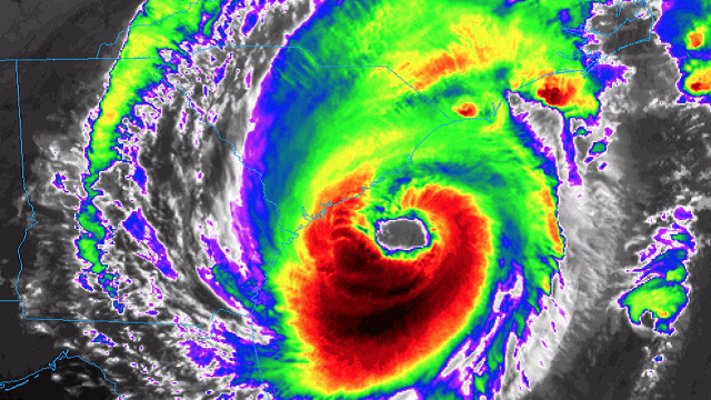
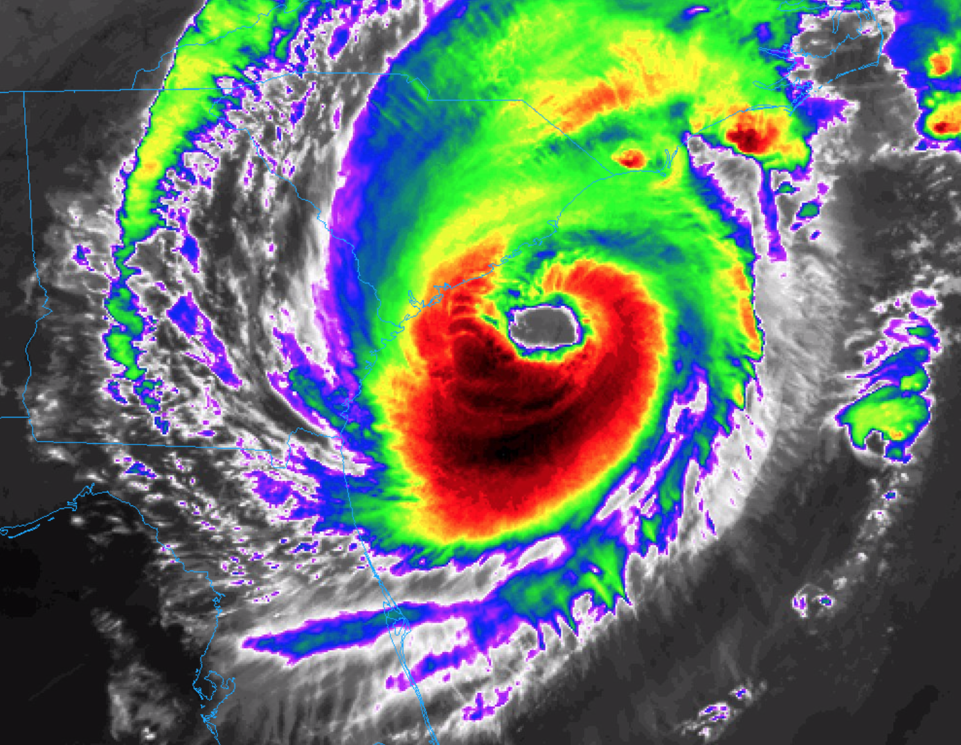
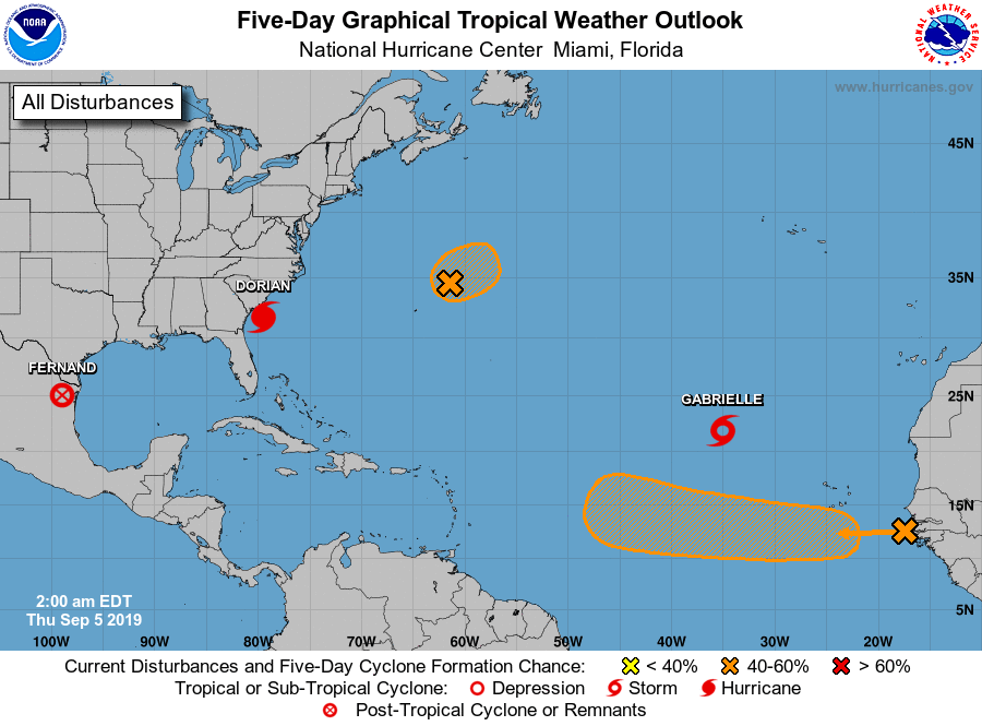
HURRICANE DORIAN: Dorian is a dangerous Category 3 hurricane with sustained winds of 115 mph. The center early this morning was 80 miles south/southeast of Charleston.
Important points:
- Life-threatening storm surge and dangerous winds are expected along portions the coasts of South Carolina and North Carolina, and portions of southeast Virginia and the southern Chesapeake Bay, regardless of the exact track of Dorian’s center. Water levels could rise well in advance of the arrival of strong winds. Residents in these areas should follow advice given by local emergency officials.
- Hurricane-force winds extend outward up to 60 miles from the center, and tropical-storm-force winds extend outward up to 195 miles. The National Weather Service Forecast Office in Charleston, South Carolina, recently reported a wind gust to 68 mph at the Charleston International Airport.
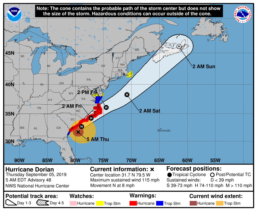
- A Hurricane Warning is in effect from the Savannah River to the North Carolina-Virginia border, and for Pamlico and Albemarle Sounds.
- A Tropical Storm Warning is in effect from the North Carolina-Virginia border to Chincoteague, Virginia, and for Chesapeake Bay from Smith Point southward.
- A Tropical Storm Watch is in effect north of Chincoteague, Virginia, to Fenwick Island, Delaware; for Chesapeake Bay from Smith Point to Drum Point; for Tidal Potomac south of Cobb Island; from Woods Hole to Sagamore Beach, Massachusetts, and for Nantucket and Martha’s Vineyard.
- Dorian should soon begin to experience increasing southwesterly shear, which should lead to at least slow weakening during the next couple of days. The official forecast maintains the cyclone at hurricane strength through 72 hours.
TROPICAL STORM GABRIELLE: This system is in the eastern Atlantic and will gain latitude and move into the open North Atlantic, far from land.
ELSEWHERE IN THE TROPICS: A disturbance north of Bermuda is moving north, and if anything develops here it will be no threat to land. A wave coming off the coast of Africa has potential for development over the next five days; it is moving west, and it is too early to know if this will ultimately impact the Lesser Antilles or turn north into the open Atlantic. Tropical Depression Fernand has dissipated over northern Mexico.
ON THIS DATE IN 1925: The state recorded its hottest temperature ever, 112 degrees, at Centreville. It was 108 in Gadsden and 109 in Demopolis. It was 105 in Tuscaloosa and 104 in Cullman. Every reporting station in Alabama recorded a high of 100 degrees or higher on this date, an unprecedented event that has never been repeated.
BEACH FORECAST: Click here to see the AlabamaWx Beach Forecast Center page.
WEATHER BRAINS: You can listen to our weekly 90-minute show any time on your favorite podcast app. This is the show all about weather featuring many familiar voices, including the meteorologists at ABC 33/40.
CONNECT: You can find me on the major social networks:
Facebook
Twitter
Instagram
Pinterest
Snapchat: spannwx
For more weather news and information from James Spann and his team, visit AlabamaWx.


