James Spann: Severe storms possible in Alabama Wednesday night
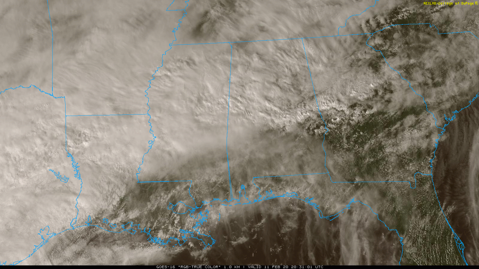
RADAR CHECK: Rain has been increasing across Alabama again over the past few hours as a nearly stalled stationary front continues to be draped across the central part of the state. Back in the colder air north of the front, temperatures are only in the upper 40s in places like Cullman and Haleyville, but to the south low 80s are reported at Montgomery. We will forecast periods of rain tonight; amounts should be generally less than one-half inch over the next 12 hours.
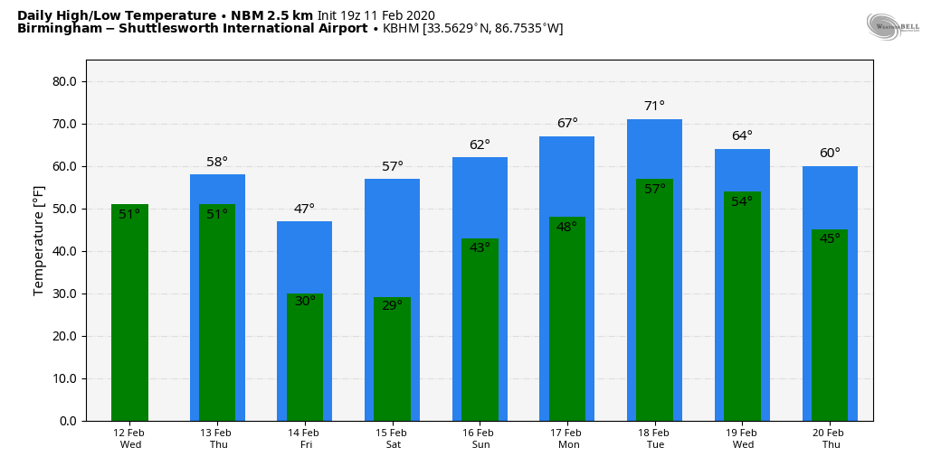
SEVERE STORMS POSSIBLE WEDNESDAY NIGHT: Wednesday will be a mostly cloudy, mild and breezy day across Alabama. A few showers are possible, and temperatures will rise into the mid 70s by afternoon. Some low 80s are possible over the southern half of the state again.
Then, as a cold front works into the state Wednesday night, we will have potential for strong to severe thunderstorms.
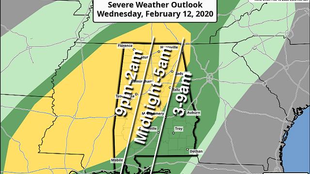
The Storm Prediction Center has defined a slight risk (level 2 out of 5) of severe storms as far east as Anniston, Prattville and Jackson. A marginal risk (level 1 of 5) is up for other parts of east and south Alabama.
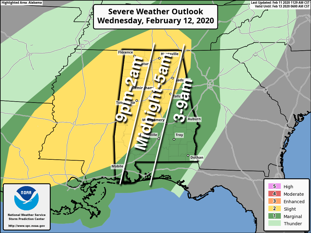
TIMING: The window for the heavier storms begins around 9 p.m. across west Alabama and around midnight for Birmingham. Much of the action will come before dawn Thursday.
THREATS: Heavier storms will be capable of producing hail, damaging winds and a tornado or two.
RAIN: Amounts of one-half inch to 1 inch are forecast Wednesday night into Thursday morning, which could be enough for some flooding considering the saturated soil conditions.
Now model data continues to show rather limited surface-based instability, which could limit the overall threat, but it doesn’t take much to get severe storms going in the cold season.
Rain will end Thursday morning; the clearing should begin late in the day or Thursday night. Thursday’s high will be in the 55- to 60-degree range.
FRIDAY AND THE WEEKEND: Friday will be cold and dry. We start the day in the 20s, followed by a high in the mid to upper 40s. Saturday will be another dry day with a cold morning; temperatures should easily reach the 20s early in the day. We rise into the mid 50s Saturday afternoon as a warming trend begins. Clouds increase Saturday night, and some light rain is possible after midnight into the daytime Sunday. Otherwise, Sunday will be mostly cloudy with a high in the low 60s.
NEXT WEEK: The week looks fairly mild and unsettled; it won’t rain every day during the week, but we will deal with rounds of showers from time to time as the active southern branch of the jet stream remains parked across the Deep South. Highs will be in the 60s on most days.
STORM TOTALS: Here are some updated storm totals from the ABC 33/40 team of Skywatchers:
- Coker — 5.73 inches
- Bibbville — 5.4
- Cottondale — 5.22
- Hoover/Brocks Gap — 4.43
- Hueytown — 4.19
- Rock Creek — 3.75
- Heflin — 3.28
- Weaver — 3.01
- Moody — 2.82
- Black Creek — 2.75
ON THIS DATE IN 1983: The “Megalopolitan blockbuster snowstorm” hit the Mid-Atlantic and southern New England. Snowfall up to 25 inches fell at Allentown, Pennsylvania. Snowfall of 35 inches occurred in parts of the Blue Ridge Mountains of West Virginia at Glen Cary. Windsor Locks, Connecticut, recorded a record 19 inches in 12 hours. A ship sank off the Virginia/Maryland coast, killing 33. There were 46 total storm-related fatalities.
BEACH FORECAST: Click here to see the AlabamaWx Beach Forecast Center page.
WEATHER BRAINS: You can listen to our weekly 90-minute show any time on your favorite podcast app. This is the show all about weather featuring many familiar voices, including the meteorologists at ABC 33/40.
CONNECT: You can find me on the major social networks:
Facebook
Twitter
Instagram
Pinterest
Snapchat: spannwx
For more weather news and information from James Spann and his team, visit AlabamaWx.


