James Spann: Strong to severe storms possible tonight in Alabama
James Spann has the midweek forecast for soggy Alabama from Alabama NewsCenter on Vimeo.
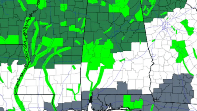
MILD, BREEZY DAY: Today will be a mostly cloudy, mild and breezy day for Alabama with a few passing showers; temperatures will reach the upper 60s and low 70s this afternoon with a gusty south wind of 12-25 mph by afternoon. With saturated soil conditions and many creeks and streams out of their banks, a flash flood watch remains in effect for roughly the northern half of Alabama. But rain amounts during the day today should remain under one-quarter inch for most communities.
SEVERE THUNDERSTORM POTENTIAL TONIGHT: An approaching cold front will bring a narrow band of strong to severe thunderstorms to Alabama tonight. With limited instability and weak lapse rates (because of warmer air aloft), the threat will be limited, but there will be good dynamic forcing with an upper trough lifting out of the Southwest U.S.
The Storm Prediction Center has a slight risk (level 2 out of 5) of severe thunderstorms identified tonight for that part of Alabama north of a line from Toxey to Linden to Calera to Spring Garden, with a marginal risk (level 1 of 5) down to Spanish Fort, Greenville and Lafayette. No severe storms are expected over southeast Alabama.
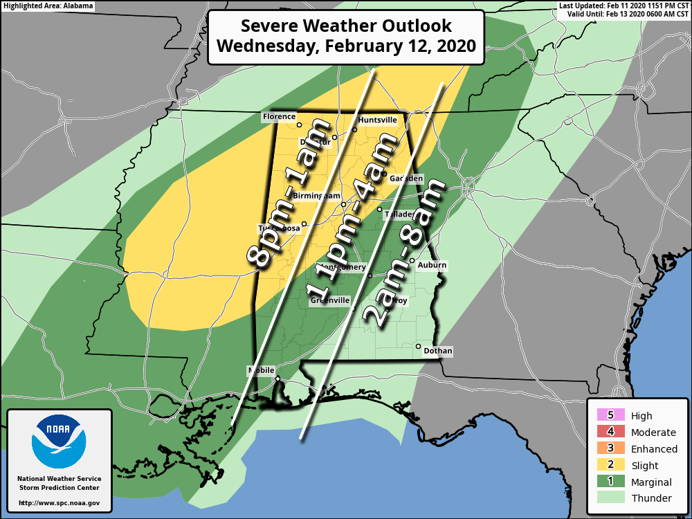
TIMING: A narrow line of storms will enter the northwest corner of the state around 8 tonight; it should reach Huntsville, Jasper and Tuscaloosa by 11 p.m., Birmingham and Gadsden by 1 a.m. and Anniston by 2 a.m. The storms will weaken as they push deeper into east Alabama.
THREATS: The main threat from this line of storms will come from strong, gusty winds. However, some small hail will be possible. A brief, isolated tornado can’t be totally ruled out, but is not likely.
The saturated soil conditions will make it easier for some trees to come down with the gusty winds associated with the line of thunderstorms tonight.
RAIN: Rain amounts of around one-half inch are likely with the passing line of storms tonight; some temporary flooding is possible.
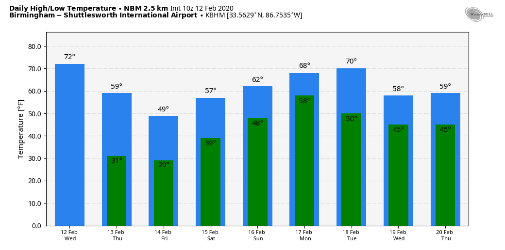
THURSDAY: The best chance of rain during the day Thursday will be over the southern half of the state, but severe storms are not expected there. For north and central Alabama, clouds will linger much of the day and temperatures will fall through the 50s with a brisk northwest wind.
FRIDAY AND THE WEEKEND: Friday and Saturday will feature a good supply of sunshine both days with cold mornings; lows will be in the 25- to 32-degree range. The high will be in the upper 40s Friday, followed by mid 50s Saturday. The latest model data now suggests Sunday will be dry for the northern half of the state with high clouds; any rain should be confined to the southern quarter of Alabama. Sunday’s high will be in the low 60s.
NEXT WEEK: While a shower is possible Monday, rain seems more likely Tuesday through Wednesday as a surface front creeps into Alabama and becomes nearly stationary.
ON THIS DATE IN 1958: Snow blanketed northern Florida, with Tallahassee reporting a record 2.8 inches. A ship in the Gulf of Mexico, 25 miles south of Fort Morgan, reported zero visibility in heavy snow on the afternoon of the 12th.
BEACH FORECAST: Click here to see the AlabamaWx Beach Forecast Center page.
WEATHER BRAINS: You can listen to our weekly 90-minute show any time on your favorite podcast app. This is the show all about weather featuring many familiar voices, including the meteorologists at ABC 33/40.
CONNECT: You can find me on the major social networks:
Facebook
Twitter
Instagram
Pinterest
Snapchat: spannwx
For more weather news and information from James Spann and his team, visit AlabamaWx.


