James Spann: Occasional rain for Alabama tonight through Thursday
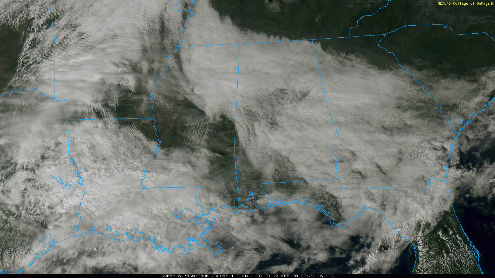
HERE COMES THE RAIN AGAIN: The sky is generally cloudy across Alabama this afternoon with temperatures mostly in the 50s and 60s. Nothing is on radar, and the sun is peeking through the clouds in spots. But clouds thicken tonight, and rain will move into the state ahead of an approaching cold front.
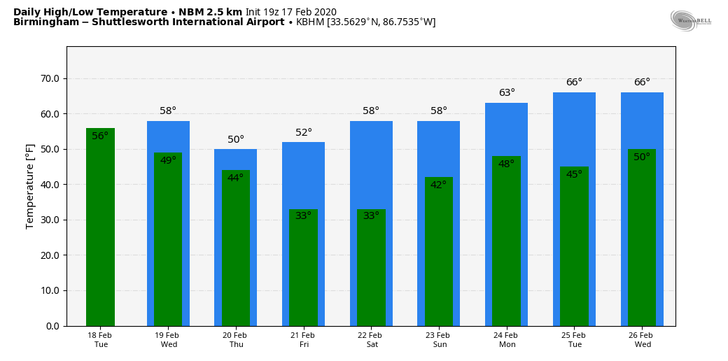
Rain will be widespread across Alabama on Tuesday. A few embedded thunderstorms are possible, but severe storms are not expected. The temperatures will be mild, rising into the 66- to 72-degree range. The rain tapers off late Tuesday night as the front settles into south Alabama.
Wednesday will be mostly cloudy and cooler, with a high in the mid to upper 50s. Some scattered light rain is possible, but most of the day should be dry. Rain will increase again late Wednesday night and during the day Thursday as a wave of low pressure moves along the stalled front over south Alabama. It will be a cold rain for the northern half of the state, with temperatures only in the 40s. The rain will end from west to east Thursday night.
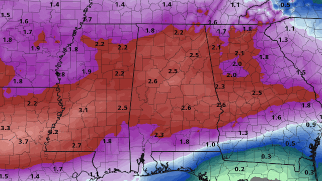
Rain amounts of 2-3 inches are likely for central Alabama between tonight and Thursday night — probably not enough for major flash flooding issues, but some localized problems are possible.
FRIDAY AND THE WEEKEND: The sky becomes sunny Friday with a high around 50 degrees. Dry weather continues Saturday; after a low between 28 and 32, we rise into the 55- to 60-degree range by afternoon with sunshine in full supply. Clouds will increase Sunday, and some rain will likely move into the state Sunday night. The high Sunday should be in the low 60s.
NEXT WEEK: The active pattern continues with potential for multiple rain-producing systems during the week.
RIVER FLOODING: The Tombigbee and lower Black Warrior Rivers in west Alabama remain in flood. The Tombigbee River at Demopolis is at 85.01 feet this afternoon, well above the flood state of 68 feet. Levels will begin to fall slowly later this week.
ON THIS DATE IN 2008: Thirteen tornadoes moved through central and east Alabama. One was an EF-3 that tore through parts of Prattville and Millbrook. The tornado touched down near the wastewater treatment facility southwest of Prattville. It tracked northeastward and crossed U.S. Highway 82, U.S. Highway 31 and Cobbs Ford Road. The southern and eastern parts of Prattville sustained significant damage. The highest winds likely occurred along Cobbs Ford Road/East Main Street near McQueen Smith Road and in the Silver Hills subdivision. An estimated 200 homes and 40 businesses were damaged or destroyed.
BEACH FORECAST: Click here to see the AlabamaWx Beach Forecast Center page.
WEATHER BRAINS: You can listen to our weekly 90-minute show any time on your favorite podcast app. This is the show all about weather featuring many familiar voices, including the meteorologists at ABC 33/40.
CONNECT: You can find me on the major social networks:
Facebook
Twitter
Instagram
Pinterest
Snapchat: spannwx
For more weather news and information from James Spann and his team, visit AlabamaWx.


