James Spann: Occasional showers for Alabama through midweek
James Spann forecasts unsettled weather for Alabama, but no flooding from Alabama NewsCenter on Vimeo.
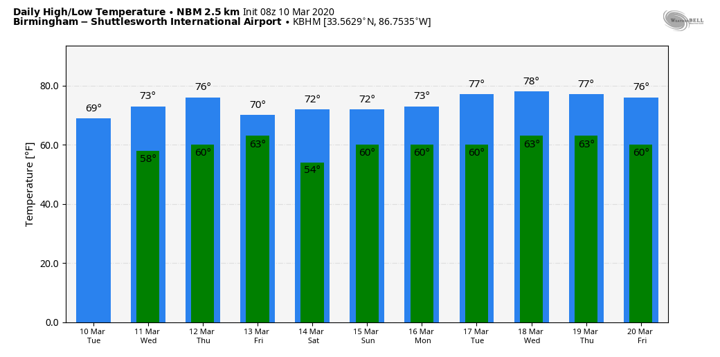
WET AT TIMES: After a nice four-day stretch of dry weather, rain has returned to Alabama this morning. The good news is that it won’t rain all day, but expect occasional showers through tonight; otherwise the day will be cloudy and mild, with a high around 70 degrees. The average high for Birmingham on March 10 is 65.
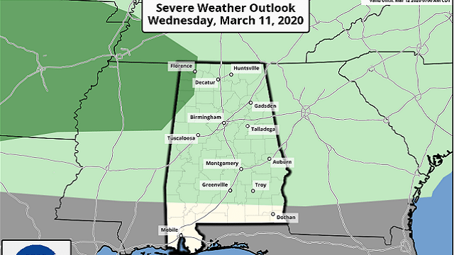
WEDNESDAY: Temperatures will rise into the low to mid 70s. A few showers are possible, but a decent part of the day will be dry. There is some conditional risk of a few heavier storms late Wednesday or Wednesday evening, but many of the high-resolution convection allowing models (CAMs) show very few thunderstorms because of warmer air aloft and weak dynamic forcing. The Storm Prediction Center has a marginal risk (level 1 of 5) for the far northwest corner of Alabama.
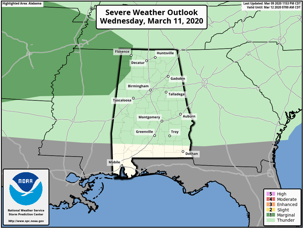
If we do see a few stronger storms Wednesday evening, the main threat could come from hail and gusty winds. Forecast upper-air conditions don’t support tornado formation.
REST OF THE WEEK: The sky will stay mostly cloudy Thursday and Friday, and occasional showers remain likely both days, but, again, not a washout. Highs will stay in the low 70s for most communities. Rain amounts between now and Friday will be in the 1- to 2-inch range for most of north and central Alabama, and flooding is not expected.
THE ALABAMA WEEKEND: South Alabama will be dry Saturday and Sunday, but the forecast for the northern half of the state is a bit iffy. We will need to mention some risk of showers over the weekend for north Alabama, mainly on Sunday. The best chance of some rain Saturday will be close to the Tennessee state line. Temperatures will remain mild, with highs at or over 70 degrees for most locations.
NEXT WEEK: The mild, showery weather continues with highs in the 70s. We’re not seeing any major severe weather signals at this point for Alabama next week, and for now it looks like rain amounts won’t be too heavy.
ON THIS DATE IN 1986: Severe thunderstorms and tornadoes hit Indiana, Kentucky and Ohio. A total of 19 tornadoes occurred. Three of the tornadoes in Indiana reached EF3 intensity. A densely populated subdivision of southeast Lexington, Kentucky, was heavily damaged by a tornado. Twenty people were injured and 900 homes were destroyed. A very strong thunderstorm downburst hit the Cincinnati area. At the Greater Cincinnati Airport, windows were blown out of the control tower, injuring the six controllers on duty. At Newport, Kentucky, 120 houses were destroyed from winds estimated from 100 to 140 mph.
BEACH FORECAST: Click here to see the AlabamaWx Beach Forecast Center page.
WEATHER BRAINS: You can listen to our weekly 90-minute show any time on your favorite podcast app. This is the show all about weather featuring many familiar voices, including the meteorologists at ABC 33/40.
CONNECT: You can find me on all of the major social networks:
Facebook
Twitter
Instagram
Pinterest
Snapchat: spannwx
For more weather news and information from James Spann and his team, visit AlabamaWx.


