James Spann: Alabama’s summer preview continues until Sunday cooldown
James Spann forecasts another very warm, dry day for Alabama from Alabama NewsCenter on Vimeo.
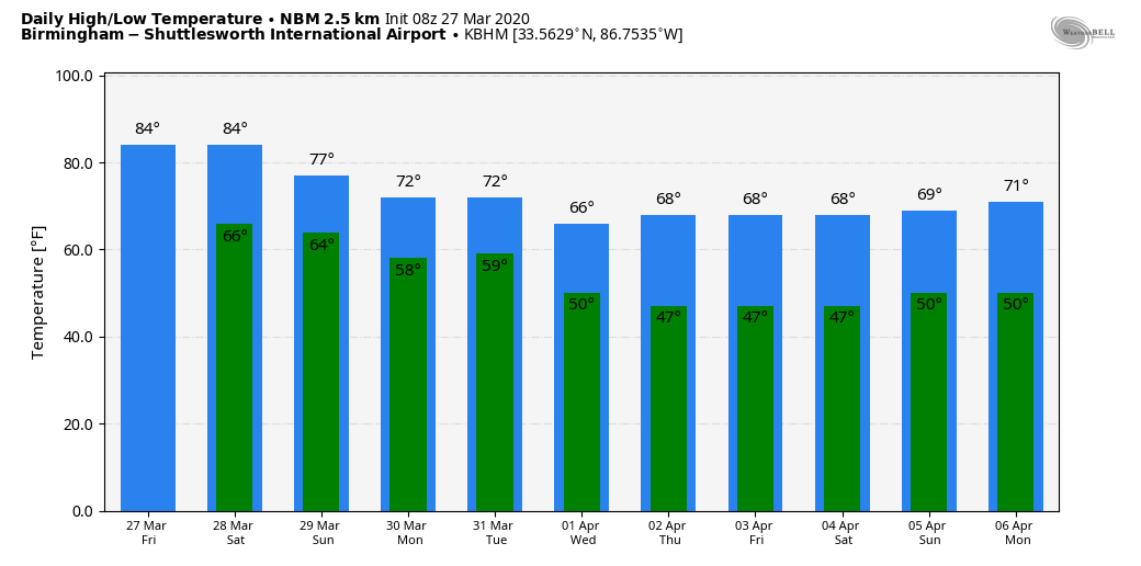
ANOTHER VERY WARM MARCH DAY: We are forecasting a high this afternoon between 84 and 88 degrees for most of Alabama, right at record levels for late March. Here are record highs for today:
- Birmingham — 89 (1919)
- Montgomery — 89 (1910)
- Tuscaloosa — 85 (2012)
- Anniston — 84 (1994)
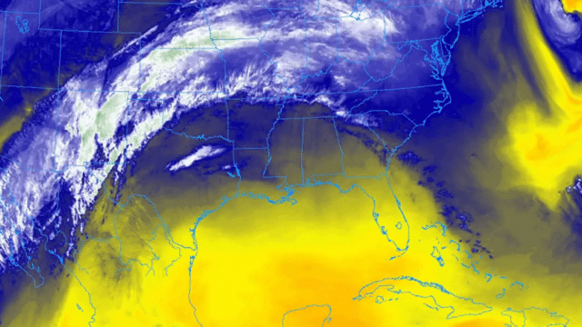
The air remains dry, and the sky will be partly sunny as a strong upper high over the Gulf of Mexico remains the main influence on our weather. Tonight will be fair with a low in the 60s.
THE ALABAMA WEEKEND: Any showers Saturday should be few and far between; we expect a mix of sun and clouds with highs back in the 80s again. But a cold front will push into the state late Saturday night with a band of showers and thunderstorms. The Storm Prediction Center has defined a slight risk (level 2 out of 5) of severe storms for the northwest corner of the state; a marginal risk is as far south as Fort Payne, Warrior and Northport.
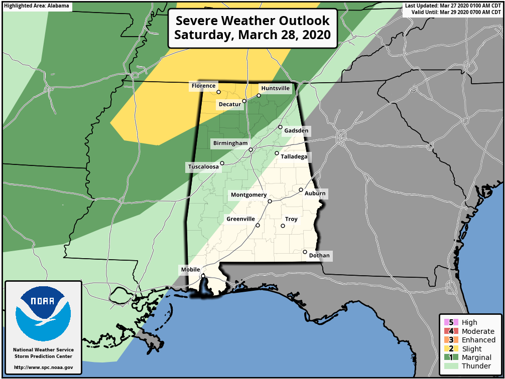
A narrow line of storms will push into the state sometime after 10 Saturday night; they initially will be capable of producing hail and strong winds over northwest Alabama. But they should weaken as they move deeper into the state after midnight, as the main dynamic support will be far north of here. Rain amounts should be less than one-half inch, and the rain will end by daybreak Sunday.
The sky becomes partly sunny Sunday with a high in the mid 70s.
NEXT WEEK: Monday will be mild and dry, but a fast-moving weather system will bring rain and thunderstorms into the state Tuesday. A few strong storms are possible, but it remains to be seen if this will bring any severe weather threat. The rest of the week will be dry with cool mornings and pleasant afternoons (lows in the 40s and highs in the 60s).
ON THIS DATE IN 1994: An EF-4 tornado struck the Goshen United Methodist Church, north of Piedmont, killing 20 people during the morning worship service; 92 were injured. A warning was issued 12 minutes before the tornado destroyed the church building, but unfortunately they never heard the warning. The deaths at the church brought to light the deficiencies in the NOAA Weather Radio network across the United States at the time, and the lack of NOAA Weather Radio use in many public spaces. We have come a long way since then, but we have much work to do. Every home, business, church and public place must have a way of hearing warnings.
Later that day, an EF2 tornado moved through north Shelby County. It extensively damaged businesses and mobile homes and caused minor damage to Pelham High School. It dissipated just west of Meadowbrook.
BEACH FORECAST: Click here to see the AlabamaWx Beach Forecast Center page.
WEATHER BRAINS: You can listen to our weekly 90-minute show any time on your favorite podcast app. This is the show all about weather featuring many familiar voices, including the meteorologists at ABC 33/40.
CONNECT: You can find me on all of the major social networks:
Facebook
Twitter
Instagram
Pinterest
Snapchat: spannwx
For more weather news and information from James Spann and his team, visit AlabamaWx.


