James Spann: A few showers, strong storms possible in Alabama Tuesday, Wednesday
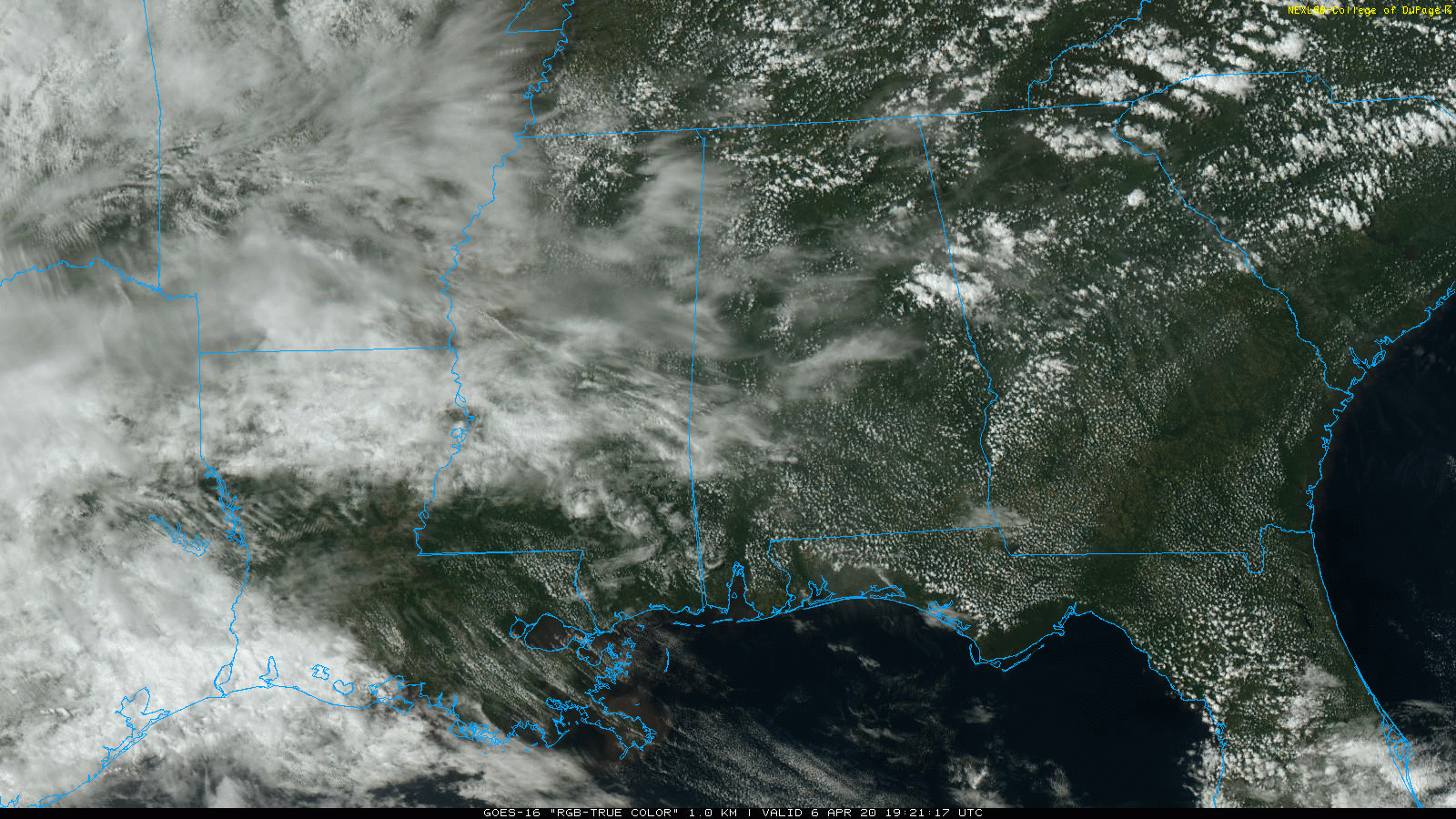
RADAR CHECK: It is a relatively quiet Monday afternoon across Alabama; the sky is partly sunny with temperatures mostly in the low 80s. We note a few isolated showers on radar over east and northwest Alabama; those will dissipate soon after sunset.
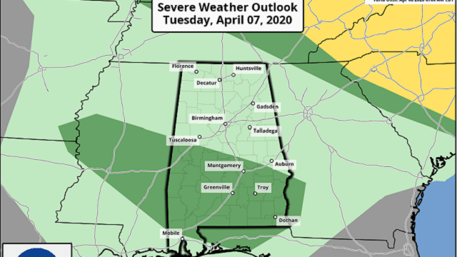
TUESDAY/WEDNESDAY: The Storm Prediction Center maintains a low-end, marginal risk (level 1 out of 5) of severe thunderstorms for roughly the southern half of Alabama Tuesday.
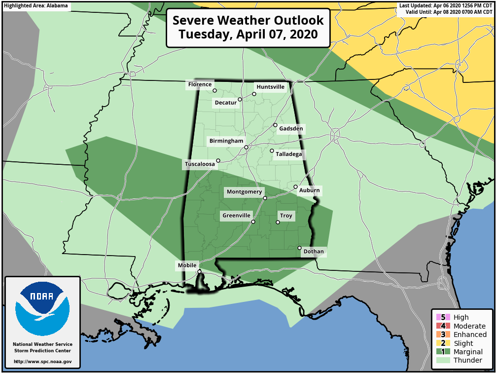
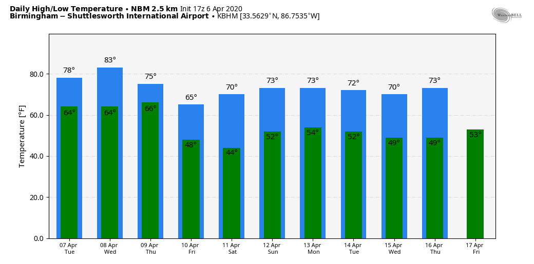
A wave will bring a few showers and storms to the state; heavier storms will be capable of producing small hail and gusty winds mainly over south Alabama. But the overall severe weather threat seems low at this point. The day will feature more clouds than sun with a high in the upper 70s.
Wednesday will be a very warm day; temperatures will reach the mid 80s with the sun out at times. This warmth will help to make the air pretty unstable by afternoon, and if thunderstorms can form they could be strong, with some hail and strong winds. The SPC has a slight risk (level 2 of 5) defined for far north Alabama, with a marginal risk (level 2 of 5) down to Eutaw, Clanton and Wedowee.
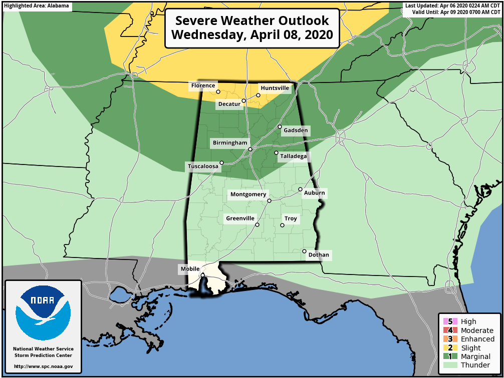
The best chance of a shower or storm Wednesday will come during the late afternoon and evening, although a morning shower can’t be totally ruled out.
THURSDAY/FRIDAY: A cold front will pass through Thursday with some risk of rain at times; the high will be in the mid 70s. Then, cooler and drier air rolls into the state Friday. The sky becomes partly sunny; areas north of Birmingham will likely hold in the 50s all day, with low 60s for the I-20 corridor.
THE ALABAMA WEEKEND: Saturday morning will be cold with some frost for valleys and protected areas; lows will be in the 36- to 44-degree range. The day will be mostly sunny with a high in the mid 60s. Clouds return late Saturday night, and we will see a big shield of rain moving in Sunday or Sunday night before the weekend wrap-up. The high Sunday will be in the low 70s; for now the threat of severe storms with the system late in the weekend looks low.
NEXT WEEK: Rain should end very early Monday, and the first half of the week looks dry with highs around 70. Some rain most likely returns later in the week.
ON THIS DATE IN 2007: The opening-season series between the Indians and Minnesota Twins was wiped out by a snowstorm and a cold snap. The Indians led 4-0 when their home opener on Friday, April 6, was called off by umpires because of heavy snow. The grounds crew who tried to make the field playable with backpack blowers and brooms spent more time on the field than the players during nearly three hours of stoppages. About a foot of snow remained on the ground Monday afternoon, April 9.
ON THIS DATE IN 2016: Nine tornadoes touched down across southeast Alabama, mainly in areas south and east of Montgomery. These were mostly EF-0 or EF1 tornadoes, although one was an EF-2 in Bullock County. There were no injuries.
WEATHER BRAINS: You can listen to our weekly 90-minute show any time on your favorite podcast app. This is the show all about weather featuring many familiar voices, including the meteorologists at ABC 33/40.
CONNECT: You can find me on all of the major social networks:
Facebook
Twitter
Instagram
Pinterest
Snapchat: spannwx
For more weather news and information from James Spann and his team, visit AlabamaWx.


