James Spann: Storms for Alabama this afternoon, severe storms likely late tonight
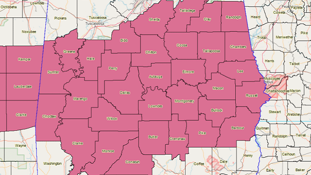
ACTIVE DAY: Scattered showers and thunderstorms have formed across central Alabama this afternoon. Heavier storms are producing hail and strong winds; a severe thunderstorm watch is in effect for much of central and south Alabama until 9 p.m.
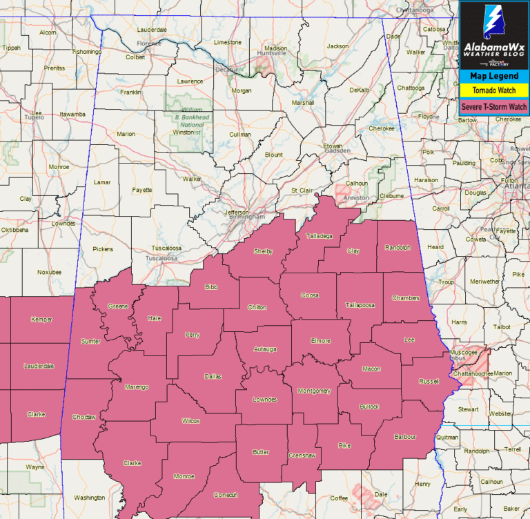
These storms will diminish this evening, but another round of thunderstorms is likely after midnight tonight ahead of a cold front. The Storm Prediction Center has defined an enhanced risk (level 3 out of 5) of severe thunderstorms for far northern Alabama, including Muscle Shoals, Athens, Huntsville and Scottsboro. A slight risk (level 2 of 5) extends down to Grove Hill, Andalusia and Dothan, and a marginal risk (level 1 of 5) is up as far south as northern Mobile and Baldwin counties.
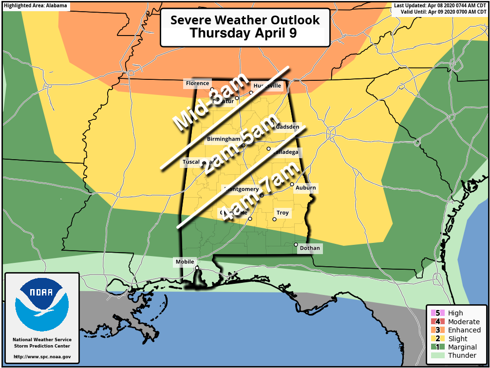
TIMING: A line of severe storms will enter northwest Alabama around midnight to 1 a.m., then push southward during the early morning. The line should reach places like Tuscaloosa, Birmingham, Anniston and Gadsden around 3 to 4 a.m. and Montgomery and Opelika around 6 a.m.
THREATS: Storms overnight will be capable of producing large hail and damaging winds. A few isolated tornadoes are possible as well.
RAIN: The thunderstorms will be moving fairly quickly, so rain amounts should be generally one-half inch for most places; flooding is not expected.
CALL TO ACTION: Remember, this is a middle-of-the-night severe weather event, so be sure you have a way of hearing warnings. Every Alabama home needs a NOAA Weather Radio with fresh batteries, properly programmed. Have Wireless Emergency Alerts enabled on your phone, and get the free ABC 33/40 Weather app. Do not put your phone in the “Do Not Disturb” mode. In your safe place, have helmets and hard-soled shoes for everyone, along with portable air horns (in case you need to get the attention of first responders). If you live in a mobile home, know where you are going and how to get there quickly.
COVID-19: The decision to seek shelter in a community storm shelter is certainly made more difficult by the consideration for COVID-19, and each individual will need to make an educated decision on where and when to shelter from a tornado. At this time, the Alabama Department of Public Health is recommending that your first priority should be to protect yourself from a potential tornado. If a warning is issued for your area, you are more likely to be affected by the tornado than the virus.
However, the decisions to open any community shelters are done at the local or county level. Before you make a decision to go to a community shelter, you should check with your community shelter managers to ensure they are open and find out whether there are any local COVID-19 considerations. Certainly, wherever you choose to shelter from a tornado, you should use as many precautions as possible to inhibit the spread of COVID-19 as best as you can. If you rely on public community shelters, now may be the time to explore other options that might keep you safer from severe weather and possibly limit your exposure to COVID-19.
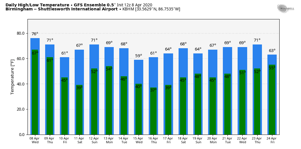
THURSDAY THROUGH SATURDAY: The sky becomes sunny Thursday with a high between 70 and 75 degrees. The weather stays dry through Saturday; the highs will be in the mid 60s Friday and close to 70 Saturday. Saturday morning will be cold for April, with lows between 36 and 44; some of the colder spots could see a bit of light frost. Clouds will increase late Saturday through Saturday night.
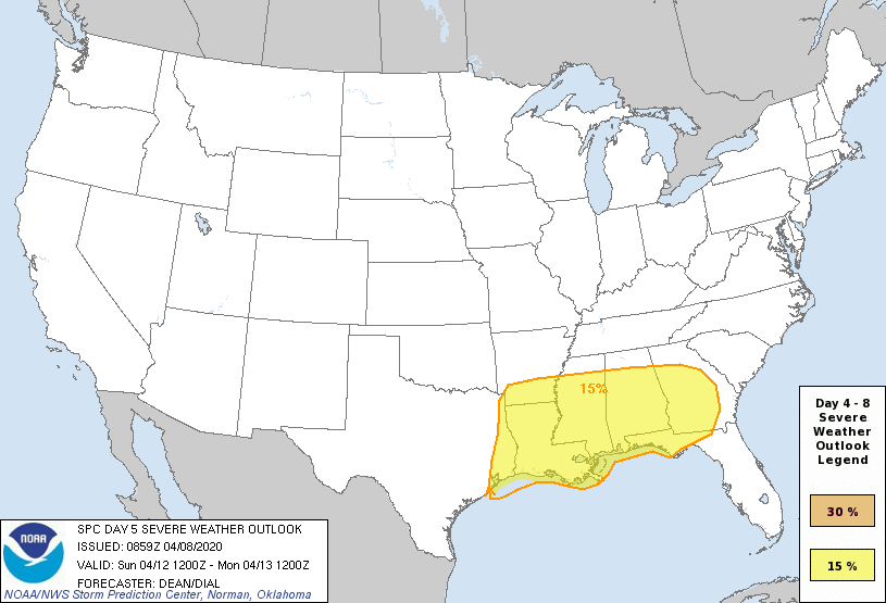
SEVERE WEATHER THREAT EASTER SUNDAY: The SPC has defined a severe weather threat for most of the Deep South, including Alabama, for Sunday. A dynamic weather system will interact with unstable air, setting the stage for strong to severe thunderstorms. It is too early to discuss timing or the magnitude of the threat; we will do that after the pre-dawn storms Thursday. But it looks like all modes of severe storms will be possible Sunday, including large hail, damaging winds and a few tornadoes.
NEXT WEEK: The week looks dry with temperatures below average, and we will have potential for a late-season freeze or frost on a couple of mornings. Growers will need to monitor temperature forecasts in coming days.
ON THIS DATE IN 1998: An EF-5 tornado cut a 31-mile-long, three-quarter-mile-wide swath through the Birmingham suburbs of Oak Grove, Sylvan Springs, Rock Creek, Pleasant Grove, Concord, Maytown, Pratt City and Edgewater before lifting in western Birmingham. The worst of the destruction occurred across the Oak Grove, Rock Creek and McDonald Chapel areas.
Thirty-two people were killed in this tornado: three in Oak Grove, 11 near Rock Creek, four in Sylvan Springs, two in Wylam Heights, nine in Edgewater, two in McDonald Chapel and one in West Ensley. The parent storm would drop another tornado that killed two more people near Wattsville in St. Clair County.
WEATHER BRAINS: You can listen to our weekly 90-minute show any time on your favorite podcast app. This is the show all about weather featuring many familiar voices, including the meteorologists at ABC 33/40.
CONNECT: You can find me on all of the major social networks:
Facebook
Twitter
Instagram
Pinterest
Snapchat: spannwx
For more weather news and information from James Spann and his team, visit AlabamaWx.


