James Spann: Frost advisory in effect for Alabama early Wednesday
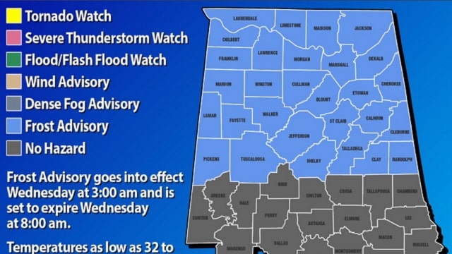
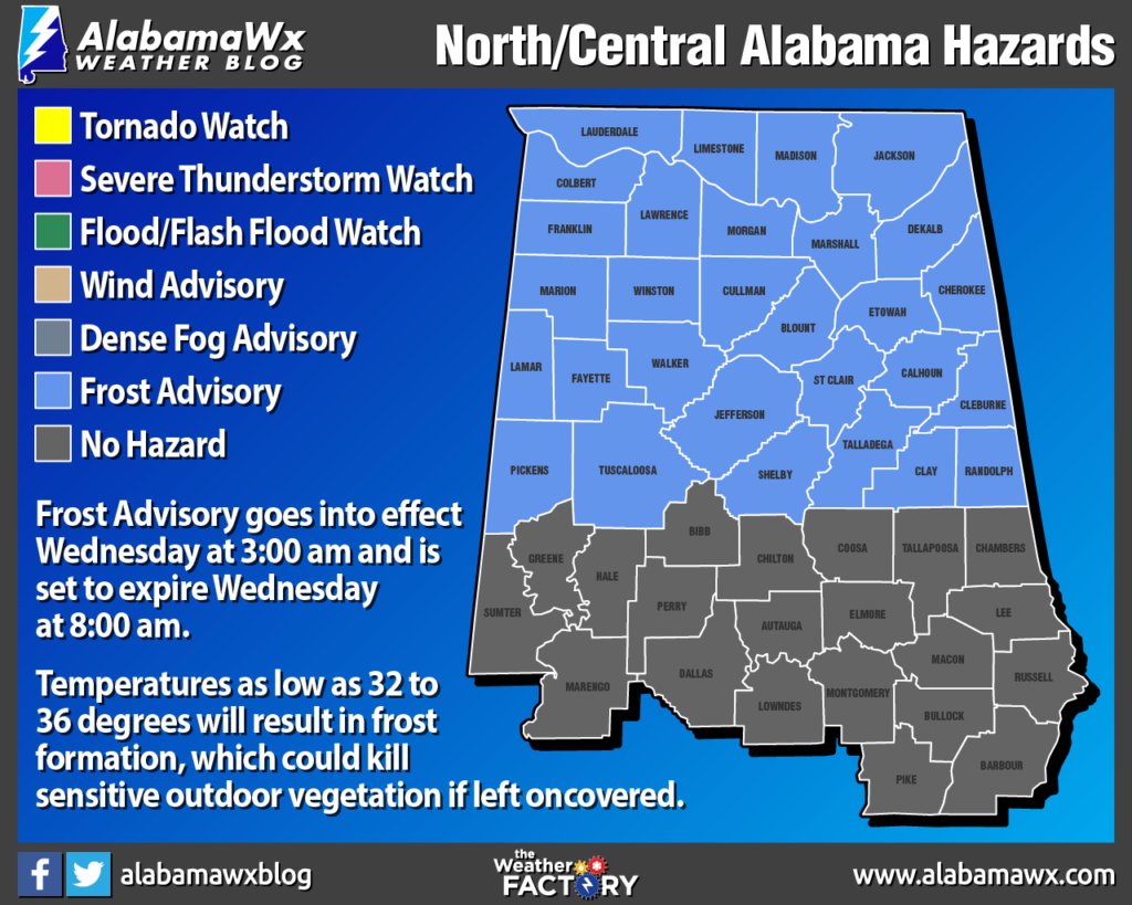
FROSTY NIGHTS: Every year I advise people not to plant anything that might be harmed by frost or a freeze until April 15. We almost always have a late-season cold snap in April, and here it is. A frost advisory is in effect for the northern half of Alabama tonight; we project lows between 32 and 36 for most places, but the colder spots will see temperatures between 27 and 32 by daybreak Wednesday.
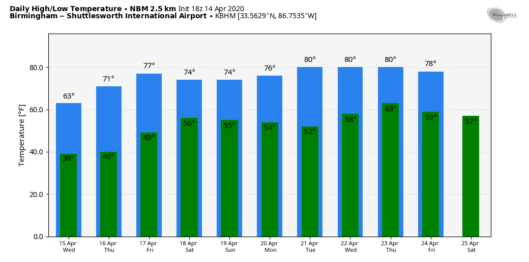
Wednesday will feature a good supply of sunshine, but temperatures stay below average, with a high in the 62- to 65-degree range. Wednesday night will be another cold one, with potential for more frost early Thursday morning. During the day Thursday, we warm to near 70 degrees with a sunny sky. We will give the green light for planting Thursday afternoon; any additional frost threats should be limited to the coldest valleys of north Alabama for the rest of the season.
The latest model guidance has trended drier for Friday, and we have taken rain out of the forecast. Expect a partly sunny sky Friday with a high in the mid 70s.
THE ALABAMA WEEKEND: Forecast confidence is low with great variability in computer model output. For now we will leave the forecast dry for Saturday, but we might need to insert a risk of rain at some point in coming days. We will mention a chance of rain Sunday and Sunday night as a wave of low pressure passes through; severe storms are not expected. Highs over the weekend will be in the 68- to 72-degree range.
NEXT WEEK: A few lingering showers are possible Monday, and now global models are advertising a more robust system by midweek with a chance of rain and thunderstorms by late Wednesday or Thursday. It’s too early to know if there will be a severe weather threat.
ALABAMA TORNADO COUNT: There are now 10 confirmed tornadoes from Sunday in Alabama, and it will take several more days for all survey work to be complete:
- Boaz (Marshall County) — EF-2
- Oneonta (Blount County) — EF-2
- Walter (Cullman County) — EF-2
- North River (Tuscaloosa County) — EF-1
- Carbon Hill (Walker County) — EF-1
- Johnson’s Crossing (Cullman County) — EF-1
- Shiloh (DeKalb County) — EF-1
- Welti (Cullman County) — EF-0
- Locust Fork (Blount County) — EF-0
- Collinsville (DeKalb County) — EF-0
ON THIS DATE IN 2019: An EF-1 tornado touched down at Troy, in Pike County. The tornado touched down in a mobile home community along Hunters Mountain Parkway, where several mobile homes sustained major damage. Around one dozen mobile homes were moved off their foundations, while several were observed to have rolled multiple times. Several of these homes were occupied, but only minor injuries were treated on scene. Two cars were also rolled in the area of greatest damage. The tornado moved northeast, crossing U.S. Highway 231, where power poles were snapped and several businesses sustained minor damage. It then moved just west of downtown Troy, where trees were uprooted and large branches were broken.
BEACH FORECAST: Click here to see the AlabamaWx Beach Forecast Center page.
WEATHER BRAINS: You can listen to our weekly 90-minute show anytime on your favorite podcast app. This is the show all about weather featuring many familiar voices, including the meteorologists at ABC 33/40.
CONNECT: You can find me on all of the major social networks:
Facebook
Twitter
Instagram
Pinterest
Snapchat: spannwx
For more weather news and information from James Spann and his team, visit AlabamaWx.


