James Spann: Alabama stays dry Wednesday, then storms arrive Thursday
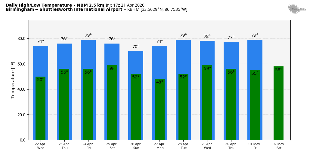
SPECTACULAR SPRING AFTERNOON: The sky is partly to mostly sunny across Alabama this afternoon with temperatures in the 70s. Tonight will be fair and cool, with a low between 48 and 54. Wednesday will be another dry day, but clouds will begin to increase slowly by afternoon ahead of the next spring storm system approaching from the west.
SEVERE STORM POTENTIAL THURSDAY: This will be another “two-rounder” for Alabama. An organized mass of rain and storms will move through the northern half of the state very early Thursday morning. These most likely will be elevated and not surface-based. But they could still pack a punch with potential for hail and strong winds. The main window for the morning storms (“round one”) will come from 2 until 8 a.m.
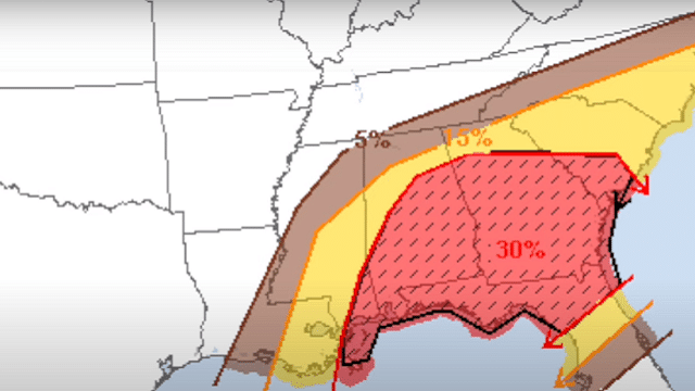
“Round two” begins by mid to late afternoon as new storms develop, especially south and east of Birmingham, where the Storm Prediction Center has defined an enhanced risk (level 3 out of 5) of severe thunderstorms. There is a slight risk (level 2 of 5) as far north as Vernon, Guntersville and Fort Payne, and a marginal risk (level 1 of 5) up to the Tennessee state line.
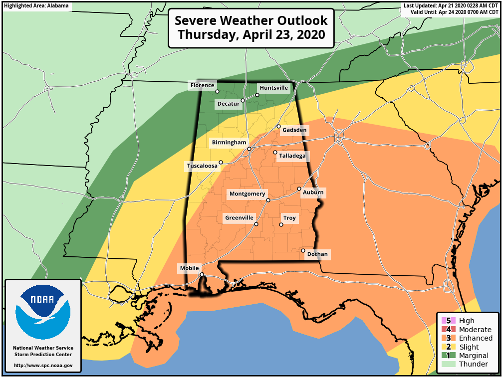
Most of the “round two” storms will come from 2 until 10 p.m. The highest tornado probabilities will be over the southern half of the state, where the air will be most unstable. A strong tornado (EF2 or higher) is possible across the southeast part of Alabama. But severe storms will be possible as far north as I-20 Thursday afternoon. In addition to the threat of tornadoes, storms will be capable of producing large hail and damaging winds. Don’t forget to pay attention to any severe thunderstorm warnings that are needed Thursday.
It will be another day to be sure you are able to receive warnings. The baseline is a NOAA Weather Radio; every Alabama home and business needs one. They work independently of the cellular networks and are very reliable.
FRIDAY AND THE WEEKEND: The day Friday will be dry and mild with a high between 77 and 80 degrees. Then, another fast-moving system will bring rain and storms to Alabama late Friday night into Saturday morning, generally in the period from midnight to noon. It remains to be seen if the atmosphere will support strong to severe storms during this window, but it certainly is possible. Drier air moves in Saturday afternoon, and for the first time in three weeks we won’t have to deal with severe thunderstorms Sunday; the day looks great, with ample sunshine and a high around 70 degrees.
NEXT WEEK: Monday and Tuesday will be dry with a high in the 70s; some risk of rain and storms will return by late Wednesday or Thursday.
ON THIS DATE IN 1967: Severe thunderstorms spawned 48 tornadoes in the Upper Midwest. Hardest hit was northern Illinois, where 16 tornadoes touched down during the afternoon and evening, causing $50 million damage. On that Friday afternoon, tornadoes struck Belvidere, Illinois, and the Chicago suburb of Oak Lawn, killing 58 people.
WEATHER BRAINS: You can listen to our weekly 90-minute show anytime on your favorite podcast app. This is the show all about weather featuring many familiar voices, including the meteorologists at ABC 33/40.
CONNECT: You can find me on the major social networks:
Facebook
Twitter
Instagram
Pinterest
Snapchat: spannwx
For more weather news and information from James Spann and his team, visit AlabamaWx.