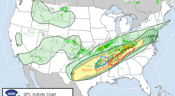
Scott Martin: A few showers in north Alabama but otherwise dry in state this weekend
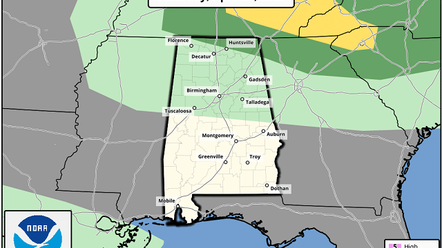
A FEW SHOWERS/STORMS UP NORTH TODAY
A surface low will be moving through the northern parts of the Southeastern U,S, today that will bring a chance of showers and thunderstorms to the northern half of the area today. There is a small chance that we could see a strong storm over the Tennessee Valley this afternoon with gusty winds and some hail possible. The Storm Prediction Center has a LEVEL 1 MARGINAL RISK up for the extreme northern parts of the area mainly along and north of a line from Lexington (Lauderdale County) to Huntsville (Madison County) to Fort Payne (Dekalb County). South of the I-20 corridor, we should stay dry throughout the day with partly to mostly sunny skies. Highs will be in the lower 70s to the mid-80s across the area.

A VERY NICE SUNDAY TO CLOSE OUT THE WEEKEND
Skies will be mainly sunny across Central Alabama on your Sunday while clouds may linger around in North Alabama until they move out during the late afternoon hours. A stray shower may be possible early in the extreme northeastern parts of North Alabama, but all will be dry for afternoon and evening hours. Highs top out in the lower 60s to the mid-70s.
THE WORK WEEK AHEAD
High pressure dominates our weather for Monday … we’ll have plenty of sunshine with highs reaching the upper 60s to the upper 70s.
Tuesday will be another fine day across North/Central Alabama as skies will be partly to mostly sunny throughout much of the daylight hours. Clouds will start to move in as a cold front will be approaching the area from the west and rain moving in after midnight. Highs will be in the lower 70s to the lower 80s.
Showers and thunderstorms will continue to move through the area during the morning and afternoon hours on your Wednesday, before moving out during the evening hours. At this point, this does not have a severe look to it, but there will be a little instability present so we’ll need to keep our eyes on it. Highs will be in the lower 70s to the lower 80s.
High pressure starts to build back into our southwest which will have us in a dry continental flow on Thursday. We’ll have mainly sunny skies with highs topping out in the upper 60s to the lower 80s across the area.
That high will be hanging out just to our south over the Gulf Coast on Friday, keeping us dry with sunny skies. Highs will be in the lower 70s to the lower 80s.
OUTLOOKS FOR MAY
The Climate Prediction Center has released its outlooks for the month of May and shows for much of North/Central Alabama that our temperatures will be around normal with the extreme southern and southeastern parts of the area slightly above normal. Rainfall for the month is also expected to be slightly above normal.
ON THIS DATE IN WEATHER HISTORY
1988 – Thunderstorms racing at 65 mph produced large hail in Alabama and Georgia. Hail damage in Alabama was estimated at $50 million, making it their worst weather disaster since Hurricane Frederick in 1979. Hail three inches in diameter accompanied a tornado near Valdosta, Georgia. Hail four and a half inches in diameter was reported south of Atlanta.
BEACH FORECAST
Even though the beaches across the Alabama and Florida Gulf Coasts are closed, you may still want to know what the weather will be like. Get the latest weather and rip current forecasts for the beaches from Bay St. Louis, Mississippi, to Panama City Beach, Florida, on our Beach Forecast Center page. There, you can select the forecast of the region that you are interested in.
ADVERTISE ON THE BLOG!
We had another fantastic year in 2019 with just over 17 million page views! That brings our total for the last 2 years close to 37 million page views! Don’t miss out! We can customize a creative, flexible, and affordable package that will suit your organization’s needs. Contact Bill Murray at (205) 687-0782.
E-FORECAST
Get the Alabama Wx Weather Blog’s Seven-Day Forecast delivered directly to your inbox by email twice daily. It is the most detailed weather forecast available in Central Alabama. Subscribe here… It’s free!
CONNECT WITH THE BLOG ON SOCIAL MEDIA
You can find the AlabamaWx Weather Blog on the major social media networks:
Facebook
Twitter
Instagram
WEATHERBRAINS
Don’t forget you can listen to our weekly 90 minute netcast anytime on the web at WeatherBrains.com or on Apple Podcasts, Stitcher, or Spotify.
For more weather news and information from Scott Martin and the rest of the James Spann team, visit AlabamaWx.com.
