James Spann: Showers, possible strong storms across Alabama today
James Spann forecasts active weather for Alabama today from Alabama NewsCenter on Vimeo.
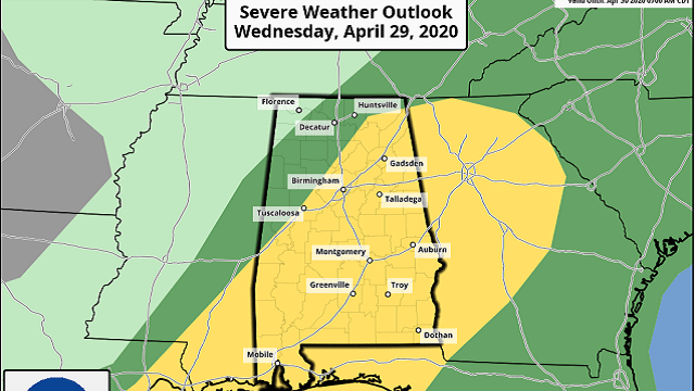
RADAR CHECK: Showers have moved into the state early this morning; as expected, they have weakened considerably over the past 12 hours. But, later today, a few strong, possibly severe thunderstorms could develop ahead of a cold front. The Storm Prediction Center has defined a slight risk (level 2 of 5) for areas south of a line from Tuscaloosa to Cullman to Scottsboro, with a marginal risk (level 1 of 5) as far north as Hamilton and Killen.
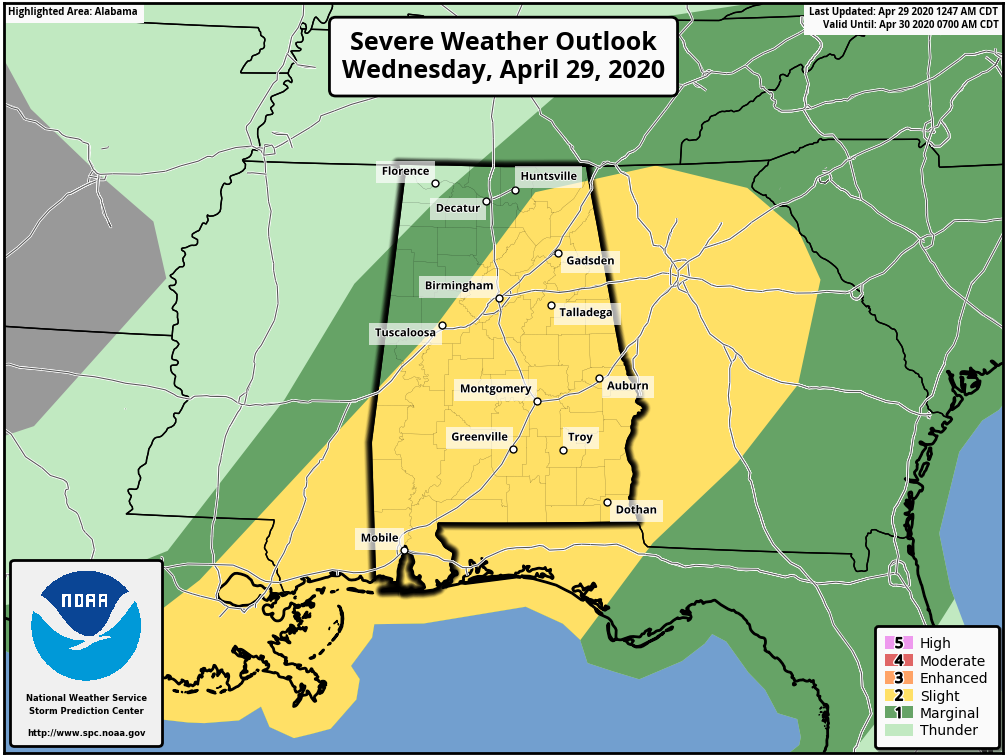
The main threat with the heavier storms this afternoon will come from strong, gusty winds, and the window will be from noon to 6 p.m. With limited instability, weak lapse rates and moderate wind fields, this is a low-end threat. But, as always, you still need to be weather aware with any system that comes through here in late April.
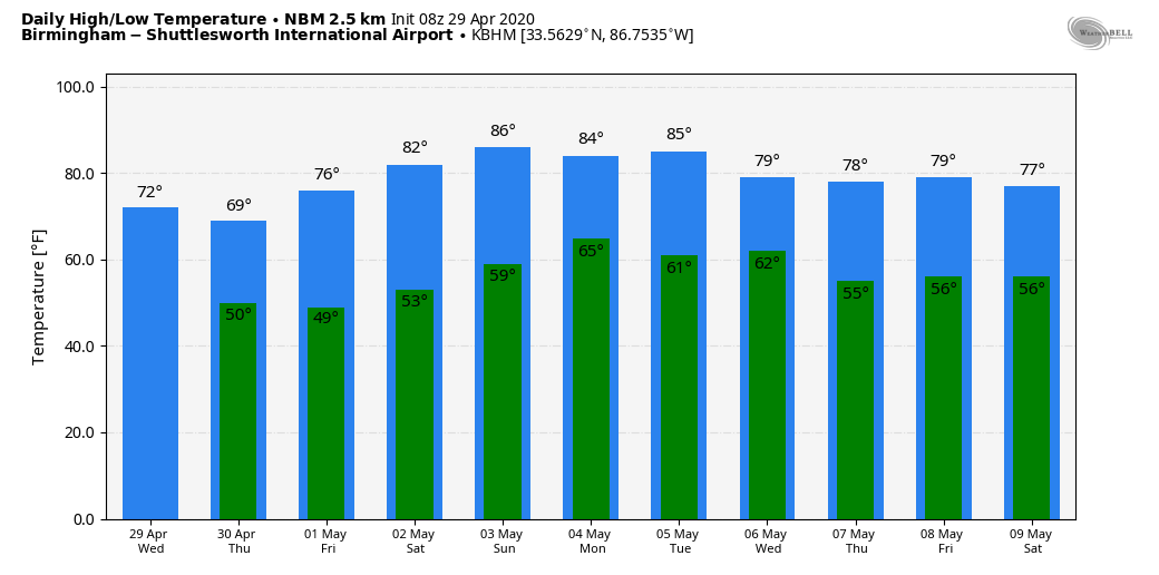
Rain amounts will be in the one-half-inch to 1-inch range for most of the state over the next 18 hours. The high today will be in the 72- to 75-degree range for most places, a little below average for this time of the year.
THURSDAY THROUGH THE WEEKEND: The sky will be partly to mostly sunny Thursday, although clouds could linger much of the day over the northeast corner of the state. The high will be in the 68- to 72-degree range. Look for sunny days and fair nights Friday through the weekend with a warming trend. The high will be in the mid to upper 70s Friday, followed by low 80s Saturday and mid 80s Sunday. It will be the warmest weekend so far this year and a nice preview of summer.
NEXT WEEK: A surface front will drift into the state early next week, and we will mention the chance of showers Monday and Tuesday. It doesn’t look like a big rain event and severe storms are not expected. The weather stays warm, with highs in the 80s; then cooler, drier air returns for the latter half of the week.
ON THIS DATE IN 1987: A storm off the southeast coast of Massachusetts blanketed southern New England with heavy snow on April 28-29. Totals of 3 inches at Boston, 11 inches at Milton and 17 inches at Worcester, Massachusetts, were records for so late in the season. Princeton, Massachusetts, was buried under 25 inches of snow.
WEATHER BRAINS: You can listen to our weekly 90-minute show any time on your favorite podcast app. This is the show all about weather featuring many familiar voices, including the meteorologists at ABC 33/40.
CONNECT: You can find me on all of the major social networks:
Facebook
Twitter
Instagram
Pinterest
Snapchat: spannwx
For more weather news and information from James Spann and his team, visit AlabamaWx.


