James Spann: Scattered showers, storms for Alabama over next few days
James Spann forecasts unsettled weather for Alabama from Alabama NewsCenter on Vimeo.
UNSETTLED WEATHER: A fairly deep upper low will develop over the Southeast over the next 24 hours and is cut off from the stronger winds aloft, meaning it will hang around for a few days. This feature will bring cloudy periods to the state, cooler-than-average temperatures, and scattered showers and thunderstorms. The storms will be rather random, so there’s no way of being able to give a start/stop time for any specific location. While no severe storms are expected, heavier showers and thunderstorms will be capable of producing small hail thanks to the cold air aloft associated with the upper low.
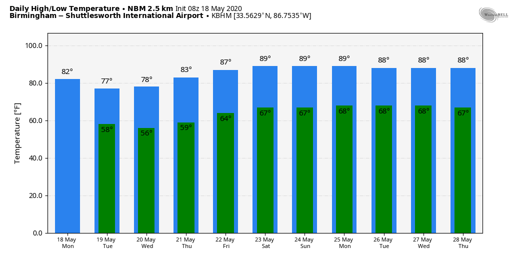
Afternoon highs will be only in the 74- to 80-degree range through Wednesday; the average high for Birmingham on May 18 is 82.
The upper low will weaken and lift northward later in the week, but moist air will linger Thursday and Friday. For these two days we expect a mix of sun and clouds, and we will maintain some risk of at least widely scattered showers and thunderstorms. Highs return to the low to mid 80s.
THE ALABAMA WEEKEND: Warm, humid weather will continue Saturday and Sunday with partly sunny days and mostly fair nights. Scattered showers and storms will remain possible, mostly during the afternoon and evening, and highs will be in the mid 80s, very close to seasonal averages.
NEXT WEEK: An upper ridge will build, meaning warmer afternoons and fewer showers and thunderstorms. Highs during the week will be mostly in the upper 80s.
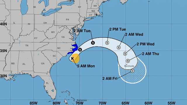
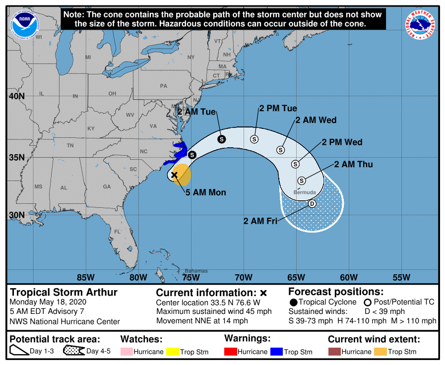
TROPICAL STORM ARTHUR: The preseason tropical storm is near the coast of North Carolina early this morning with sustained winds of 45 mph. The system will turn eastward, away from the coast, later today and tonight. It is forecast to make a loop in the open Atlantic later this week as it becomes a post-tropical system. The rest of the Atlantic basin is quiet.
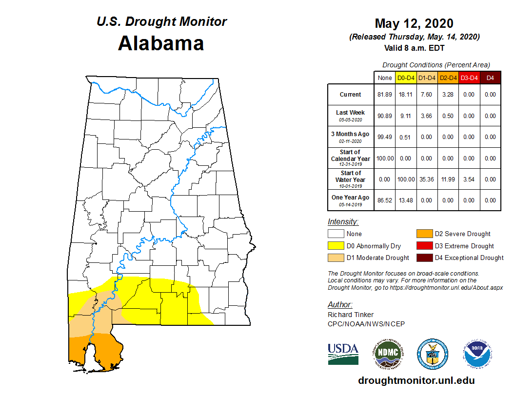
GULF COAST DROUGHT: Severe drought conditions continue across the southern parts of Mobile and Baldwin counties, but they did receive a few good downpours last night for the first time in a few weeks.
ON THIS DAY IN 1980: Mount Saint Helens erupted, spewing ash and smoke 63,000 feet into the air. Heavy ash covered the ground to the immediate northwest and small particles were carried to the Atlantic coast.
BEACH FORECAST: Click here to see the AlabamaWx Beach Forecast Center page.
WEATHER BRAINS: You can listen to our weekly 90-minute show any time on your favorite podcast app. This is the show all about weather featuring many familiar voices, including the meteorologists at ABC 33/40.
CONNECT: You can find me on the major social networks:
Facebook
Twitter
Instagram
Pinterest
Snapchat: spannwx
For more weather news and information from James Spann and his team, visit AlabamaWx.com.


