James Spann: Alabama humidity levels slowly rise for the rest of the week
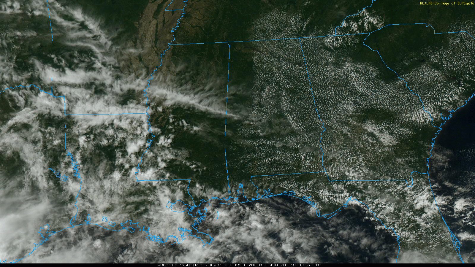
SUNNY MONDAY: Temperatures are mostly in the mid-80s across Alabama this afternoon with a good supply of sunshine through a scattered field of cumulus clouds. There is nothing on radar, and tonight will be mostly fair.
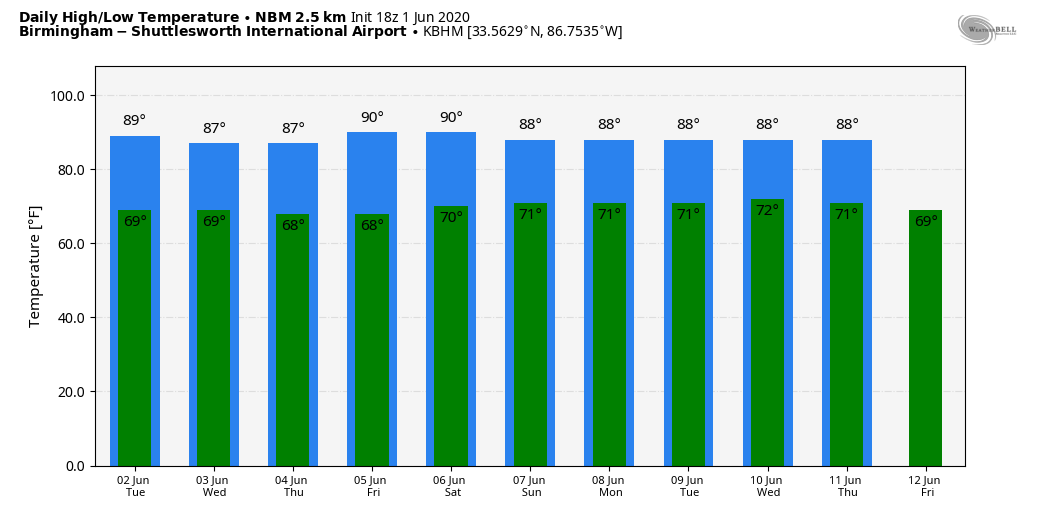
We will introduce some risk of isolated showers Tuesday afternoon, but most of the state will stay dry with a partly sunny sky. Temperatures reach the upper 80s.
REST OF THE WEEK: As humidity levels rise, we will have the potential for random, scattered showers and thunderstorms each day across Alabama Wednesday through Friday. No washout, and the best chance of the showers will come during the afternoon and evening hours, mostly between 1 and 9 p.m. Highs will be in the mid to upper 80s with a mix of sun and clouds daily.
THE ALABAMA WEEKEND: We will keep a persistence forecast going. That means partly sunny days, highs in the upper 80s and the usual risk of pop-up showers and thunderstorms, mainly during the peak of the daytime heating. Odds of any one spot getting wet both days are around 40%.
NEXT WEEK: With a tropical system expected to stay west of Alabama, we see no major need to vary from the standard early summer forecast — partly sunny days, a few scattered showers or storms each day, highs mostly in the upper 80s. Just what you expect in June in Alabama.
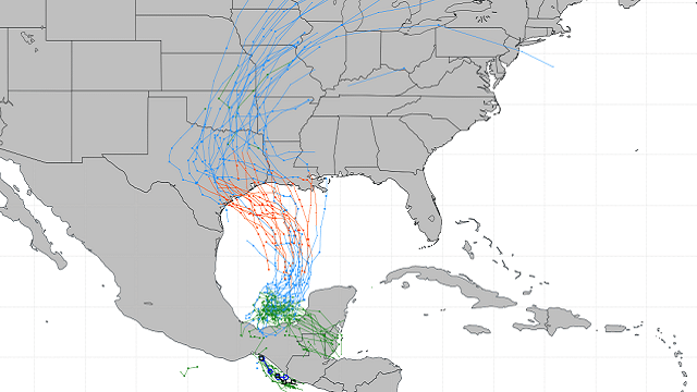
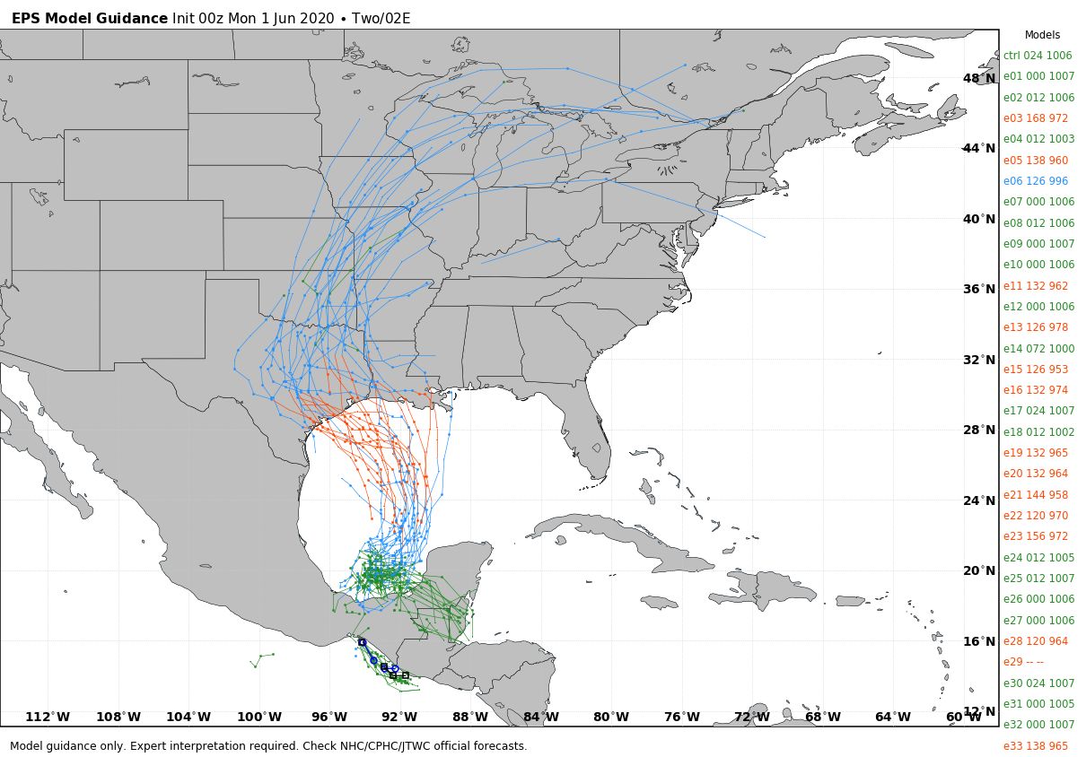
TROPICS: We have a 90% chance of tropical development over the far southwest Gulf of Mexico. Satellite imagery and radar observations from Mexico show that the area of disturbed weather centered near the west coast of the Yucatan peninsula is gradually becoming better organized. The disturbance will move west-northwestward over the Bay of Campeche later this afternoon, where environmental conditions are expected to be conducive to support development, and a tropical depression or storm is likely to form tonight or Tuesday. The system is then forecast to drift westward or west-southwestward over the southern Bay of Campeche through the middle of the week. Interests along the coast of the Bay of Campeche should monitor the progress of this disturbance, as tropical storm watches or warnings could be required for a portion of this area later today or tonight.
The name will be Cristobal, and long-range ensemble data from models suggest the highest impact potential will come over the Texas or Louisiana coast in six to seven days. Of course, until the system gets organized and we get data from hurricane hunter aircraft, there is no way of knowing exactly the final landfall point or the intensity.
THE ALABAMA/NORTHWEST FLORIDA GULF COAST: While the core impact of Cristobal will be well to the west, the central Gulf Coast will be on the onshore flow side (east side) of the circulation. This means deeper moisture will likely affect places like Gulf Shores, Destin and Panama City Beach later this week and into the weekend, with higher than the usual potential for showers and thunderstorms. But this doesn’t mean a washout, and I would expect to see some sun at times. If I had a vacation trip planned, I would not change anything.
BEACH FORECAST: Click here to see the AlabamaWx Beach Forecast Center page.
WEATHER BRAINS: You can listen to our weekly 90-minute show anytime on your favorite podcast app. This is the show all about weather featuring many familiar voices, including the meteorologists at ABC 33/40.
CONNECT: You can find me on the major social networks:
Facebook
Twitter
Instagram
Pinterest
Snapchat: spannwx
For more weather news and information from James Spann and his team, visit AlabamaWx.


