James Spann: Clouds increase over Alabama Tuesday; rain statewide by Thursday
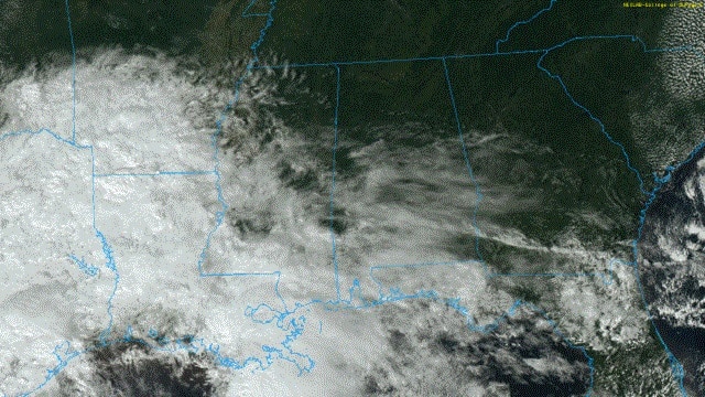
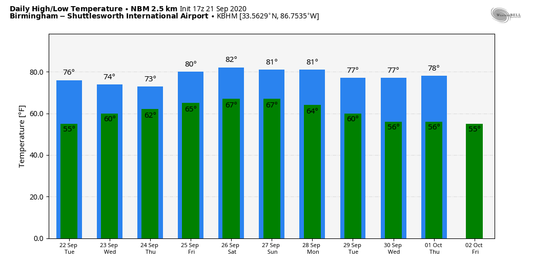
FINE FALL DAY: The northern half of the state is enjoying a picture-perfect early autumn day. With ample sunshine, temperatures are in the low to mid 70s; the average high for Sept. 21 at Birmingham is 84. Clouds persist over the southern counties of the state, with some patchy, light rain near the coast.
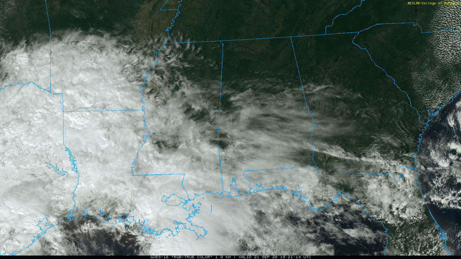
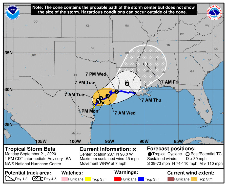
Clouds will increase statewide Tuesday ahead of Tropical Storm Beta, which will be moving along the upper Texas coast. But most of the state remains dry with highs holding in the 70s. On Wednesday the sky will be mostly cloudy, and some rain could reach west Alabama by afternoon. Rain will move into the rest of the state Wednesday night as Beta, most likely a tropical depression by then, moves into Louisiana.
THURSDAY THROUGH THE WEEKEND: The weather will be wet at times and unsettled on these four days as the remnant circulation of Beta moves into Mississippi Thursday night and Friday. Rain is likely much of the day Thursday, but at this point we are not expecting a significant tornado threat, since the low will be weakening and there is little surface-based instability across the state.
Friday through Sunday, the sky will be mostly cloudy and we will be dealing with occasional showers and a few thunderstorms each day. It won’t rain all day every day, but if you have anything planned outside, be ready for rain at any hour of the day or night. The weather will be more humid; highs will be in the low 80s with lows in the mid to upper 60s. Sunshine will be very limited.
NEXT WEEK: A nice surge of cool, dry air moves into Alabama Monday, and for now the week looks rain-free with mostly sunny, pleasant days and clear, cool nights. Highs will be mostly in the 70s, lows mostly in the 50s.
TROPICS: Tropical Storm Beta is just 40 miles southeast of Port O’Connor, Texas, with winds of 45 mph. It will hug the upper Texas coast through Wednesday, producing heavy rain and gusty winds. The remnant circulation moves into Louisiana Thursday and Mississippi Friday.
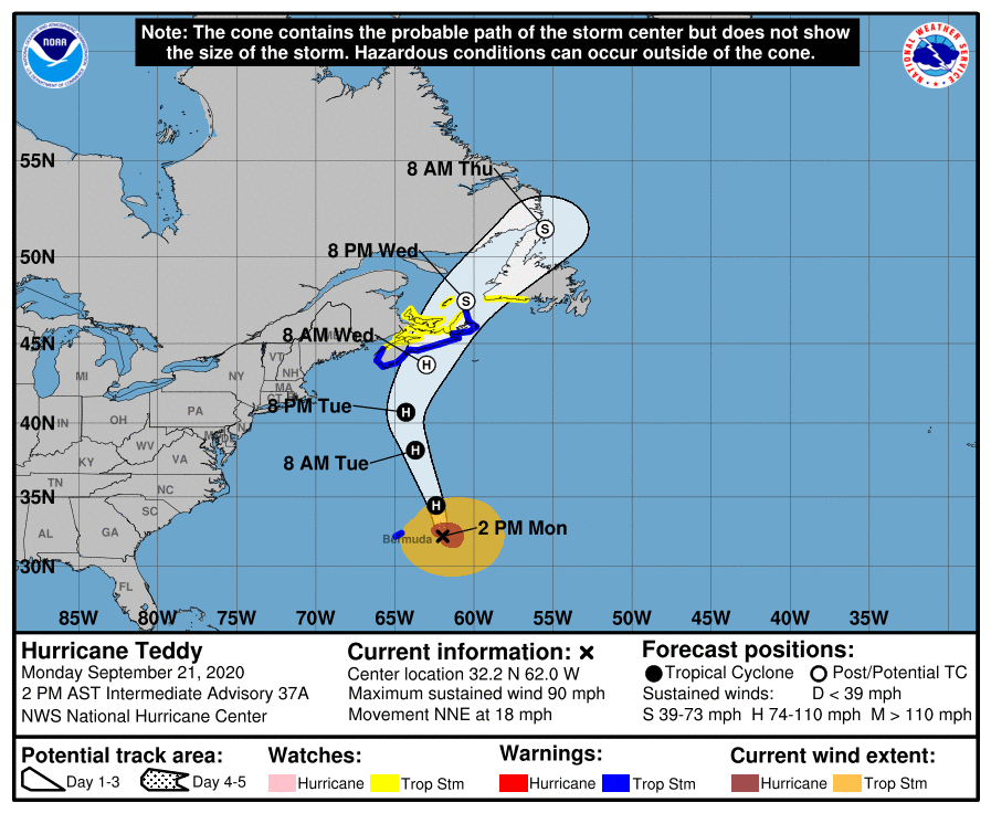
Hurricane Teddy, with winds of 90 mph, is passing east of Bermuda this afternoon. It becomes post-tropical Wednesday as it moves into Nova Scotia. It will have no impact on the U.S. other than rough surf along the East Coast.
Elsewhere, the “ghost of Paulette” is in the Northeast Atlantic and could become a subtropical storm again tonight or Tuesday as it moves toward Europe. A disturbance around the southern tip of Florida has just a 20% chance of development over the next five days.
EQUINOX IS TUESDAY: Fall “officially” arrives Tuesday. The sun will be directly above the equator at 8:31 a.m. Central Time as it heads south for the season. The sun rises Tuesday almost due east and sets almost due west, very close to 12 hours apart.
ON THIS DATE IN 1989: Just before midnight, Hugo made landfall on Isle of Palms, South Carolina, as a Category 4 hurricane. This storm brought strong winds to many areas of South Carolina. In downtown Charleston, sustained winds of 87 mph were reported along with gusts of 108 mph. Hugo was the strongest hurricane to make landfall on the continental U.S. in two decades. Along the coast of South Carolina, Hugo set new records for storm surge heights along the U.S. East Coast, reaching 20.2 feet near McClellanville, South Carolina. The surge and winds wrought extensive damage across South Carolina’s barrier islands, destroying many beachfront homes and other coastal installations. Hugo’s northward acceleration at landfall led to unusually large and significant impacts to forests between South Carolina and Virginia, inflicting further damage to property; in South Carolina alone the loss of timber was estimated at $1.04 billion. Flood and wind impacts followed Hugo across much of the eastern United States and into eastern Canada.
BEACH FORECAST: Click here to see the AlabamaWx Beach Forecast Center page.
WEATHER BRAINS: You can listen to our weekly 90-minute show anytime on your favorite podcast app. This is the show all about weather featuring many familiar voices, including the meteorologists at ABC 33/40.
CONNECT: You can find me on the major social networks:
Facebook
Twitter
Instagram
Pinterest
Snapchat: spannwx
For more weather news and information from James Spann and his team, visit AlabamaWx.


