Scott Martin: A few raindrops possible for Alabama Sunday; dry for the next seven days

THE ALABAMA WEEKEND: Today will be an absolutely wonderful day across Alabama if you don’t mind a cool start. We’ll have plenty of sunshine with afternoon highs ranging from the lower 70s in the north to the upper 70s in the south.
A cold front will quickly move through Alabama on Sunday, but with very dry air in place there is only a very small chance of an isolated shower or two during the morning and possibly into the early afternoon. Once the front moves out by the afternoon, skies will begin to clear and temperatures will start to steadily fall. Highs will range from the mid-60s in the northwest to the upper 70s in the southeast.
THE WORK WEEK: Much cooler and drier air will be in place Monday through Wednesday. We’ll have sunny skies and highs in the 60s.
With high pressure and sinking air in place for Thursday, we’ll see slightly warmer temperatures. We’ll have mainly sunny skies and highs in the mid to upper 60s. Friday will be slightly warmer again with mainly sunny skies. Highs will be in the upper 60s to the lower 70s.
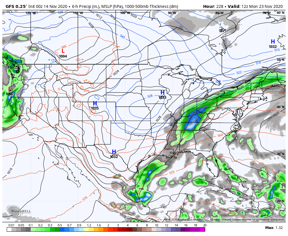
THE NEXT CHANCE OF RAIN: As we step off into Voodoo Land, the next chance of rain will come as a cold front during the late-night hours on Sunday, Nov. 22, continuing through a good portion of Monday, Nov. 23.
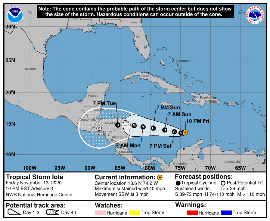
TROPICS: As of 9 p.m. Friday, the center of Tropical Storm Iota was around 350 miles south of Kingston, Jamaica. Iota is moving toward the south-southwest near 3 mph. A westward motion at a slightly faster forward speed is expected to begin by late Saturday and continue through Monday. On the forecast track, Iota will move across the central Caribbean Sea during the next day or so and approach the coasts of Nicaragua and northeastern Honduras on Monday. Maximum sustained winds are near 40 mph with higher gusts. Steady to rapid strengthening is likely over the weekend, and the system is forecast to be a major hurricane when it approaches Central America. Portions of Honduras and northern Nicaragua could see 8 to 16 inches of rainfall, with isolated maximum totals of 20 inches possible. This rainfall would lead to significant, life-threatening flash flooding and river flooding, along with landslides in areas of higher terrain.

Also, at 9 p.m. Friday, the center of Tropical Storm Theta was around 520 miles southeast of the Azores. Theta is moving toward the east near 10 mph. An eastward or east-southeastward motion with a gradual decrease in forward speed is expected through Sunday, followed by a sharp northward turn Sunday night into early next week. Satellite-derived wind data indicate that maximum sustained winds have decreased to near 50 mph with higher gusts. Weakening is forecast during the next couple of days, and Theta is expected to become a remnant low by late Sunday.
The rest of the Atlantic Basin is quiet for now.
ON THIS DATE IN 1753: A violent easterly gale at New York City flooded cellars and spoiled wharves.
BEACH FORECAST CENTER: Get the latest weather and rip current forecasts for the beaches from Dauphin Island to Panama City Beach, Florida, on our Beach Forecast Center page. There, you can select the forecast of the region you are interested in.
For more weather news and information from James Spann, Scott Martin and other members of the James Spann team, visit AlabamaWx.


