James Spann: Alabama dry through Friday with cool days, chilly nights
James Spann forecasts more cool, dry weather for Alabama from Alabama NewsCenter on Vimeo.
ANOTHER COLD START: These are temperatures across Alabama just before sunrise:
- Grantley — 27
- Fort Payne — 29
- Gadsden — 30
- Decatur — 31
- Anniston — 32
- Weaver — 32
- Talladega — 32
- Meridianville — 32
- Hueytown — 33
- Good Hope — 33
- Sylacauga — 34
- Demopolis — 35
- Northport — 36
- Selma — 36
- Birmingham — 37
- Montgomery — 37
- Tuscaloosa — 37
- Heflin — 37
- Mobile — 47
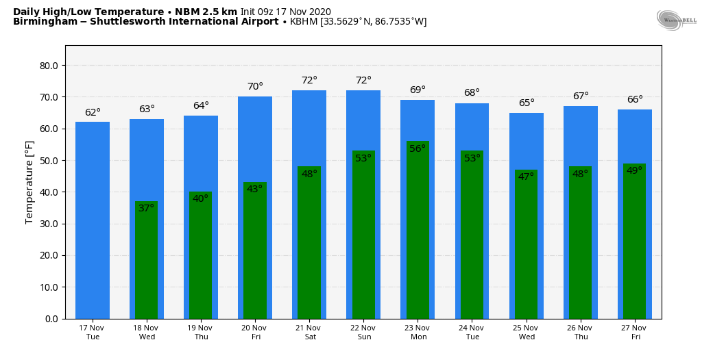
Alabama’s weather won’t change much through Thursday; expect sunny, cool days and clear, chilly nights. Highs will be between 60 and 65 degrees, with lows in the 30s. Friday will be another sunny day; we begin the day in the 40s and the high will be in the upper 60s.
THE ALABAMA WEEKEND: Saturday will feature a good supply of sunshine with a high in the low 70s. Moisture levels will increase Sunday, and we will mention just a few isolated showers with a high between 70 and 73.
THANKSGIVING WEEK: A surface front will approach Alabama early in the week, becoming stationary somewhere near north Alabama. This will bring a chance of showers and possibly a thunderstorm or two Monday and Tuesday; then we trend drier over the latter half of the week. Highs will be mostly in the 60s.
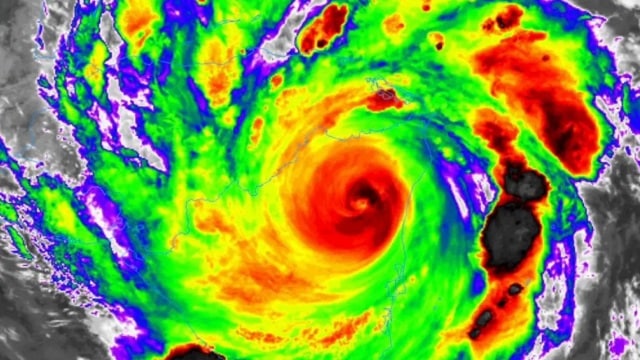
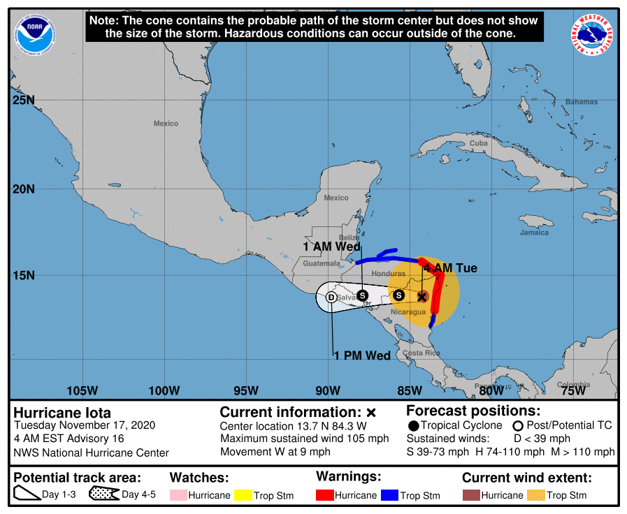
TROPICS: Iota is inland over Central America and weakening quickly; it made landfall last night on the coast of Nicaragua as an upper-end Category 4 hurricane. The landfall point was within 15 miles of where Hurricane Eta moved inland on Nov. 4; Eta was also a Category 4 at the time of landfall.
Elsewhere, a broad area of low pressure could form in a couple of days over the southwestern Caribbean Sea. Environmental conditions are forecast to be conducive for slow development, and a tropical depression could form by the weekend while the system moves slowly westward or west-southwestward across the southwestern Caribbean Sea. Regardless of development, areas of heavy rain are possible during the next several days from Nicaragua southward across Central America and into Colombia. These rains could cause new flooding concerns, especially across previously inundated areas.
No tropical trouble is in sight for the Gulf of Mexico for the next seven days, and the hurricane season ends at the end of this month.
ON THIS DAY IN 1957: Just after noon, tornadoes started touching down in eastern Mississippi. Two people were killed by a strong tornado that cut a 15-mile path from near Macon. Mississippi. Then, a little after 3 p.m., a violent tornado touched down 6 miles northwest of Jasper. Mr. and Mrs. Wilford Bradford had just built a new home there. The ranch home was blown 150 feet and smashed to bits. The couple and their 14-year-old daughter were killed. One other person was killed along the 5-mile path that carried the tornado near Saragossa and Manchester. An amateur photographer snapped a dramatic picture of the tornado that ran on front pages of newspapers all over the country, including the front page of The Birmingham News the next day.

BEACH FORECAST: Click here to see the AlabamaWx Beach Forecast Center page.
WEATHER BRAINS: You can listen to our weekly 90-minute show anytime on your favorite podcast app. This is the show all about weather featuring many familiar voices, including the meteorologists at ABC 33/40.
CONNECT: You can find me on the major social networks:
For more weather news and information from James Spann and his team, visit AlabamaWx.


