James Spann: Clearing, colder in Alabama today; more rain Wednesday
James Spann forecasts a cool, mostly dry work week with midweek rain from Alabama NewsCenter on Vimeo.
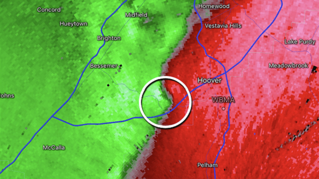
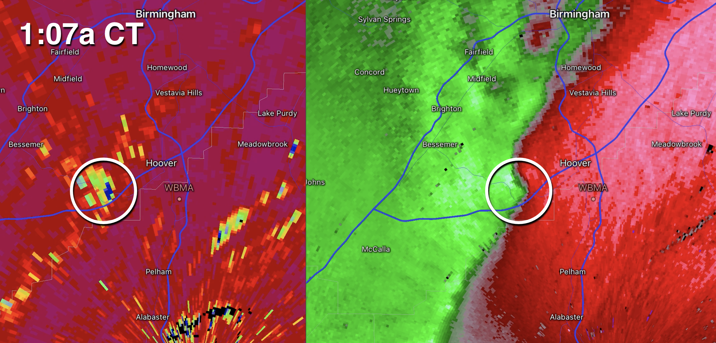
COLDER, DRIER: A large mass of rain has moved out of Alabama early this morning; it brought amounts of 1 to 2 inches to much of the state. A small, brief tornado apparently touched down shortly after 1 a.m. in southwest Jefferson County near the Hoover/Bessemer line, knocking down some trees and power lines.
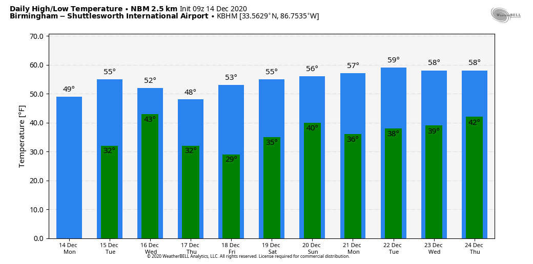
We expect a clearing sky today with a high between 52 and 55 degrees this afternoon; the average high for Birmingham on Dec. 14 is 56.
MORE RAIN: Tuesday will be dry with a partly sunny sky; after a low in the low to mid 30s, the high will be in the mid 50s. Clouds increase Tuesday night ahead of the next weather system approaching, and some rain is possible after midnight. Rain is likely Wednesday, especially during the morning. There’s no risk of severe storms; temperatures will hold in the 40s north of Birmingham through the day. Rain amounts with this feature will be around one-half inch, and the rain will end from west to east Wednesday afternoon.
Thursday and Friday will be rain-free; expect a good supply of sunshine both days. Morning lows will be between 26 and 32 degrees; the high will be close to 50 Thursday, followed by mid 50s Friday.
THE ALABAMA WEEKEND: Clouds return Friday night, and global model data suggests rain will be likely at some point Saturday or Saturday night. For now no severe storms are expected, and rain amounts should be less than one-half inch. Sunday will feature a clearing sky; highs over the weekend will be in the 50s, right at seasonal averages for this time of the year.
CHRISTMAS WEEK: Long-range guidance hints at some rain around Christmas Eve (Thursday), followed by clearing and colder weather Friday. Otherwise, the week looks fairly quiet with no high-impact weather events for the Deep South.
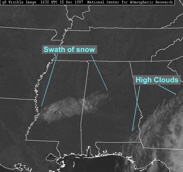
ON THIS DATE IN 1997: A surprise snow event unfolded as a deep, cold-core upper low moved into Mississippi. Dynamic cooling was responsible for changing rain over to snow, and it continued into west Alabama. What was expected to be a big rain event brought 4 to 8 inches of heavy, wet snow from near Jackson, Mississippi, to Demopolis, Alabama.
BEACH FORECAST: Click here to see the AlabamaWx Beach Forecast Center page.
WEATHER BRAINS: You can listen to our weekly 90-minute show any time on your favorite podcast app. This is the show all about weather featuring many familiar voices, including the meteorologists at ABC 33/40.
CONNECT: You can find me on the major social networks:
For more weather news and information from James Spann and his team, visit AlabamaWx.


