James Spann: Cold, dry weekend ahead for Alabama; rain, some snow on Monday
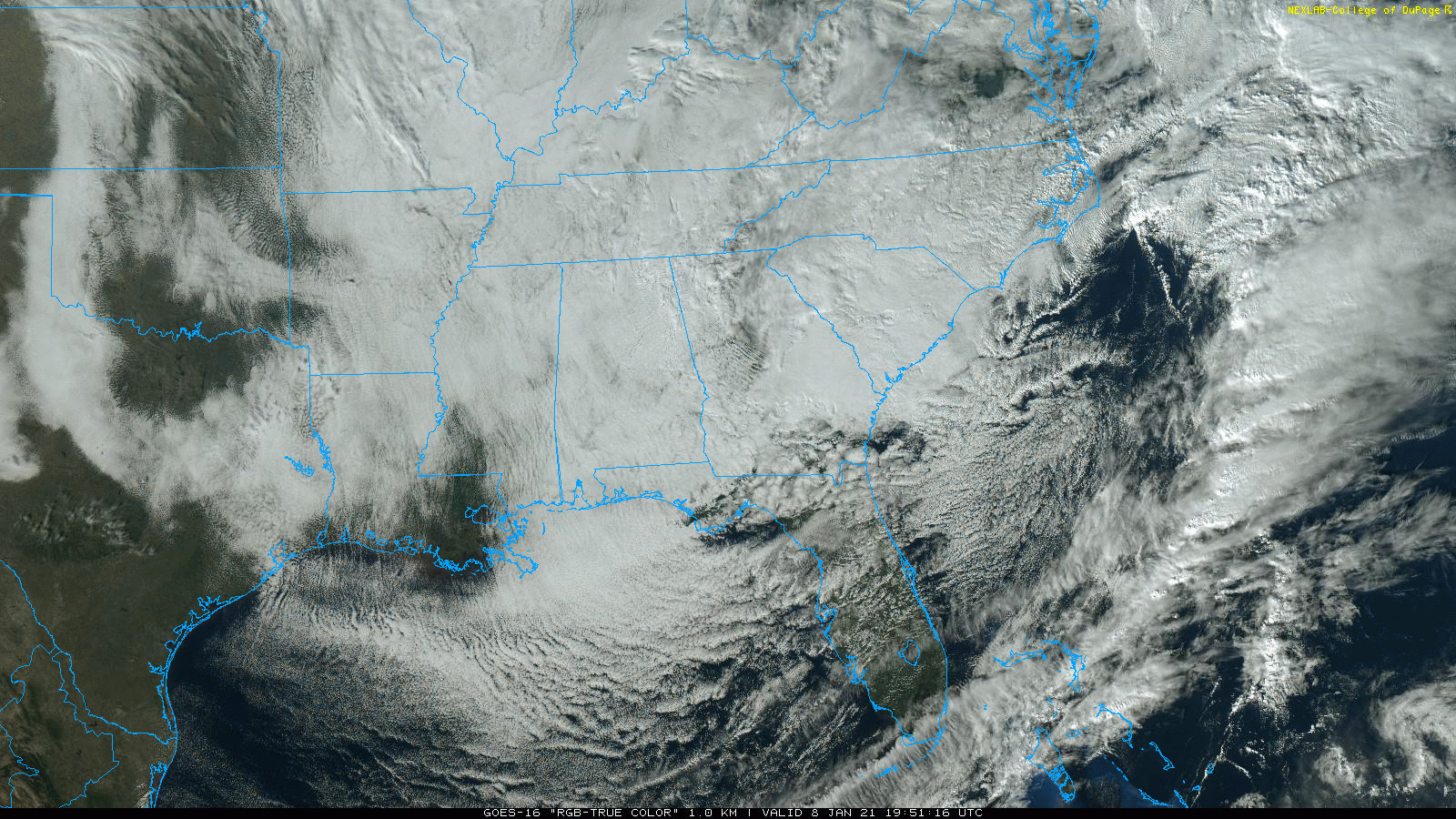
COLD WINTER DAY: Temperatures just haven’t budged across Alabama today. They are generally between 35 and 43 degrees at mid-afternoon; the average high for Birmingham on Jan. 8 is 53. Clouds persist over the state, but the precipitation has ended. We expect gradual clearing late tonight; the low early Saturday will be in the mid to upper 20s.
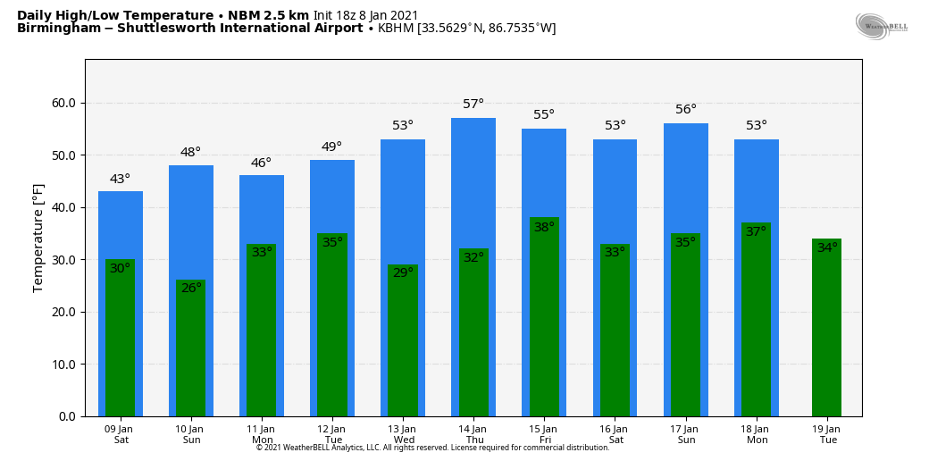
THE ALABAMA WEEKEND: Cold, dry weather is the story Saturday and Sunday; the high will be in the mid 40s Saturday, followed by upper 40s Sunday. The sky will be partly sunny both days; clouds will increase Sunday night ahead of the next weather system approaching from the west.
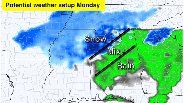
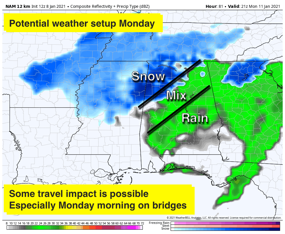
COLD, MESSY DAY MONDAY: Precipitation will begin across Alabama Monday morning, and as it begins a mix of snow, sleet and possibly some freezing rain is possible over the northern half of the state. The best chance of snow is over the northwest counties, north and west of Birmingham.
For central Alabama, a brief period of wintry mixed precipitation is likely early Monday as temperatures will initially be around freezing before warming into the upper 30s by late morning. The area of concern is generally along and northwest of a line from Marion Junction to Prattville to Roanoke. The precipitation is expected to be light and the duration is limited. In addition, ground temperatures remain above freezing, which would limit any slick spots to elevated surfaces such as bridges and overpasses at worst.
A cold rain is likely for most of Alabama during the midday and afternoon, but snow could continue over the northwest counties. Moisture will be somewhat limited, but some accumulation is very possible, if not likely, around Florence and Muscle Shoals. Be sure and watch for weather updates over the weekend.
REST OF NEXT WEEK: The weather looks dry Tuesday through Friday. Temperatures will moderate, with highs back in the 50s by Wednesday and Thursday. Some global models show much colder air returning next Friday.
ON THIS DATE IN 1973: Georgia’s worst ice storm since 1935 occurred. Freezing rain and sleet began during the early morning Dec. 7 and ended in most areas during the day Dec. 8. Total damage was estimated at well over $25 million. The electric power companies suffered losses estimated at $5 million, and telephone companies had another $2 million in damages. Some schools were closed for more than a week.
BEACH FORECAST: Click here to see the AlabamaWx Beach Forecast Center page.
WEATHER BRAINS: You can listen to our weekly 90-minute show any time on your favorite podcast app. This is the show all about weather featuring many familiar voices, including the meteorologists at ABC 33/40.
CONNECT: You can find me on the major social networks:
For more weather news and information from James Spann and his team, visit AlabamaWx.com.


