James Spann: Calmer day for Alabama; a few strong storms over the weekend
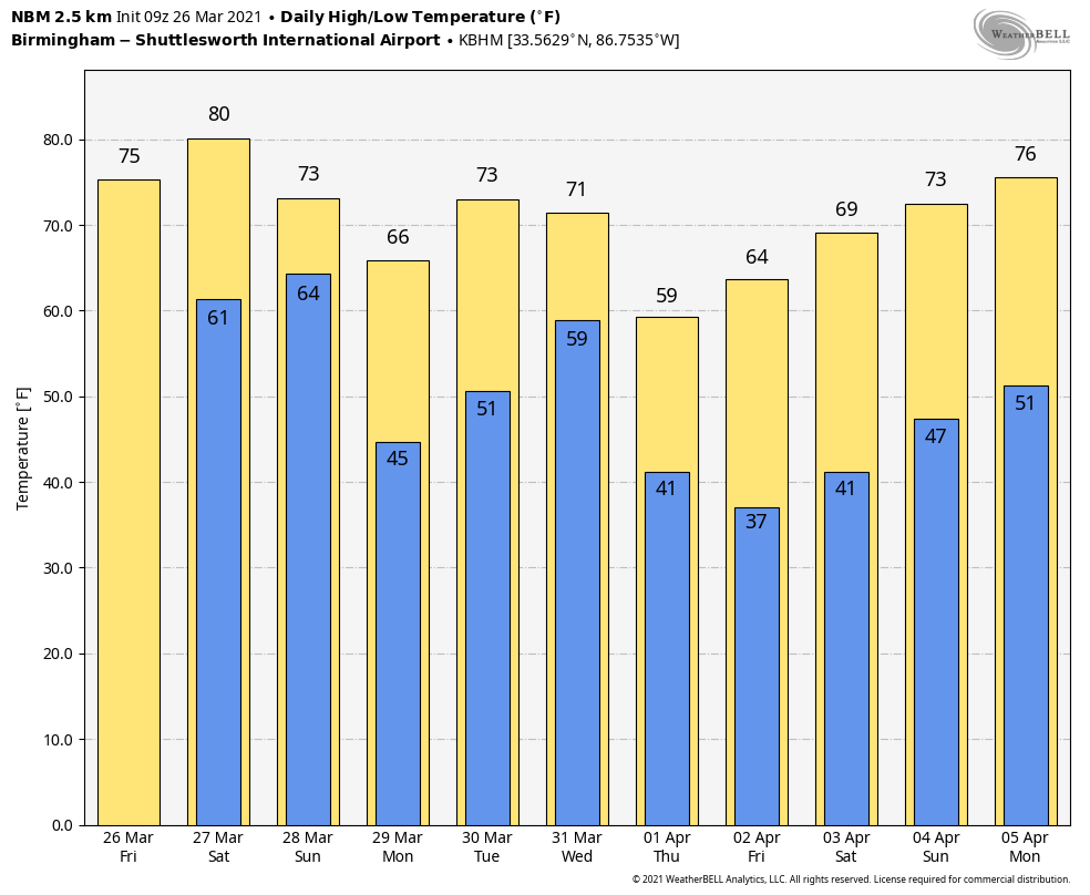
CALMER DAY: After a day of violent tornadoes responsible for at least five deaths in Alabama and extensive damage, the weather today will be much calmer. A band of showers early this morning is along a cold front lined up from near Lafayette to Montgomery to Grove Hill. Showers over Alabama today will be confined to the southern half of the state; elsewhere the sky becomes partly sunny with a high in the mid 70s.
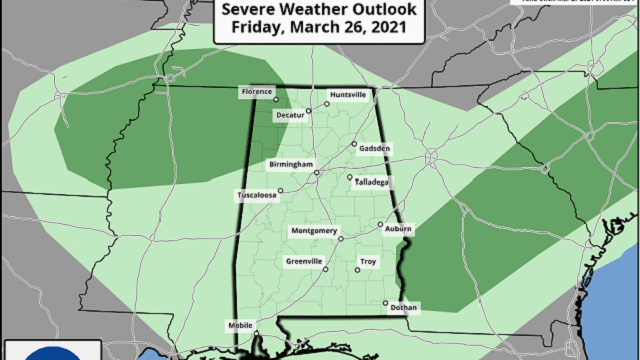
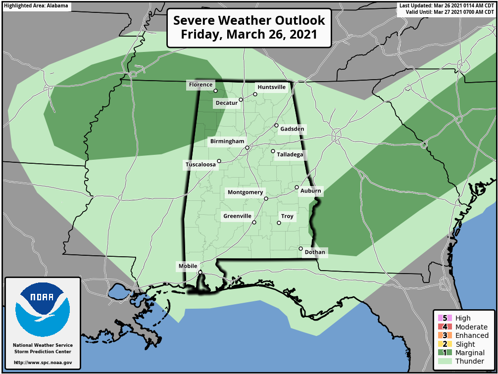
The front will move northward tonight as a warm front, and showers and a few storms are possible statewide. A few strong storms are possible over the northwest corner of the state, where the Storm Prediction Center has defined a marginal risk (level 1 out of 5) of severe thunderstorms. The main risk is from small hail and gusty winds, but this is a low-end threat.
 THE ALABAMA WEEKEND: Saturday will be warm with more clouds than sun; a few scattered showers are possible, but a decent part of the day will be dry with a high around 80 degrees. A cold front will approach the state Saturday night, when showers and thunderstorms become more likely. That activity will likely continue into Sunday.
The SPC has defined a slight risk (level 2 out of 5) of severe storms for Saturday night over northwest Alabama, with a marginal risk (level 1 of 5) down to I-59. There is a marginal risk for most of the state Sunday.
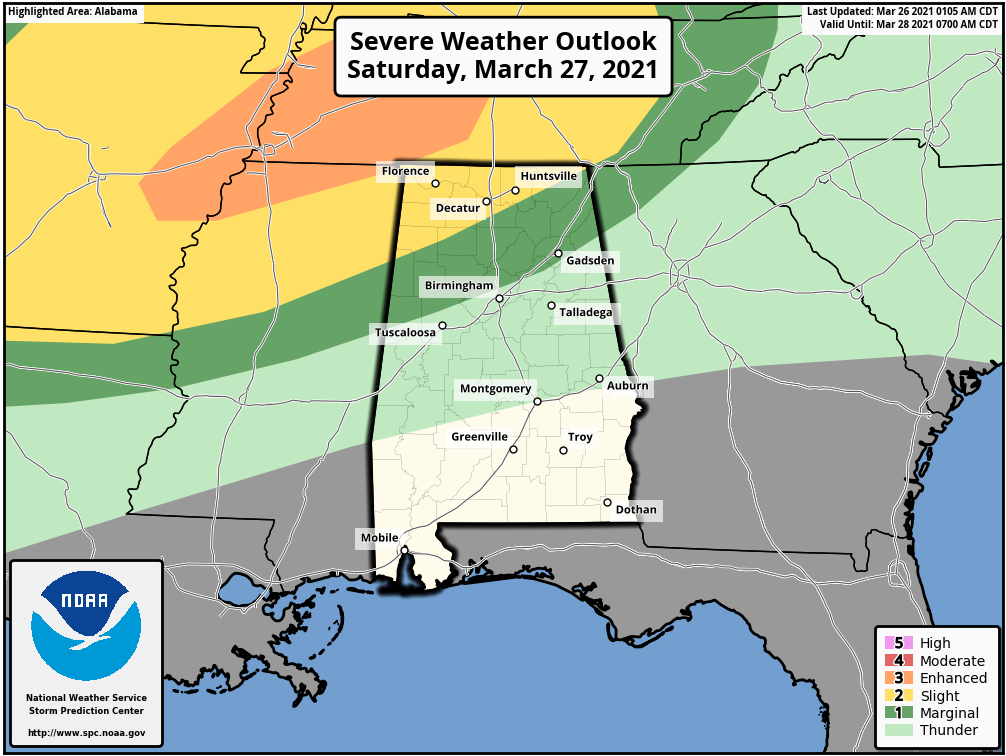
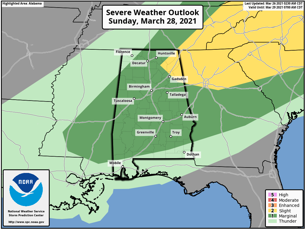 Thunderstorms Saturday night and Sunday will be capable of producing some hail and strong, possibly damaging winds. Based on the forecast wind fields, the tornado threat is low. Rain amounts over the weekend will be around 1 inch for most places. The ground is saturated, and a few isolated flooding issues can’t be totally ruled out. Sunday’s high will be in the low 70s.
NEXT WEEK: Another disturbance will bring a round of rain and possibly a few thunderstorms Monday and Monday night. Tuesday looks dry, followed by yet another chance of rain and storms Wednesday ahead of a cold front. Thursday and Friday will be dry and a bit cooler. For now the severe weather risk looks relatively low for the week.
ON THIS DATE IN 1948: Good Friday tornadoes moved from Terre Haute to Redkey, Indiana, killing 20 people. About 80% of the town of Coatesville was destroyed and 16 people were killed. The Coatesville Carnegie Library was a total loss. The path was a half-mile wide.
BEACH FORECAST: Click here to see the AlabamaWx Beach Forecast Center page.
WEATHER BRAINS: You can listen to our weekly 90-minute show any time on your favorite podcast app. This is the show all about weather featuring many familiar voices, including the meteorologists at ABC 33/40.
CONNECT: You can find me on the major social networks:
For more weather news and information from James Spann and his team, visit AlabamaWx.


