James Spann: Light rain for Alabama at times tonight, clearing on Thursday
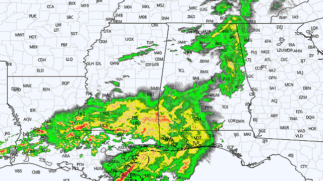
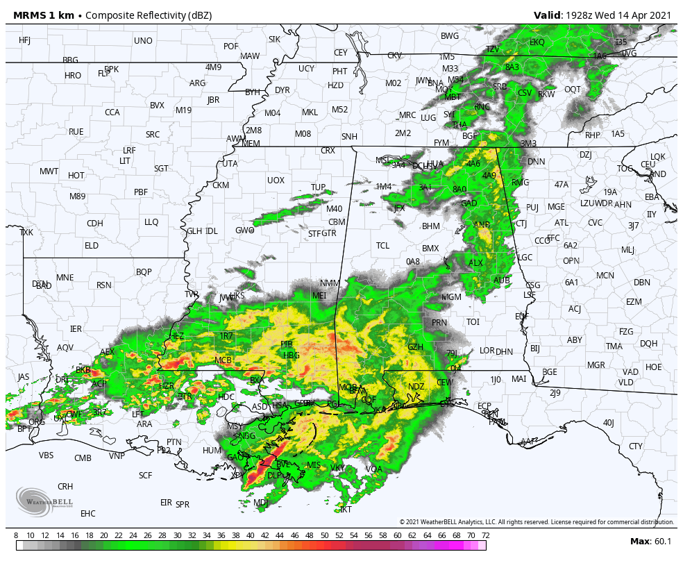
RADAR CHECK: Rain continues to fall this afternoon over much of east, central and southwest Alabama. There have been a few embedded thunderstorms today, but they have been well below severe limits. We will maintain the chance of some rain at times tonight and early Thursday, but a punch of dry air rolls into the state during the day Thursday with a clearing sky. Most communities will enjoy a good supply of sunshine by midday and through the afternoon; temperatures will remain below average, with highs between 67 and 71 degrees.
FRIDAY AND THE WEEKEND: Clouds will increase again Friday and we will mention the chance of rain at times late Friday night into Saturday morning. It looks like the main window for rain comes from around midnight Friday night through noon Saturday; amounts should be one-half inch or less, and there is no risk of severe thunderstorms. Clouds will linger Saturday afternoon with a high in the mid to upper 60s, about 10 degrees below average for mid-April in Alabama.
Sunday will be dry with a mix of sun and clouds and a high between 65 and 70 degrees.
NEXT WEEK: A quiet weather pattern continues. The weather looks dry Monday through Thursday; some rain could return on Friday, April 23. Temperatures will be near or a little below average.
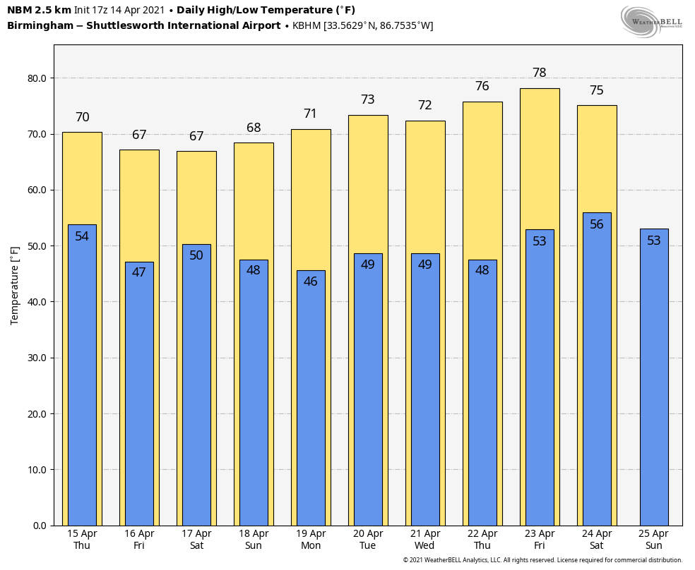
FOOTBALL WEATHER: Both Auburn and Alabama will hold their annual spring scrimmage games Saturday. The game in Tuscaloosa kicks off at noon; kickoff in Auburn is set for 1. Some light rain is likely Saturday morning across the state, but we believe the weather at both stadiums will be dry by afternoon with lingering clouds. Temperatures will be between 65 and 69 degrees in Tuscaloosa and Auburn Saturday afternoon.
ON THIS DATE IN 1935: Black Sunday refers to a particularly severe dust storm that occurred on April 14, 1935, as part of the Dust Bowl. During the afternoon, the residents of the Plains States were forced to take cover as a dust storm or “black blizzard” blew through the region. The storm hit the Oklahoma Panhandle and northwestern Oklahoma first and moved south for the remainder of the day. It hit Beaver around 4 p.m., Boise City around 5:15 p.m. and Amarillo, Texas, at 7:20 p.m. The conditions were the most severe in the Oklahoma and Texas panhandles, but the storm’s effects were felt in surrounding areas.
ON THIS DATE IN 2019: Eleven tornadoes touched down across Alabama. All were rated EF-0/1 and there were no fatalities or injuries. These tornadoes moved through communities such as Troy, Glencoe, Gallion and Phenix City. One EF-0 tornado moved through Highland Lakes in Shelby County.
BEACH FORECAST: Click here to see the AlabamaWx Beach Forecast Center page.
WEATHER BRAINS: You can listen to our weekly 90-minute show any time on your favorite podcast app. This is the show all about weather featuring many familiar voices, including the meteorologists at ABC 33/40.
CONNECT: You can find me on the major social networks:
For more weather news and information from James Spann and his team, visit AlabamaWx.


