James Spann: Warm, dry Wednesday ahead for Alabama; rain Thursday night
WARM AFTERNOON: Temperatures are mostly in the low to mid 80s across Alabama this afternoon with a good supply of sunshine through high cirrus clouds. Tonight will be mostly fair with a low in the mid 60s.
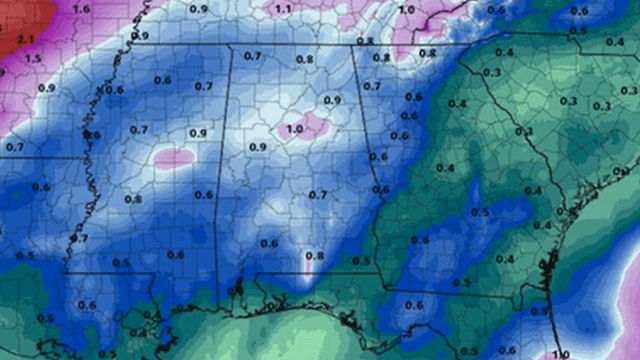
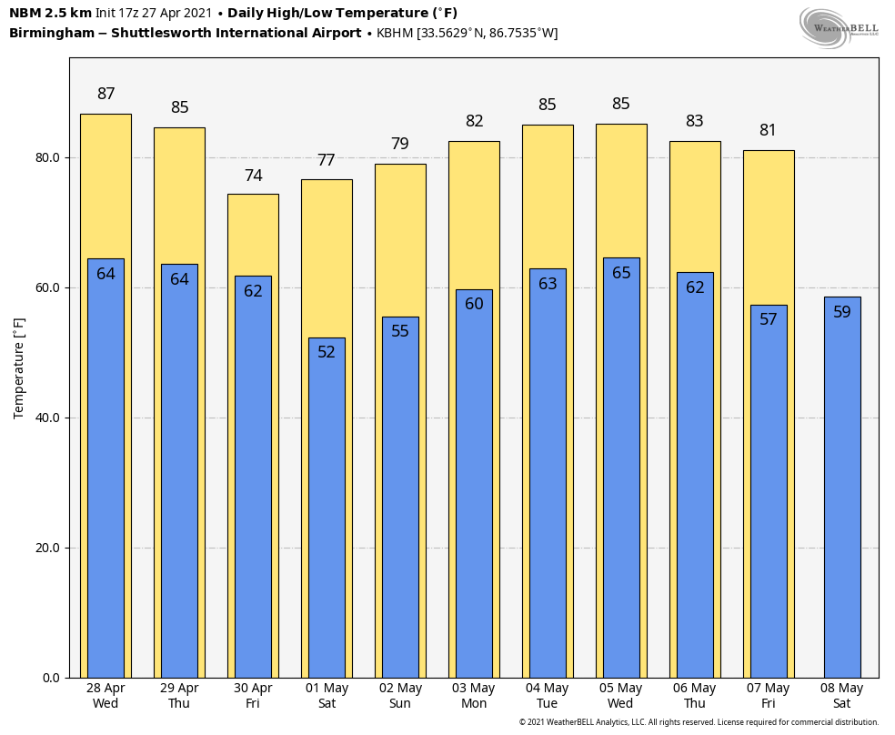
Not much change in our weather is expected Wednesday; look for a partly sunny sky with a high between 82 and 85 degrees. Clouds will increase during the day Thursday, but the day will stay dry with a high in the low 80s. A cold front will bring a chance of showers late Thursday night into Friday; it still looks like the main window for rain over the northern half of the state comes from around midnight Thursday night through noon Friday. Rain could linger into Friday evening over the southern counties of Alabama.
Rain amounts of around one-half inch are likely and, while some thunder is possible, severe storms are not expected with very limited instability and weak dynamic forcing. Friday will be cooler with a high in the low 70s.
THE ALABAMA WEEKEND: We still expect a dry weekend. The American global model has gone rogue and suggests some rain Saturday with a wave forming on the front to the south, but the reliable European model shows very dry air and a sunny sky both days, and we will follow that in our forecast. The high will be in the mid 70s Saturday, followed by low 80s Sunday.
NEXT WEEK: Forecast confidence is low due to model inconsistency. Showers could return as early as Monday night or Tuesday.
ON THIS DATE TEN YEARS AGO: A generational event brought 62 tornadoes to Alabama, killing 252 people and injuring many more. Three of the tornadoes were rated EF-5; one of those moved through the communities of Hackleburg and Phil Campbell in northwest Alabama. This tornado killed 72 people, making it the deadliest single tornado ever to strike the state of Alabama as well as (at the time) the deadliest in the United States since the 1955 Udall, Kansas, tornado that killed 80 people. In addition to being the deadliest, this tornado also had the longest track of any tornado in the outbreak, with its path extending 132 miles across northern Alabama and into Tennessee.
There were eight EF-4 tornadoes, including the one that moved through Tuscaloosa and the western part of the Birmingham metro.
There were two rounds of thunderstorms that horrible day. The morning event brought widespread wind damage, three tornadoes rated EF-3 and five rated EF-2. Five were killed, and more than a quarter of a million people lost power. Then, during the afternoon and evening, violent supercells brought long-track tornadoes like bullets from hell.
BEACH FORECAST: Click here to see the AlabamaWx Beach Forecast Center page.
WEATHER BRAINS: You can listen to our weekly 90-minute show any time on your favorite podcast app. This is the show all about weather featuring many familiar voices, including the meteorologists at ABC 33/40.
CONNECT: You can find me on the major social networks:
For more weather news and information from James Spann and his team, visit AlabamaWx.


