James Spann: Showers, thunderstorms arrive in Alabama later today, tonight
James Spann forecasts showers, storms for Alabama later today from Alabama NewsCenter on Vimeo.
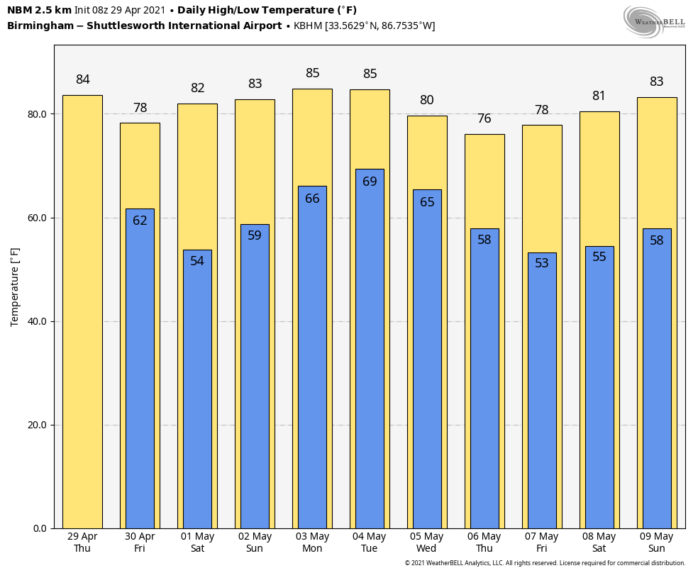
RADAR CHECK: An active batch of rain and thunderstorms is pushing into west Tennessee this morning ahead of a cold front, but most of Alabama remains dry around sunrise with temperatures mostly in the 60s. A few showers are possible today over the Tennessee Valley of far north Alabama, but most places remain dry during the day with a high in the low 80s. Morning clouds will give way to intervals of sunshine this afternoon.
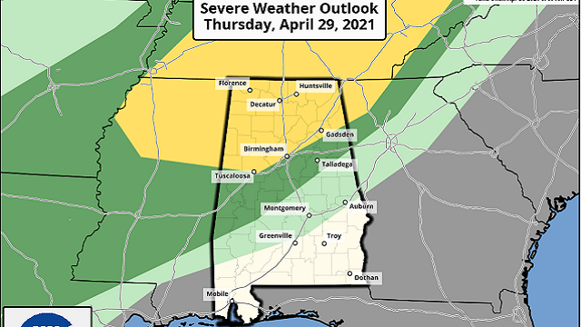
TONIGHT: Showers and storms will push into Alabama this evening ahead of the cold front, and the Storm Prediction Center has amended its forecast, introducing a slight risk (level 2 out of 5) of severe thunderstorms for areas north of a line from Reform to Tuscaloosa to Birmingham to Gadsden. A marginal risk (level 1 of 5) is defined as far south as Linden, Clanton and Heflin.
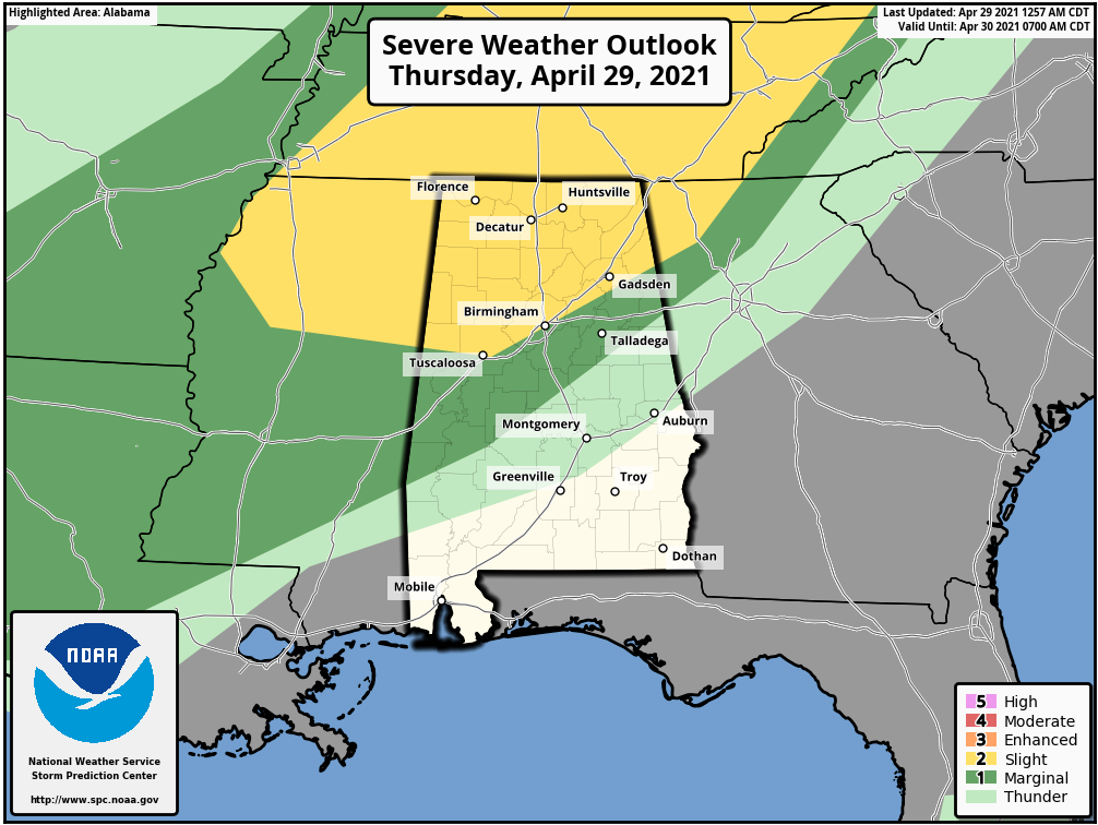
It now looks like there will be sufficient instability for a few thunderstorms from roughly 6 p.m. to midnight with potential for strong, gusty winds and small hail. The chance of a tornado is low, but not zero. Rain amounts tonight should be one-half inch or less for most communities.
Showers will shift down into the southern half of the state after midnight, but they will continue to weaken.
FRIDAY AND THE WEEKEND: Dry air moves into the northern two-thirds of the state Friday; the sky will be partly to mostly sunny with a high in the upper 70s. Any showers Friday should be confined to southwest Alabama, and even there most of the day should be dry. Saturday will be a delightful day to start the weekend, with a good supply of sunshine and a high around 80 degrees.
Moisture will return Sunday, and we will bring in a chance of scattered showers and thunderstorms by afternoon. Odds of any one spot getting wet Sunday are 40-50%. Sunday’s high will be close to 80.
NEXT WEEK: A summer-like pattern sets up for the first half of the week, with moist, unstable air in place. We will deal with scattered showers and thunderstorms daily Monday through Wednesday. Storms will be most active during the afternoon and evening hours, and with high levels of instability we could see a few strong, possibly severe thunderstorms along the way. Highs will be in the low 80s for the first half of the week.
The weather will trend drier and cooler Thursday and Friday.
ON THIS DATE IN 1910: The temperature at Kansas City, Missouri, soared to 95 degrees to establish a record for April. Four days earlier the afternoon high in Kansas City was 44 degrees following a record cold morning low of 34 degrees.
ON THIS DATE IN 1991: Southeast Bangladesh was devastated by a tropical cyclone with sustained winds of approximately 155 mph late in the night. A 20-foot storm surge inundated the offshore islands south of Chittagong and pushed water from the Bay of Bengal inland for miles. Best estimates put the loss of life from this cyclone between 135,000 and 145,000 people.
BEACH FORECAST: Click here to see the AlabamaWx Beach Forecast Center page.
WEATHER BRAINS: You can listen to our weekly 90-minute show any time on your favorite podcast app. This is the show all about weather featuring many familiar voices, including the meteorologists at ABC 33/40.
CONNECT: You can find me on the major social networks:
For more weather news and information from James Spann and his team, visit AlabamaWx.


