James Spann: Wet, unsettled pattern continues across Alabama
James Spann forecasts more rain before Alabama gets a break from Alabama NewsCenter on Vimeo.
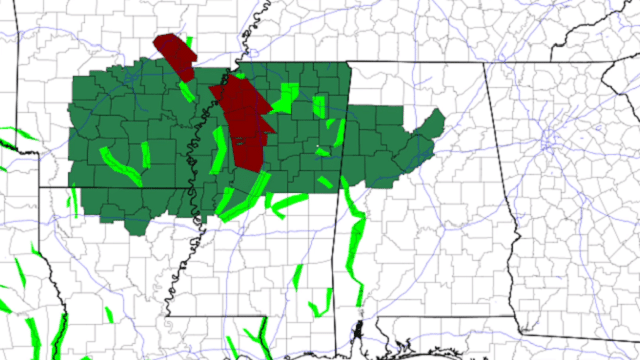
RADAR CHECK: Another batch of rain and storms is moving through north and central Alabama early this morning in the moisture-laden air mass over the state. A Flash Flood Warning is in effect for southern Pickens County until 11:30 a.m.
The sky will be mostly cloudy today with rain and thunderstorms likely; the higher rain coverage will be over the central counties of the state. Like Wednesday, the main concern will be flooding due to the efficient rain-producing thunderstorms and saturated soil. A few trees could come down with wind gusts of only 30-40 mph due to the soil conditions. A Flash Flood Watch is in effect for parts of west and central Alabama, where some spots could see more than 2 inches of rain again today.
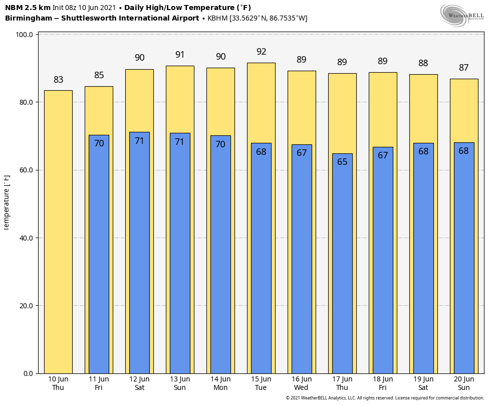
Many communities across central Alabama won’t get out of the 70s today due to clouds and rain; the high will be in the 80s over south Alabama, where the sun will be out at times.
FRIDAY AND THE WEEKEND: The weather won’t change much on Friday; the sky will be cloudy at times with scattered to numerous showers and thunderstorms. Over the weekend, showers and storms become fewer in number with increasing amounts of sunshine. Odds of any one spot getting wet will be 30-40% Saturday, dropping to 20% Sunday. Highs over the weekend will be between 88 and 91 degrees as heat levels rise.
NEXT WEEK: A much drier air mass will be in place across Alabama through the week; showers will be few and far between. The highs will be around 90 Monday and Tuesday, dropping into the 80s Wednesday through Friday. Dewpoints will be considerably lower, and some north Alabama communities could drop into the 50s over the latter half of the week.
WEDNESDAY’S RAIN: Rain totals with our Skywatchers include:
- Arley — 2.86 inches
- Moody — 2.81
- Leeds — 2.47
- West Blocton — 2.21
- Heflin — 1.78
- Alabaster — 1.68
- Bessemer — 1.38
- Carbon Hill — 1.3
- Hueytown — 1.26
- Springville — 1.25
- Fayette — 1.23
- Oneonta — 1.16
- Remlap — 1.11
- Oak Grove — 1.1
- Northport — 1.03
- Crestwood — 1.03
- Morris — 1.01
- Coker — 1.01
- Mountain Brook — 0.41
TROPICS: The Atlantic basin is quiet and is now expected to remain quiet through the weekend. Still, global models continue to hint at potential tropical development in the western Gulf of Mexico in about a week. It’s too early to be specific. The main concern with early-season systems is generally heavy rain and flooding.
ON THIS DATE IN 1752: It is believed that this was the day Benjamin Franklin narrowly missed electrocution while flying a kite during a thunderstorm to determine whether lightning is related to electricity.
BEACH FORECAST: Click here to see the AlabamaWx Beach Forecast Center page.
WEATHER BRAINS: You can listen to our weekly 90-minute show any time on your favorite podcast app. This is the show all about weather featuring many familiar voices, including the meteorologists at ABC 33/40.
CONNECT: You can find me on the major social networks:
For more weather news and information from James Spann and his team, visit AlabamaWx.


