James Spann: Mostly dry weather for Alabama through Friday
James Spann forecasts lower humidity for Alabama from Alabama NewsCenter on Vimeo.
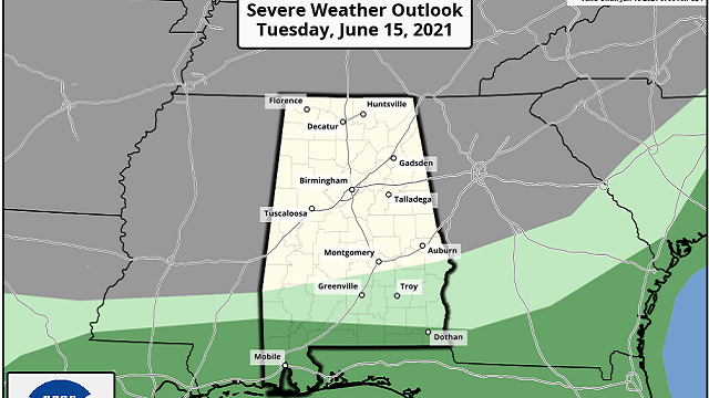
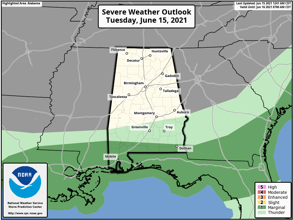
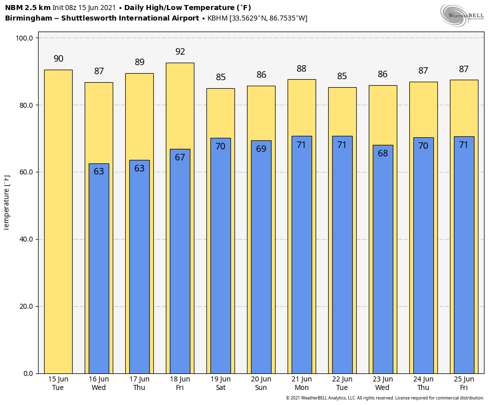
LOWER HUMIDITY: Drier air continues to advance into Alabama this morning, and for the northern two-thirds of the state today will be mostly sunny and not as humid as recent days thanks to the lower dew points. We expect a high this afternoon in the upper 80s. A few scattered storms will form this afternoon over the far southern part of the state, where the Storm Prediction Center has defined a low-end, marginal risk (level 1 of 5) south of a line from Chatom to Andalusia to Dothan.
Dry weather will continue across the state Wednesday and Thursday with pleasant mornings; cooler pockets will drop into the mid to upper 50s during the early morning hours. Highs will be between 85 and 89 degrees, right at seasonal averages for mid-June.
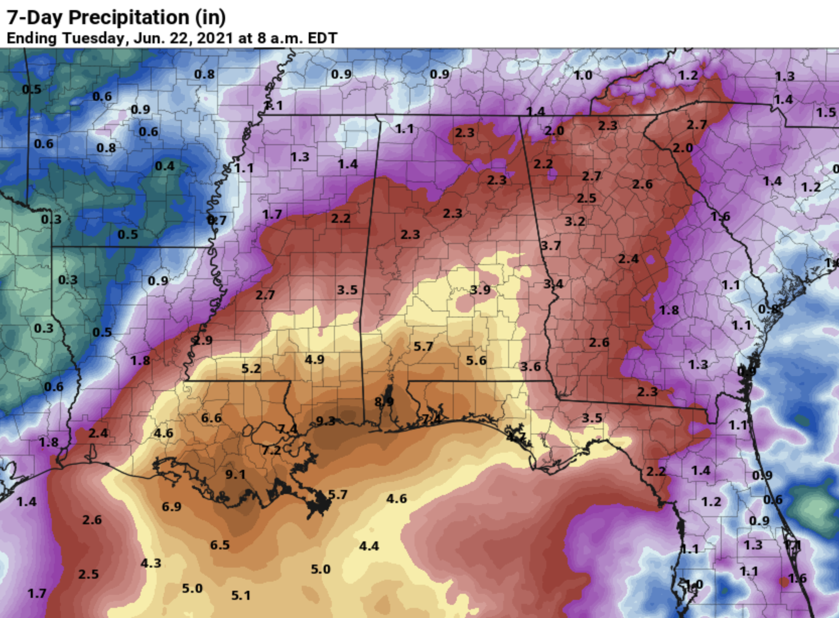
FRIDAY AND THE WEEKEND: Our weather will all depend on the behavior of a tropical low in the Gulf of Mexico. Rain is possible Friday over the southern half of the state, and we will forecast a good chance of occasional rain and possibly a few thunderstorms statewide Saturday and Sunday. Tropical systems like this in June can be very efficient rain producers, and there is potential for an axis of heavy rain for some part of the state, especially south Alabama. But, until the system actually becomes better organized, confidence in details (rain placement, timing, etc.) remains low.
The Weather Prediction Center is suggesting parts of south Alabama could see more than 5 inches of rain Friday through Sunday, but again we stress this forecast could change.
Highs over the weekend will be generally in the 80s, although some places could hold in the 70s, especially Saturday with clouds and rain.
NEXT WEEK: The tropical system should be out of here by Monday, but a cold front could trigger a few showers late in the day or Monday night. The global model suggests drier air could drop into north and central Alabama by Tuesday.
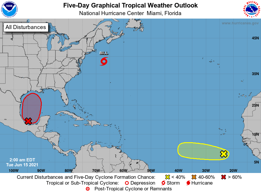
TROPICS: Tropical Storm Bill is in the Atlantic well east of the upper U.S. Atlantic coast with winds of 50 mph. It becomes post-tropical late tonight as it gains latitude.
In the far eastern Atlantic, a tropical wave several hundred miles south of the Cabo Verde Islands is producing a large area of cloudiness and disorganized showers. Any development of this system should be slow to occur during the next few days. Thereafter, a combination of dry air aloft and strong upper-level winds will limit chances of formation while the wave moves over the central tropical Atlantic.
For those in the Southeast, the system to watch is in the southwest Gulf of Mexico, where a tropical depression is expected to form within the next 72 hours. The main impact from this system will be heavy rain and rip currents for the central Gulf Coast Friday and Saturday; it won’t become a hurricane and possibly won’t even reach tropical storm strength.
ON THIS DATE IN 1991: The second largest volcanic eruption of the 20th century began as Mount Pinatubo injected 15 to 30 million tons of sulfur dioxide 100,000 feet into the atmosphere. As a result of the eruptions, 343 people were killed in the Philippines and 200,000 were left homeless. Material from the explosion would spread around the globe, leading to climate changes worldwide as the sun’s energy was blocked out and global temperatures cooled by as much as one degree Fahrenheit. Globally, 1992 was one of the coldest years since the 1970s.
BEACH FORECAST: Click here to see the AlabamaWx Beach Forecast Center page.
WEATHER BRAINS: You can listen to our weekly 90-minute show any time on your favorite podcast app. This is the show all about weather featuring many familiar voices, including the meteorologists at ABC 33/40.
CONNECT: You can find me on the major social networks:
For more weather news and information from James Spann and his team, visit AlabamaWx.


