James Spann: Drier air rolls into Alabama tonight
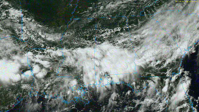
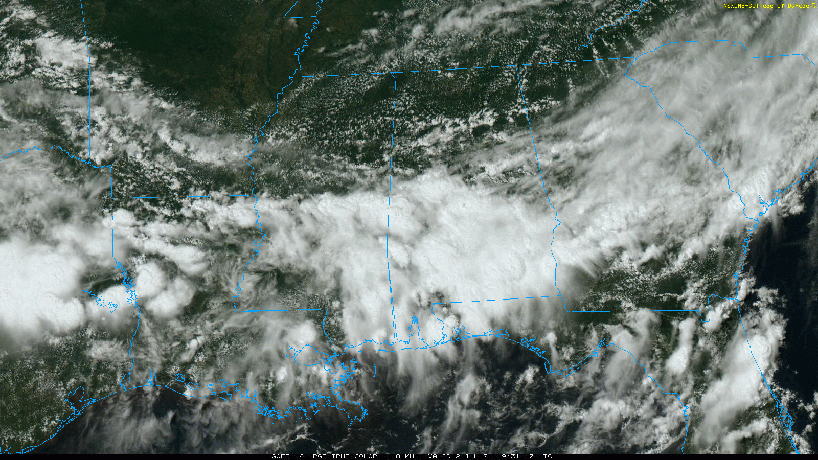
RADAR CHECK: Showers and thunderstorms are fairly widespread across the southern two-thirds of Alabama this afternoon ahead of a rare July cold front over the Tennessee Valley. This front will continue southward, and much of the state will be in very dry air late tonight. This will set the stage for a nice Fourth of July weekend.
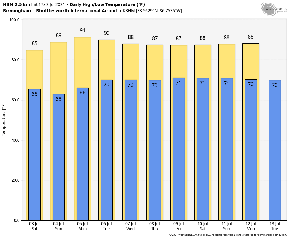
 HOLIDAY WEEKEND: For most of Alabama, we are forecasting sunny days, cooler nights and lower humidity levels over the holiday weekend. Highs will be in the mid 80s Saturday, followed by upper 80s Sunday. Some of the cooler spots will dip into the pleasant 50s at daybreak Sunday. We will need to maintain the chance of scattered showers and thunderstorms for far south Alabama and along the Gulf Coast, but the weekend won’t be a washout, and there will be sun from time to time.
Moisture will begin to return Monday, and a few isolated showers could pop up, but much of the state will be dry.
REST OF NEXT WEEK: We will bring back the chance of scattered showers and thunderstorms daily Tuesday through Friday, which is a routine part of the forecast around here this time of the year. For now it looks like the main impact with Elsa (the tropical system we are watching) will be east of Alabama.
 HURRICANE ELSA: Elsa is packing sustained winds of 85 mph in the eastern Caribbean this afternoon. It is moving rapidly (for a tropical system) to the west/northwest at 29 mph. Weakening is forecast over the weekend as interaction begins with Hispaniola and Cuba, and the National Hurricane Center is forecasting the system to move through the Florida peninsula (not the panhandle) as a tropical storm Tuesday and Tuesday night.

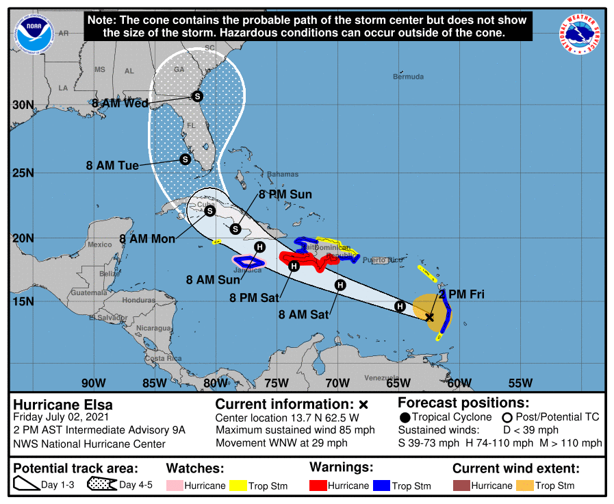
It should be noted that the average NHC track errors are 175 miles and 200 miles four and five days out, respectively. Given the larger-than-normal uncertainty and because hazards will extend well away from the center of the storm, don’t focus on the exact forecast points in the NHC track. But, for now, it looks like Alabama and the central Gulf Coast (Gulf Shores, Pensacola, Destin, Panama City Beach) will be on the good, drier west side of the system. We will be much more specific on the potential impact to the Florida peninsula over the next 48 hours as the system gets closer.
The rest of the Atlantic basin is quiet.
ON THIS DATE IN 2001: In Michigan, frost and freezing temperatures were observed in some locations, with Grant dropping to 29 degrees. Muskegon reported its coldest July temperature on record with 39 degrees. Other daily record lows included Lansing, 38; Muskegon, 39; Flint, 40; Youngstown, Ohio, 40; and Grand Rapids, 43 degrees.
BEACH FORECAST: Click here to see the AlabamaWx Beach Forecast Center page.
WEATHER BRAINS: You can listen to our weekly 90-minute show any time on your favorite podcast app. This is the show all about weather featuring many familiar voices, including the meteorologists at ABC 33/40.
CONNECT: You can find me on the major social networks:
For more weather news and information from James Spann and his team, visit AlabamaWx.


