James Spann: Summer mix of sun, storms for Alabama over the weekend
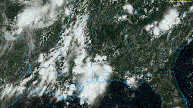
RADAR CHECK: The northern half of Alabama is relatively dry at mid-afternoon with only isolated showers, but showers and storms are extensive over east Mississippi and southwest Alabama. Flash Flood Warnings were required for parts of Baldwin County, where more than 3 inches of rain came down this morning.
A number of showers and thunderstorms will develop over north and central Alabama over the next six to eight hours in a moist, unstable air mass. Away from showers, temperatures are mostly in the upper 80s.

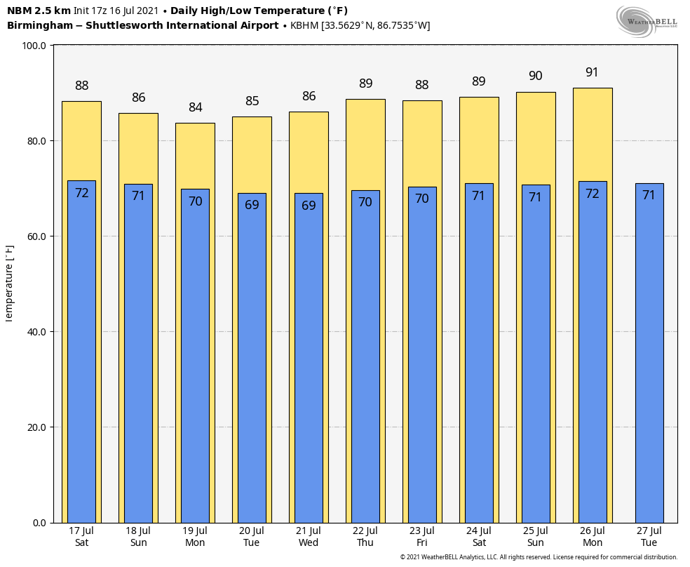
THE ALABAMA WEEKEND: We expect a classic summer mix of sun and thunderstorms Saturday and Sunday, with storms most active between 1 and 11 p.m. In this air mass, however, a few late-night or morning showers can’t be ruled out. Storms that form will be very efficient rain producers. Highs over the weekend will be mostly in the mid 80s.
NEXT WEEK: The weather won’t change much. Look for warm, humid days with periods of sun and scattered to numerous showers and thunderstorms, mostly during the afternoon and evening hours. Temperatures will remain below average, with highs most days between 85 and 89 degrees.
TROPICS: The Atlantic basin is very quiet, and tropical storm formation is not expected through early next week.
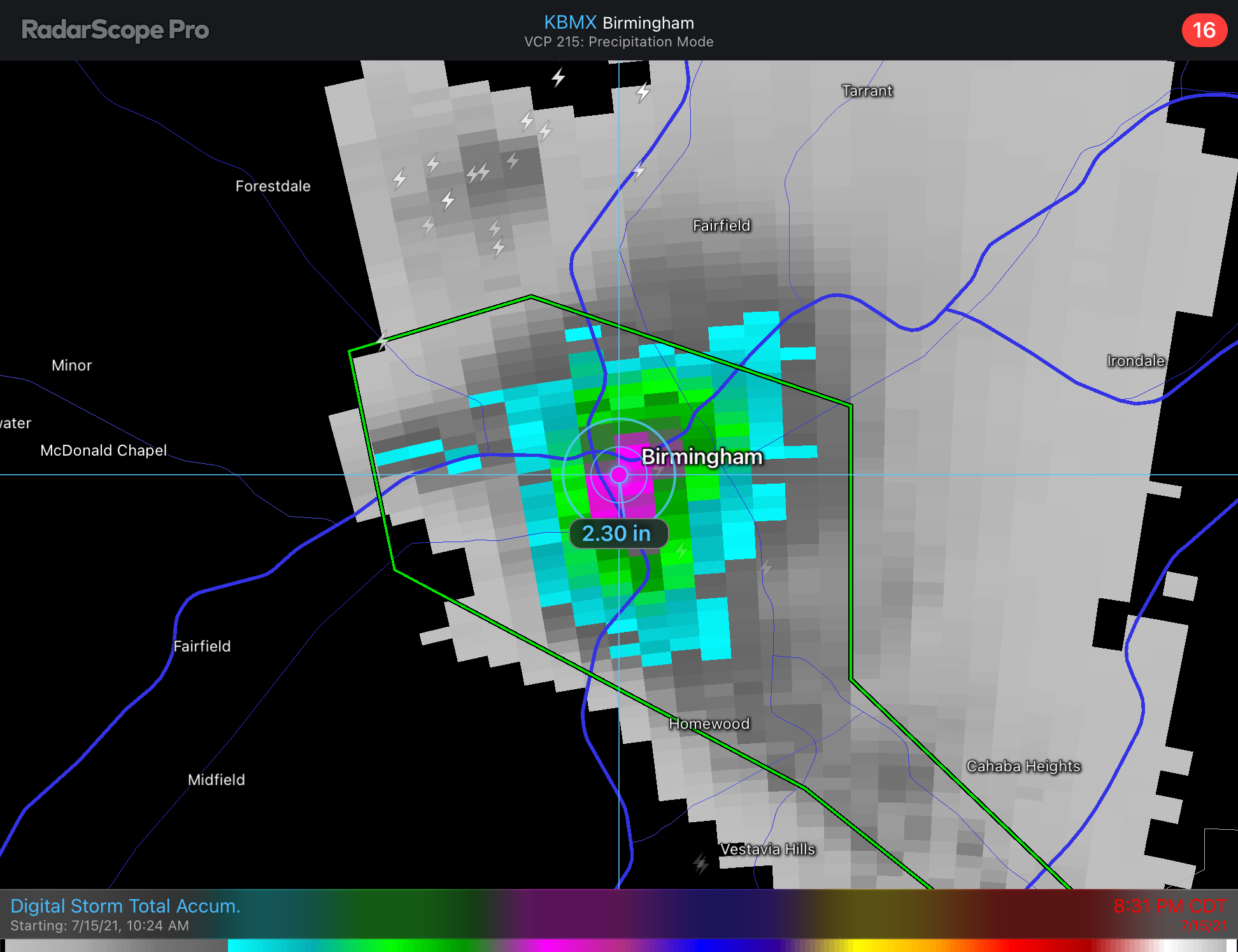
UHI STORM?: An isolated, lone thunderstorm developed over downtown Birmingham around 7 p.m. Thursday and dropped more than 2 inches of rain in a short amount of time. A Flash Flood Warning was issued and some streets temporarily were impassable because of high water. Considering the circumstances, there is a good chance that the urban heat island effect was partly to blame for the development of this storm.
An urban heat island occurs when a city registers higher temperatures than the surrounding rural areas. Cities like Birmingham heat up because of all the cars, air-conditioning units, idling engines and miles of asphalt and concrete that either produce or retain heat. The added heat causes air to ascend over the city center and sink along its periphery, aiding in thunderstorm development.
ON THIS DATE IN 1979: The most damaging tornado in Wyoming history touched down 3 miles west-northwest of the Cheyenne airport. This strong tornado moved east or east-southeast across the northern part of Cheyenne, causing $22 million in damage and one fatality. In all, 140 houses and 17 trailers were destroyed and 325 other homes were damaged. Four C-130 aircraft and National Guard equipment sustained $12 million damage.
BEACH FORECAST: Click here to see the AlabamaWx Beach Forecast Center page.
WEATHER BRAINS: You can listen to our weekly 90-minute show any time on your favorite podcast app. This is the show all about weather featuring many familiar voices, including the meteorologists at ABC 33/40.
CONNECT: You can find me on the major social networks:
For more weather news and information from James Spann and his team, visit AlabamaWx.


