Scott Martin: Heat Advisories up for many Alabama counties; scattered to numerous storms expected
TUESDAY’S WEATHER: Tuesday will be an active day, mainly during the late morning through the afternoon and evening, as a stalled front just to our north will eventually push southward while losing definition. Numerous showers and storms will be likely by the afternoon, especially for locations along and south of I-59. Highs will be in the upper 80s to the mid 90s.
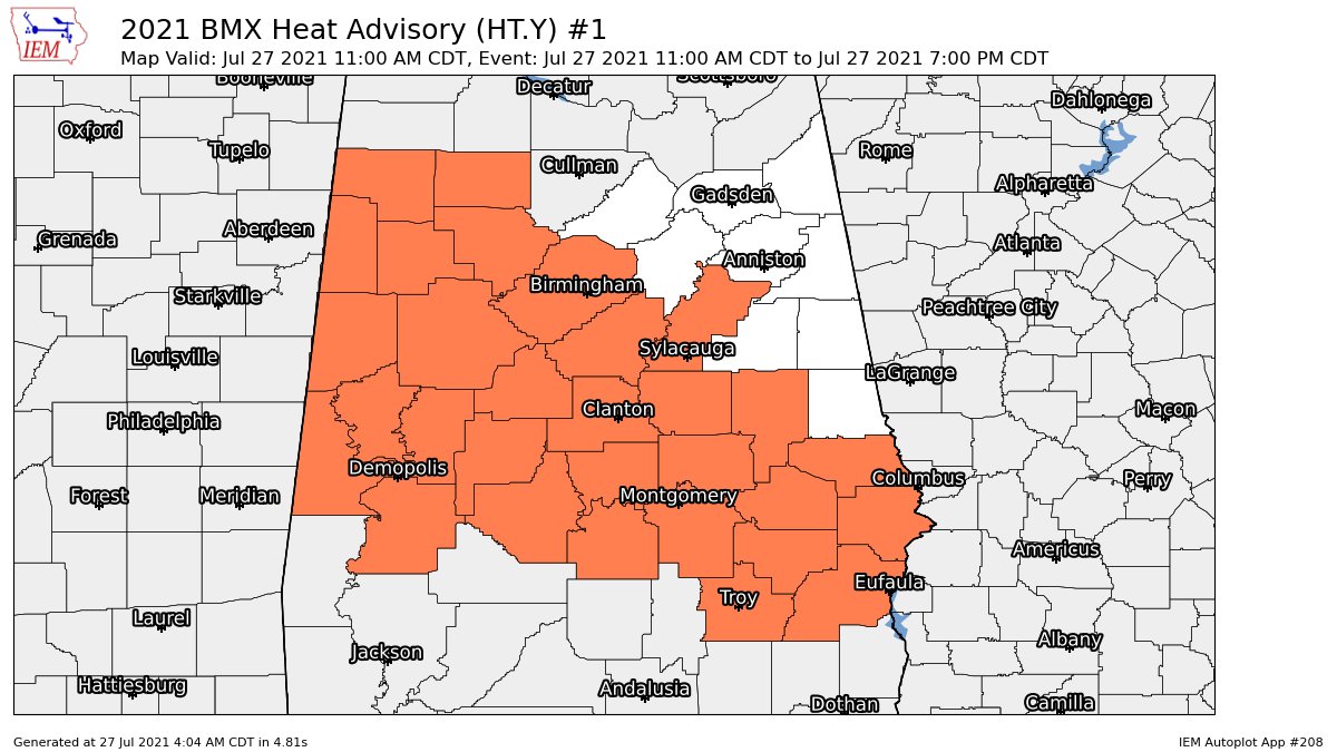
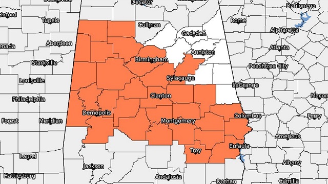
National Weather Service Birmingham has issued a Heat Advisory for Autauga, Barbour, Bibb, Bullock, Chilton, Coosa, Dallas, Elmore, Fayette, Greene, Hale, Jefferson, Lamar, Lee, Lowndes, Macon, Marengo, Marion, Montgomery, Perry, Pickens, Pike, Russell, Shelby, Sumter, Talladega, Tallapoosa, Tuscaloosa, Walker and Winston counties in central Alabama until 7 p.m. this evening.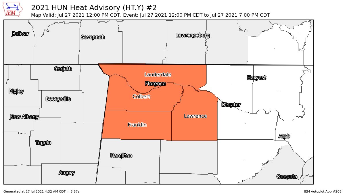
National Weather Service Huntsville has done the same for Colbert, Franklin, Lauderdale and Lawrence counties in north Alabama.
THE REST OF THE WORK WEEK: Most of Alabama will get a decent break from any rainfall Wednesday through Friday, as we’ll see a trend downward in afternoon convection. Tropical moisture may keep the extreme southern portions of the state active on Wednesday with scattered to numerous showers and storms, but the rest will see only a slight chance of a few isolated showers. Highs will be in the lower to mid 90s.
Thursday and Friday will be mainly dry and hot, as skies will be mostly sunny both days. There will be only a small chance of a few isolated afternoon showers or storms, with highs reaching the mid to upper 90s for much of the state. Some locations may see heat index values above 105 degrees, which would allow for heat advisories to be issued. Please use caution if having to be outdoors for any extended period of time. Drink plenty of cold fluids and take plenty of breaks.
THE WEEKEND AHEAD: A cold front will work its way into northern Alabama Saturday and will stall out before reaching the I-20 corridor, bringing an increase to the scattered shower and thunderstorm chances for both days. Saturday’s activity doesn’t look to start until early evening, while Sunday’s looks to fire up by mid to late morning. Highs will be in the upper 80s to the mid 90s.
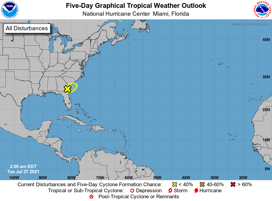
TROPICS: A weak area of low pressure is just inland along the Georgia coastline. Shower and thunderstorm activity associated with the low has increased somewhat but remains disorganized. This system is expected to meander along the coastline of Georgia and South Carolina over the next day or so, and a small chance of development remains if it moves back offshore over the warm Gulf Stream waters. Locally heavy rainfall remains possible over portions of the Georgia and South Carolina coast today. The rest of the Atlantic Basin remains quiet.
For more weather news and information from James Spann, Scott Martin and other members of the James Spann team, visit AlabamaWx.


