James Spann: Drier air for north, central Alabama Tuesday
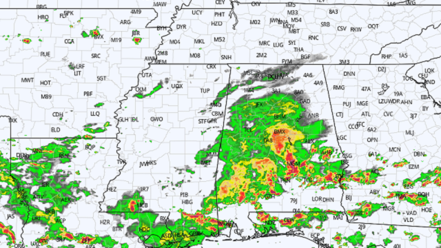
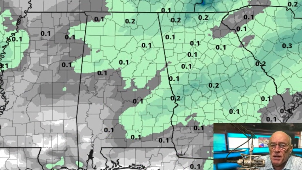
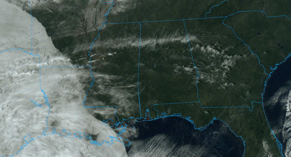
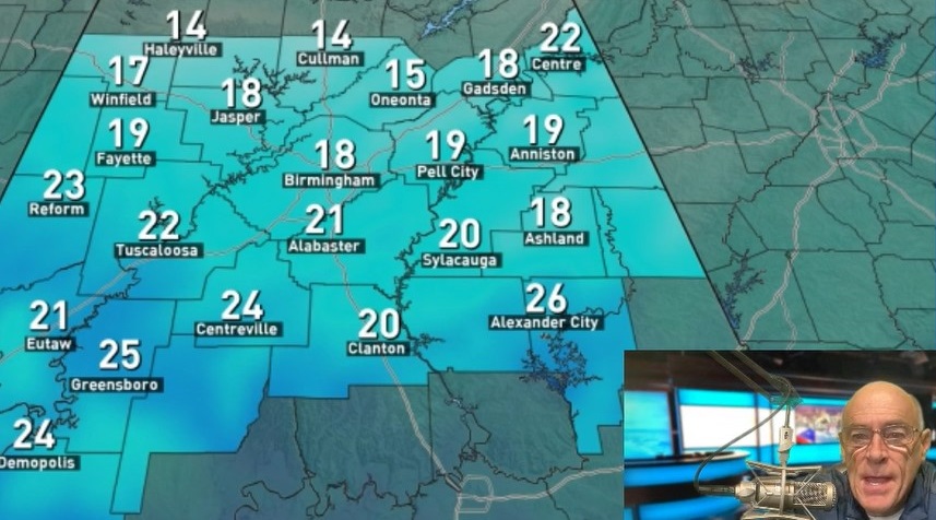
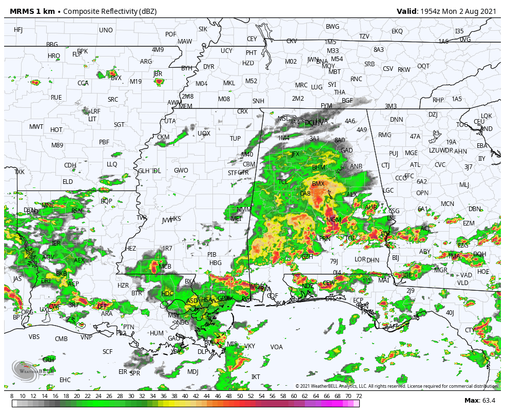
RADAR CHECK: A large mass of rain covers much of central Alabama this afternoon. We note heavier thunderstorms developing over south Alabama ahead of a surface front draped across the state. Heavy rain is moving into Montgomery as I write this at mid-afternoon. Storms are below severe limits, and temperatures are well below average for early August. Birmingham reported 78 degrees at 3 p.m.; the average high for Aug. 2 is 91.
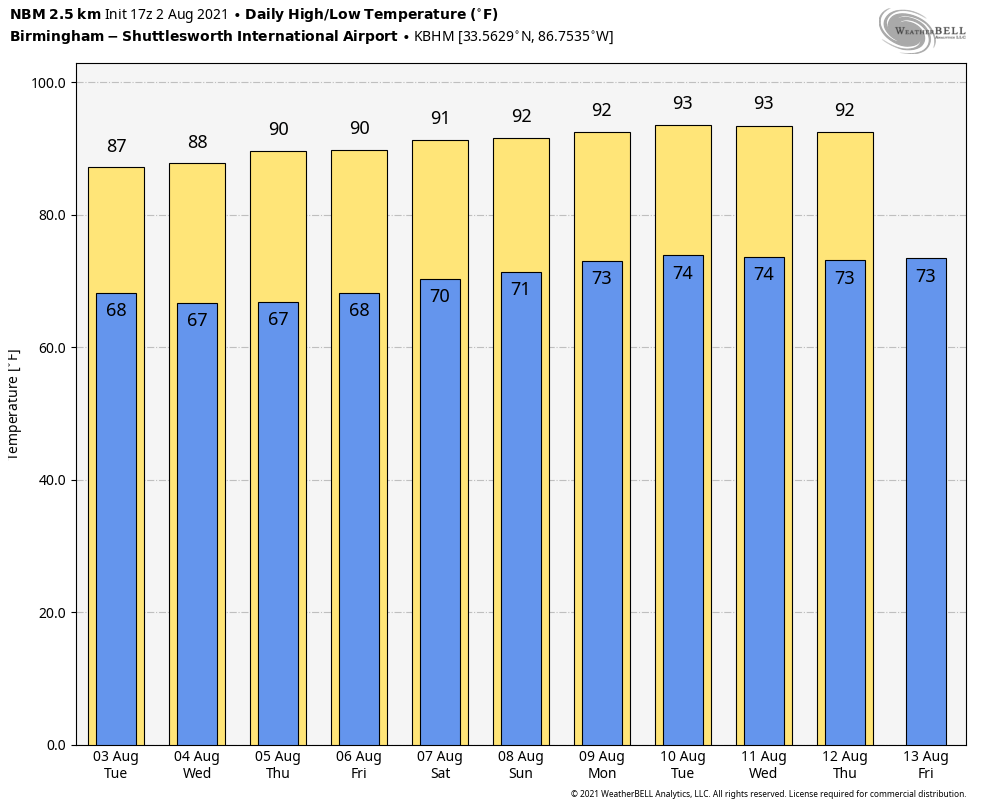
Rain and storms will diminish tonight, and the surface front will sag slowly southward. On Tuesday, the northern half of the state will be mostly dry with only a small risk of a shower; rain and storms remain possible over the southern counties. In fact, there is a Flash Flood Watch for the southeast corner of Alabama including Dothan, Ozark and Enterprise. For most of Alabama, temperatures will remain well below 90 degrees Tuesday.
WEDNESDAY THROUGH FRIDAY: The front over south Alabama will wash out, and we will mention some risk of scattered showers and storms each day, mostly during the afternoon and evening hours. Otherwise, expect partly sunny days with highs mostly in the upper 80s.
THE ALABAMA WEEKEND: We are forecasting a mix of sun and clouds Saturday and Sunday with scattered showers and storms, mostly between 1 and 10 p.m. The high both days will be around 90 degrees. The chance of any one spot getting wet will be 35-45%.
NEXT WEEK: An upper ridge will slowly rebuild across the region; highs will be between 90 and 93 degrees most days. The sky will be partly sunny, and we will continue to mention scattered, mostly afternoon and evening showers and thunderstorms, very standard for August.
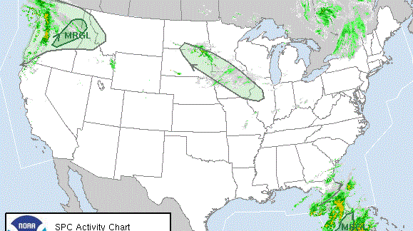
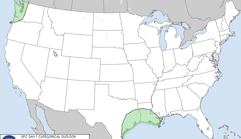
TROPICS: Out in the far eastern Atlantic, a surface trough of low pressure centered a few hundred miles south of the Cabo Verde Islands is producing disorganized showers and thunderstorms. Some development of this system is possible during the next couple of days while it moves northward or northwestward before the system moves over cool waters by Thursday. This is not close to the U.S., and most of the Atlantic basin will remain very quiet this week.
LOOKING BACK AT JULY: Birmingham’s average temperature for July was 89.1 degrees, below the average of 91. The rain total was 8.66 inches, well above the average of 5.42 inches but not close to the record of 20.12 inches, set in 1916. In fact, July 2021 didn’t even make the top 15 in terms of rain amounts.
ON THIS DATE IN 1985: Delta flight 191 crashed at Dallas-Fort Worth airport at 6:05 p.m., killing 137 people. The National Transportation Safety Board’s Accident Board determined that the cause of the incident was wind shear associated with an intense thunderstorm downdraft that occurred at the north end of the airport along runway 17 Left. Today we know this intense, localized downburst as a microburst, a weather phenomenon that was not well understood at the time of the accident. Delta 191’s aftermath changed how regulators approached weather threats, how pilots talked to each other in the cockpit and even how fire rescue crews at airports save lives at crashes.
BEACH FORECAST: Click here to see the AlabamaWx Beach Forecast Center page.
WEATHER BRAINS: You can listen to our weekly 90-minute show any time on your favorite podcast app. This is the show all about weather featuring many familiar voices, including the meteorologists at ABC 33/40.
CONNECT: You can find me on the major social networks:
For more weather news and information from James Spann and his team, visit AlabamaWx.