James Spann: Scattered showers, storms become more numerous for Alabama Friday
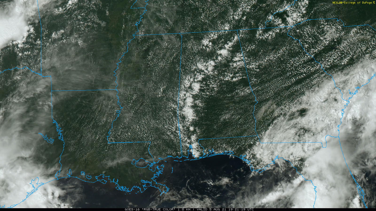
RADAR CHECK: As expected, showers are few and far between across Alabama this afternoon. Most of them are north and west of Birmingham; they are small and short-lived. Most of the state is dry with a partly sunny sky; temperatures are mostly in the mid to upper 80s. The average high for Birmingham on Aug. 5 is 91.
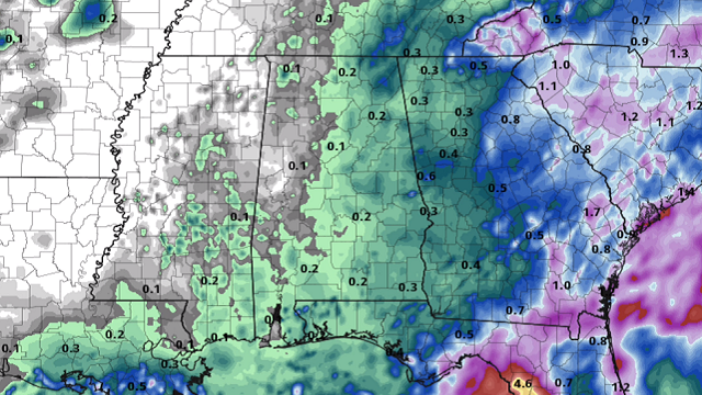
FRIDAY AND THE WEEKEND: An upper trough will bring an increase in the number of scattered showers and thunderstorms Friday and Saturday. Still, it won’t rain everywhere. Most of the showers will come from about 1 until 10 p.m. The chance of any one spot getting wet both days is 40-50%; otherwise, expect a mix of sun and clouds with a high in the upper 80s. Showers become fewer in number Sunday with a high around 90 degrees.
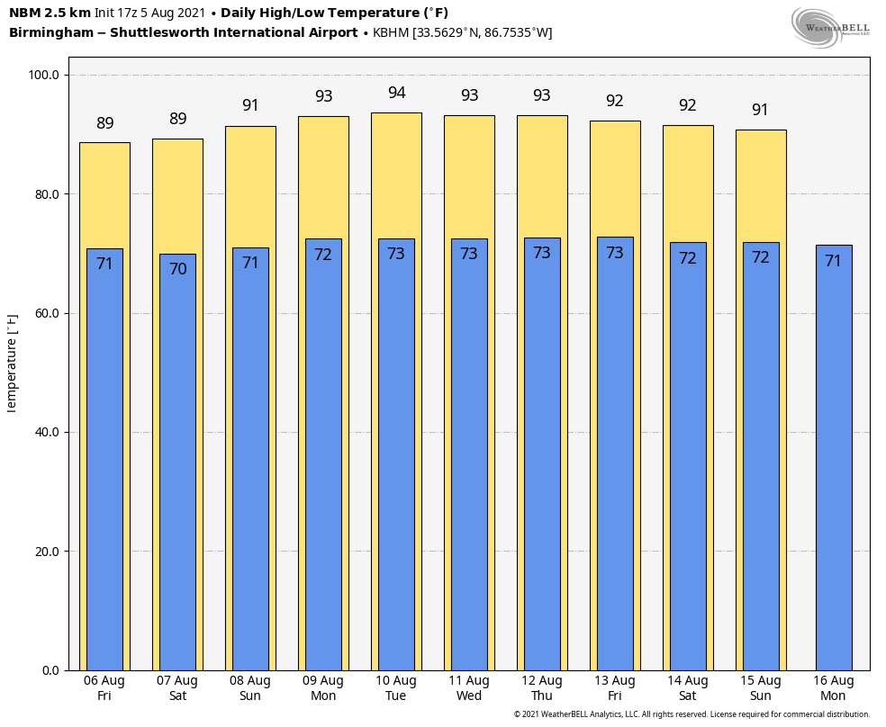
NEXT WEEK: An upper ridge will cover the Deep South, setting the stage for fairly routine August weather. Look for partly sunny, hot, humid days with a few widely scattered, random, scattered showers and thunderstorms each day during the afternoon and evening hours. Highs most days will be in the low 90s; a few spots could see mid 90s.
TROPICS: A tropical wave in the Central Atlantic between the coast of Africa and the Lesser Antilles has only a 20% chance of development over the next five days. However, to the east, a tropical wave near the west coast of Africa is producing a large area of disorganized showers and thunderstorms. The wave is expected to move off the coasts of Senegal, The Gambia and Guinea-Bissau later tonight. Environmental conditions appear somewhat conducive for gradual development, and a tropical depression is likely to form over the eastern tropical Atlantic south of the Cabo Verde Islands by late Saturday or early Sunday, while the system moves westward to west-northwestward at about 15 mph. There is a 70% chance this becomes a tropical depression or tropical storm over the next five days. It’s too early to know whether it will affect any land area.
ON THIS DATE IN 1875: Several tornadoes moved across northern and central Illinois. One of the stronger tornadoes touched down in Warren and Knox counties, where it destroyed 25 homes and killed two people. Another in a series of tornadoes touched down near Knoxville and moved east into northern Peoria County. This estimated F4 tornado injured 40 people and was described by eyewitnesses as looking like a “monstrous haystack.”
BEACH FORECAST: Click here to see the AlabamaWx Beach Forecast Center page.
WEATHER BRAINS: You can listen to our weekly 90-minute show any time on your favorite podcast app. This is the show all about weather featuring many familiar voices, including the meteorologists at ABC 33/40.
CONNECT: You can find me on the major social networks:
For more weather news and information from James Spann and his team, visit AlabamaWx.


