James Spann: Mid 90s for Alabama Tuesday
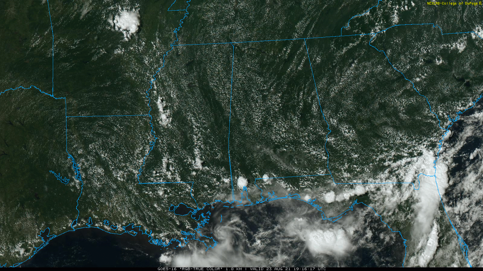
HOT SUMMER AFTERNOON: Temperatures are mostly between 90 and 94 degrees across Alabama this afternoon with a mostly sunny sky. Most of the state is dry; we see just a few isolated storms over Mobile and Baldwin counties. Tonight will be mostly fair with a low in the 70s.
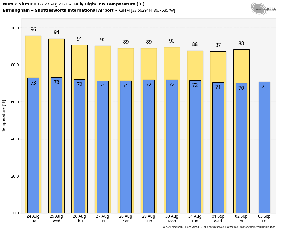
REST OF THE WEEK: Tuesday will be hot and dry for most of the state as an upper ridge strengthens. The high will be between 93 and 96 degrees for most communities, one of the hottest days so far this summer. The hottest temperature so far this summer at Birmingham is 95, recorded on July 28; we will be close to that level Tuesday. The ridge slowly weakens over the latter half of the week, opening the door for the return of scattered, mostly afternoon and evening showers and thunderstorms Wednesday through Friday with heat levels slowly coming down. The high will be in the low to mid 90s Wednesday and close to 90 by Thursday and Friday.
THE ALABAMA WEEKEND: We expect pretty routine summer weather over the weekend — partly sunny days with a few afternoon and evening showers and storms in scattered spots. Odds of any one spot seeing rain both days is 40-50%. Afternoon highs will range from 88 to 91 degrees in most communities, near or just below average for late August in Alabama.
NEXT WEEK: We will roll with a persistence forecast through the week — partly sunny days, fair nights and the typical risk of a passing shower or storm during the afternoon and evening hours. Highs will be mostly in the upper 80s.
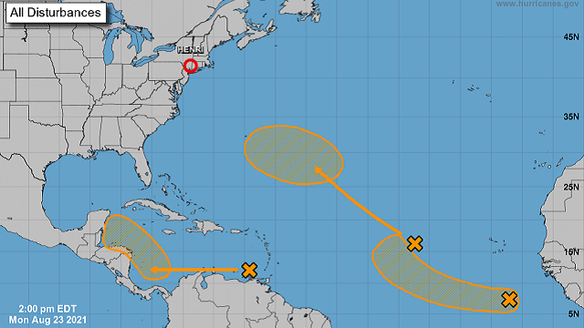
TROPICS: The National Hurricane Center is monitoring two tropical waves in the Atlantic; both have a 40% chance of becoming a tropical depression or storm over the next five days. A third wave is in the eastern Caribbean Sea; it is expected to form a broad area of low pressure over the southwestern Caribbean Sea by late week. Thereafter, environmental conditions are forecast to become favorable for gradual development while the system moves west-northwestward over the northwestern Caribbean Sea. If this system develops, it will likely move across the Yucatan peninsula and ultimately into the coast of Mexico far south of Brownsville, Texas, in a week or so. The NHC also gives this one a 40% chance of becoming a depression or storm within five days.
There are no systems threatening the central Gulf Coast for the next seven days.
ON THIS DATE IN 1933: A hurricane made landfall near Nags Head, North Carolina, and tracked up the Chesapeake Bay. The Chesapeake-Potomac hurricane moved over Norfolk, Virginia, and Washington, D.C. A 7-foot tide flooded businesses in Norfolk. The American Meteorological Society’s August 1933 weather review described it as “one of the most severe storms that have ever visited the Middle Atlantic Coast.”
ON THIS DATE IN 2005: Tropical Depression Twelve formed over the southeast Bahamas as the result of the merger of a tropical wave and the remnants of Tropical Depression Ten four days earlier. It would go on to become Hurricane Katrina, one of the deadliest hurricanes (1,836 lives) in U.S. history.
BEACH FORECAST: Click here to see the AlabamaWx Beach Forecast Center page.
WEATHER BRAINS: You can listen to our weekly 90-minute show any time on your favorite podcast app. This is the show all about weather featuring many familiar voices, including the meteorologists at ABC 33/40.
CONNECT: You can find me on the major social networks:
For more weather news and information from James Spann and his team, visit AlabamaWx.


