James Spann: Showers, storms remain possible in Alabama today; dry air rolls in Wednesday
James Spann forecasts one more rainy day for parts of Alabama from Alabama NewsCenter on Vimeo.
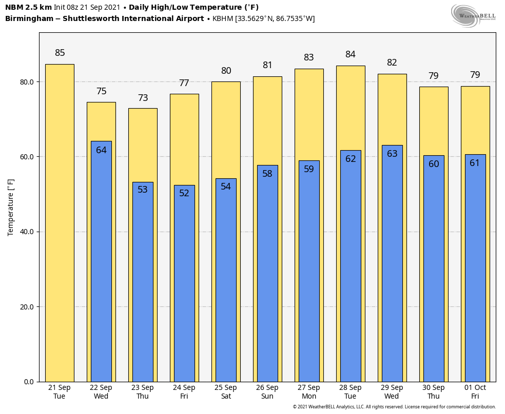
RADAR CHECK: Showers and a few thunderstorms are developing early this morning over the northern half of Alabama as moist air lingers over the state. Look for more clouds than sun today with scattered to numerous showers and storms through tonight; the high will be in the low 80s this afternoon. The Flash Flood Watch for the northern half of the state expired last night and was not extended.
COLD FRONT WEDNESDAY: The long-awaited cold front will roll through the state early Wednesday. Showers will end by midmorning over the northern half of the state. The sky becomes partly to mostly sunny by afternoon with a brisk north wind of 10-20 mph; gusts to 25 mph are possible. Humidity levels will lower during the day as the dry air takes over. The front is arriving right on time; autumn officially arrives Wednesday at 2:20 p.m. This is when the sun is directly over the equator, and we have approximately 12 hours of daylight and 12 hours of darkness.
Look for picture-perfect fall weather Thursday through the weekend with sunny, pleasant days and clear, cool nights. Temperatures will drop into the 45- to 55-degree range early Thursday and Friday mornings, easily the coolest air so far this season. Look for highs in the mid 70s Thursday and Friday, followed by low 80s Saturday and Sunday.
NEXT WEEK: Dry weather continues Monday through Wednesday with highs in the low 80s. Global models suggest a few showers could return by Thursday and Friday as moisture levels rise, but amounts will likely be light.
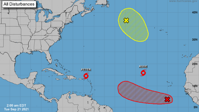
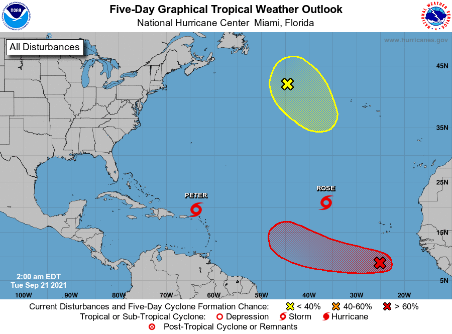
TROPICS: Tropical Storms Peter and Rose are “junk systems” in the Atlantic — weak, disorganized and no threat to land. A tropical wave in the east has a high chance of becoming a tropical depression or storm over the next few days as it moves to the west/northwest, but it will turn northward well before reaching the U.S. There are no systems threatening the Gulf of Mexico over the next seven days.
 ON THIS DATE IN 1938: A powerful hurricane struck Long Island and southern New England. The Category 3 hurricane was traveling at 47 mph when it made landfall near Bellport, New York. This storm caused at least 600 deaths and left approximately 63,000 homeless.
ON THIS DATE IN 1989: Hurricane Hugo made landfall on Isle of Palms, South Carolina, as a Category 4 hurricane. This storm brought strong winds to many areas of South Carolina. In downtown Charleston, sustained winds of 87 mph were reported, along with gusts of 108 mph. At the time, Hurricane Hugo was the strongest storm to strike the United States in the previous 20-year period. The hurricane was also the nation’s costliest in terms of monetary losses, with approximately $7 billion in damage. An estimated 49 deaths were directly related to the storm, including 26 in the U.S., Puerto Rico and the U.S. Virgin Islands.
BEACH FORECAST: Click here to see the AlabamaWx Beach Forecast Center page.
WEATHER BRAINS: You can listen to our weekly 90-minute show any time on your favorite podcast app. This is the show all about weather featuring many familiar voices, including the meteorologists at ABC 33/40.
CONNECT: You can find me on the major social networks:
For more weather news and information from James Spann and his team, visit AlabamaWx.


