Scott Martin: No rain in sight for a while in Alabama
THIS WEEKEND: We’ll have a few clouds out there today to start with, but nearly all of those will dissipate, leaving us with sunny skies by the afternoon. Highs will be in the upper 70s to the lower 80s. Sunday will be another sunny day with highs in the upper 70s to the mid 80s.
THE WORK WEEK AHEAD: Same story for Monday, with temperatures getting a little warmer and highs in the lower to mid 80s. It will be a little warmer again on Tuesday, with sunny skies and highs ranging from the lower 80s in the north to the upper 80s in the south. Wednesday will be sunny with highs in the mid to upper 80s.
We start to see evidence for the potential of a back-door cold front moving into the state on Thursday that may squeeze a shower or two out over extreme northern Alabama, but skies will remain sunny for central Alabama. Highs will range from the lower 80s in the north to the upper 80s in the south.
That front moves farther into the state on Friday, cooling the temperatures off a little bit. Could there be a shower form somewhere in central Alabama? Maybe, but overall chances will be very low. Skies will be mainly sunny, with highs in the upper 70s to the mid 80s.
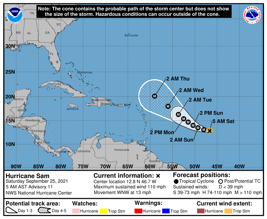
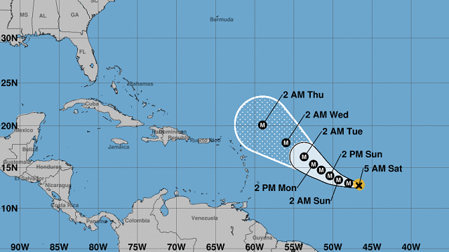
TROPICS: Hurricane Sam continues to strengthen in the Atlantic, with maximum sustained winds topping out at 110 mph as of the 4 a.m. update. It is moving west-northwest for now but will eventually curve away from the Leeward Islands and move to the north. It will continue to get stronger and will most likely be a major hurricane by 10 a.m. Sam is no threat to the U.S. mainland.
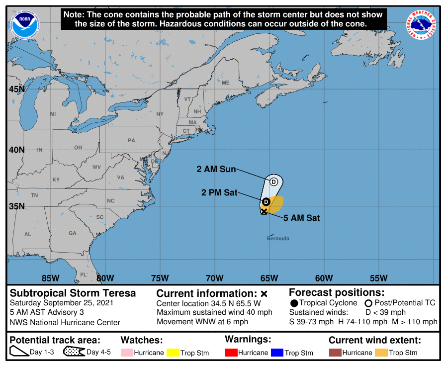
We also have a very disorganized Subtropical Storm Teresa north-northwest of Bermuda with winds at 40 mph. It is moving west-northwest for now but will turn to the north-northeast later today. Teresa will not last long and is expected to degenerate into a remnant low on Sunday. It’s no threat to the U.S. mainland.
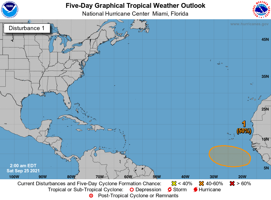
A tropical wave that will move off the African coast within the next few days has the potential to become a depression by midweek. It is way too early to know where this disturbance will be heading, but we’ll keep our eyes on it.
For more weather news and information from James Spann, Scott Martin and other members of the James Spann team, visit AlabamaWx.


