James Spann: Wet pattern for Alabama through Wednesday
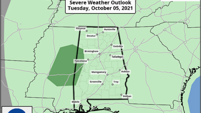
RADAR CHECK: Showers and thunderstorms are most active this afternoon south of I-59 (south of a line from Tuscaloosa to Birmingham to Gadsden). Flash Flood Warnings have been issued for parts of Montgomery, Wilcox, Lee and Russell counties, where amounts have likely exceeded 2 inches. There is some sun over the northern quarter of Alabama, where temperatures have reached the low 80s.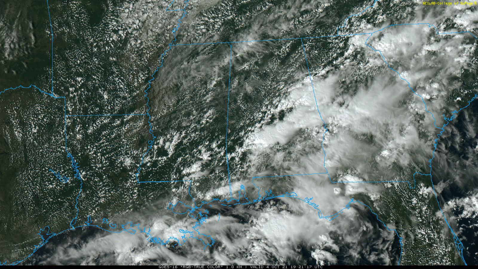 A Flash Flood Watch remains in effect for much of Alabama through Wednesday as an upper low to the west will keep a wet weather pattern in place. We expect occasional showers and a few thunderstorms tonight, Tuesday and Wednesday, with potential for heavy rain at times. There is a low-end marginal risk of severe thunderstorms for a small part of west Alabama; some hail is possible there due to the cold air aloft associated with the upper low over Mississippi.
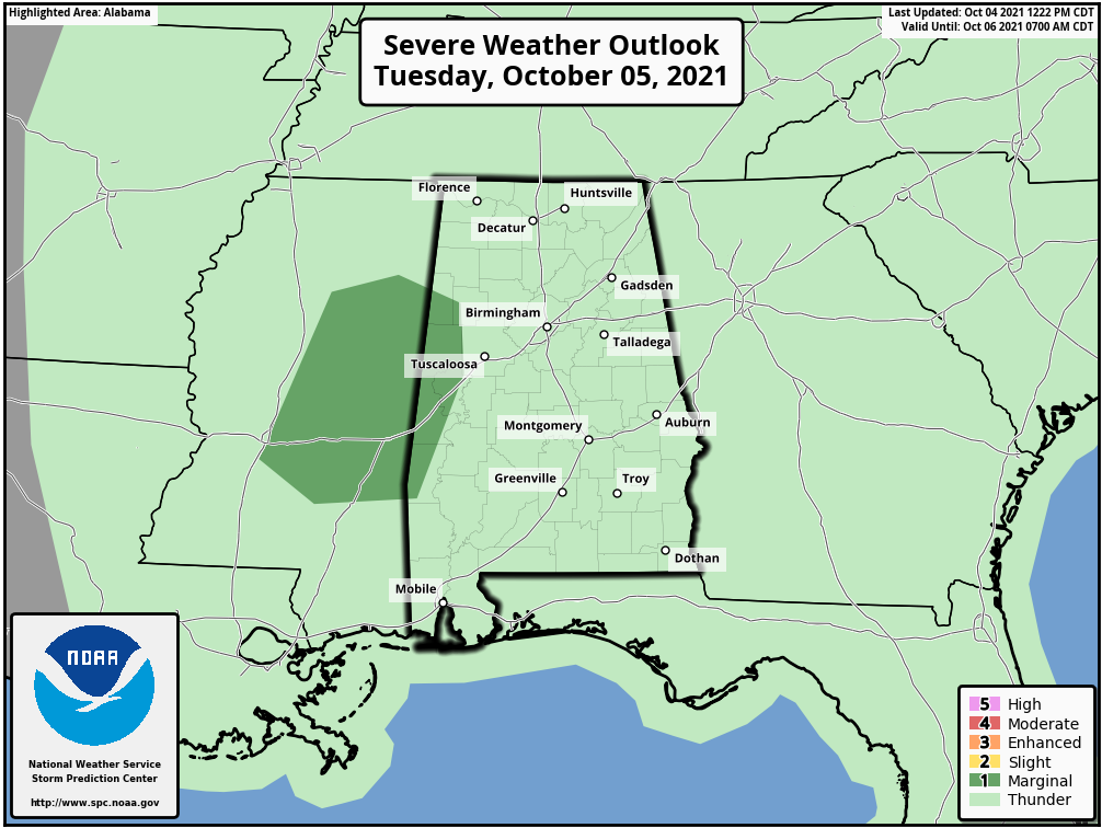
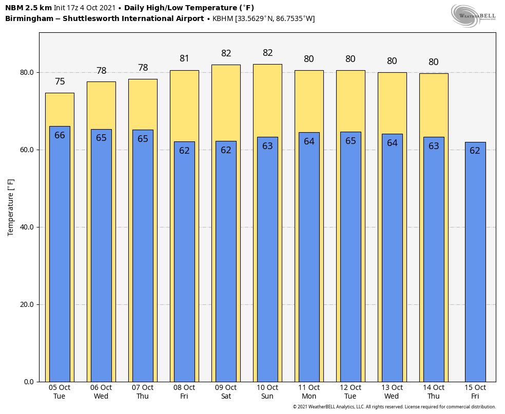
Additional rain amounts of 1-3 inches are likely for most of the state through Thursday morning, with isolated heavier amounts. Showers will begin to thin out during the day Thursday as the upper low lifts out.
FRIDAY AND THE WEEKEND: Dry weather returns to Alabama and the Deep South. The sky will be partly to mostly sunny Friday with a high in the low 80s. Look for a sun-filled sky Saturday and Sunday with highs between 82 and 85 degrees. Lows over the weekend will be in the 60s.
NEXT WEEK: Dry weather will likely persist across the Deep South much of next week with temperatures near average; highs will be around 80 with lows in the 60s. There’s still no sign of any major shots of colder air for the next seven to 10 days here.
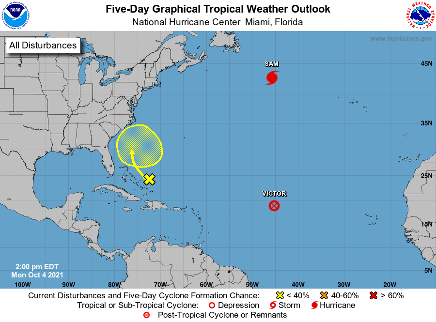
TROPICS: Victor, in the Central Atlantic, has dissipated this afternoon. Hurricane Sam, in the North Atlantic, becomes post-tropical in the colder water Tuesday morning. The National Hurricane Center is monitoring a tropical wave east of the Bahamas. It is moving northwest but has only a very low chance (10%) of developing due to harsh upper-air winds. The rest of the Atlantic basin, including the Gulf of Mexico, is quiet.
ON THIS DATE IN 2005: Hurricane Stan, a minimal Category 1 hurricane with 75 mph maximum sustained surface winds, made landfall near Punta Roca Partida, Mexico. While not a particularly strong hurricane, the torrential rains caused flooding and landslides, which resulted in 1,513 deaths in Guatemala.
BEACH FORECAST: Click here to see the AlabamaWx Beach Forecast Center page.
WEATHER BRAINS: You can listen to our weekly 90-minute show any time on your favorite podcast app. This is the show all about weather featuring many familiar voices, including the meteorologists at ABC 33/40.
CONNECT: You can find me on the major social networks:
For more weather news and information from James Spann and his team, visit AlabamaWx.


