James Spann: Scattered showers for Alabama through Wednesday morning; some sun Wednesday afternoon
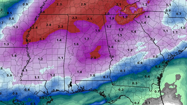
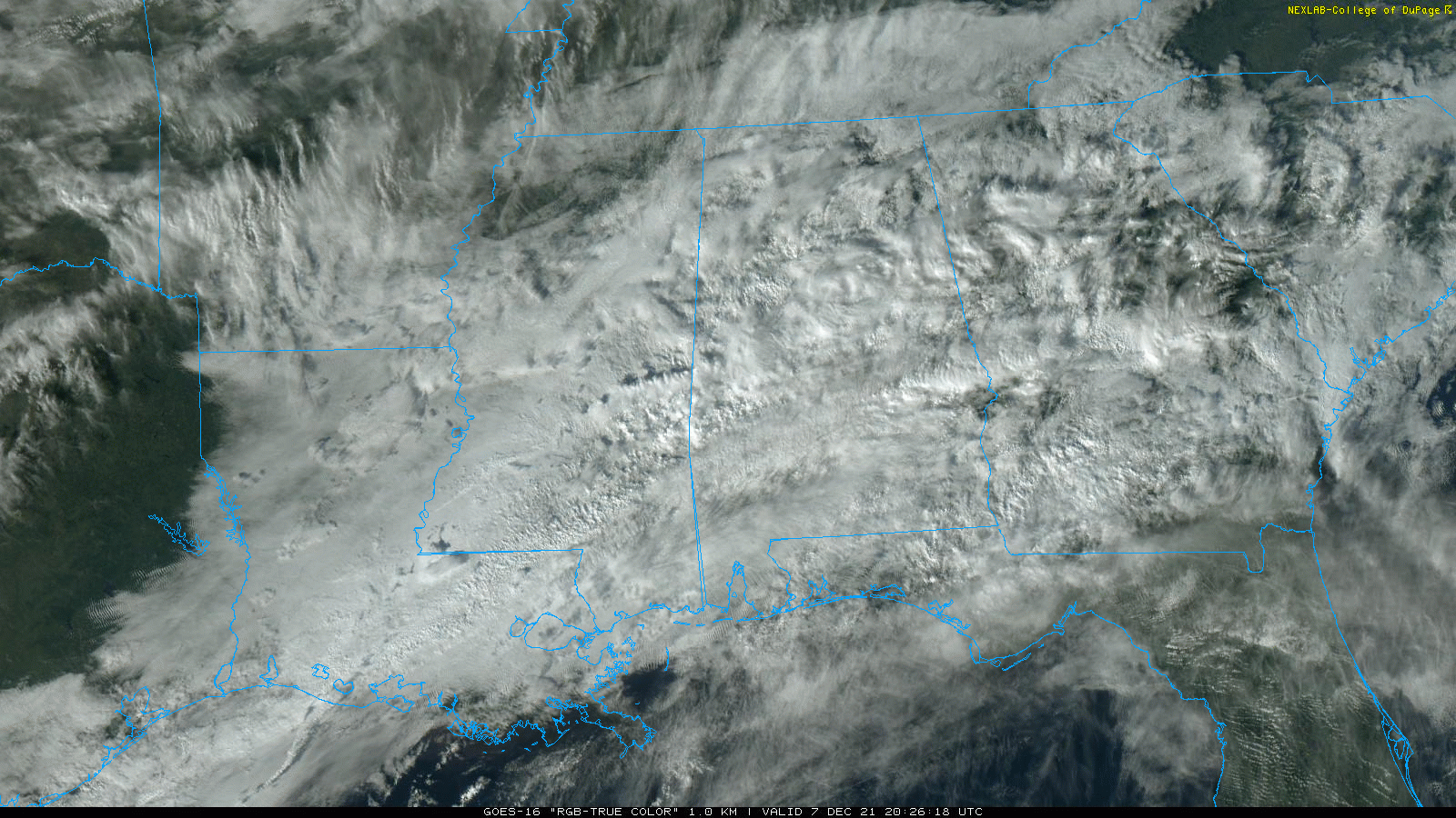
RADAR CHECK: It is a cloudy, cold day for Alabama. Temperatures are only in the 40s over the northern third of the state. Radar shows a few scattered showers over the central counties moving eastward, north of a stalled cold front not far from the Gulf Coast. Showers will increase statewide late tonight and Wednesday morning as a wave of low pressure rides along the front.
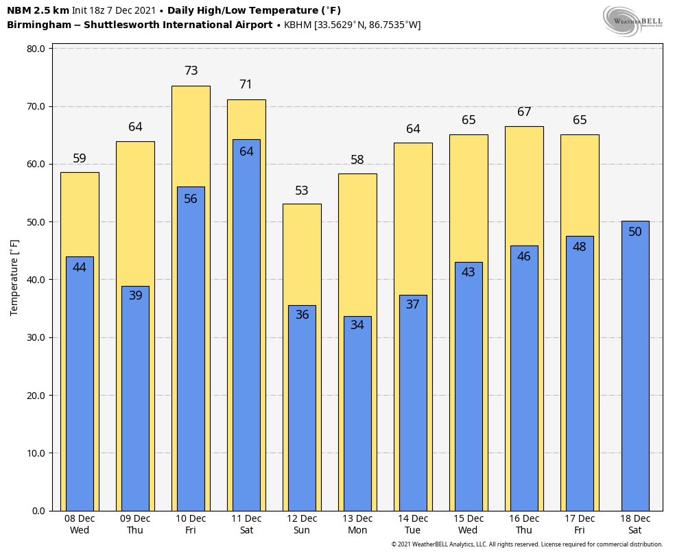
 Rain amounts won’t be too heavy, and the showers will likely be over by mid-morning. We expect to see clearing Wednesday afternoon as the wave moves on to the east. The high will be close to 60 degrees.
The warming trend continues Thursday; we reach the upper 60s with a mix of sun and clouds. A few showers are possible Thursday, but they should be few and far between. On Friday temperatures warm into the mid 70s, not too far from record levels for early December in Alabama. The air will be unstable, and we expect scattered showers and thunderstorms to form during the day. A few strong storms are possible Friday afternoon and Friday night in this kind of environment.
THE ALABAMA WEEKEND: Saturday still looks wet and stormy as a cold front approaches; rain and strong storms are likely during the day. A low-end severe weather threat is a fair possibility, with strong winds the main threat. The high will be between 67 and 70 degrees. New global model data suggests the rain will end from west to east Saturday evening. Sunday will be sunny and cooler, with a high in the mid 50s.
NEXT WEEK: A strong upper ridge will develop near the Gulf Coast, and the weather will be dry most of the week. The high will be not too far from 60 Monday, followed by mid 60s Tuesday through Friday. A cold front could bring a few showers on Friday, Dec. 17, but at this point it doesn’t look like a major rain event.
ON THIS DATE IN 1951: It was the warmest December day on record for most of Alabama. Montgomery soared to 83 degrees. Other highs included 80 at Birmingham and Anniston, 79 in Tuscaloosa and 78 in Huntsville.
ON THIS DATE IN 2006: A rare tornado tore through Kensal Rise in London. This T4 on the TORRO scale, equivalent to an EF2 on the Fujita scale, injured six people and damaged 150 homes. According to the BBC, the last tornado that had caused significant damage in London was in December 1954, in West London.
BEACH FORECAST: Click here to see the AlabamaWx Beach Forecast Center page.
WEATHER BRAINS: You can listen to our weekly 90-minute show any time on your favorite podcast app. This is the show all about weather featuring many familiar voices, including the meteorologists at ABC 33/40.
CONNECT: You can find me on the major social networks:
For more weather news and information from James Spann and his team, visit AlabamaWx.


